Property Record
Fm 1015, Weslaco, TX 78596
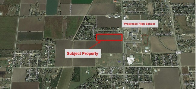

Property Detail
Fm 1015
McAllen/Edinburg/Pharr
LLANO GRANDE LOT 91 9.80 AC NET
McAllen-Edinburg-Mission, TX
HIDALGO
L5025-00-000-0091-00
Texas
Privatepreserveopenspacevacantlandforestlandconservation
91
2024
9.80 AC
2025
Outlying Hidalgo County
022703
NEARBY LISTINGS FOR SALE OR LEASE
DEMOGRAPHICS near Fm 1015
1 mile
3 mile
5 mile
2025 Total Population
3,398
12,510
52,654
2030 Population
3,351
12,996
55,773
Pop Growth 2025-2030
(1.38%)
+ 3.88%
+ 5.92%
Average Age
34
38
38
2025 Total Households
877
3,896
17,389
HH Growth 2025-2030
(1.71%)
+ 4.75%
+ 6.49%
Median Household Inc
$45,588
$51,649
$52,299
Avg Household Size
3.80
3.20
2.90
2025 Avg HH Vehicles
2.00
2.00
2.00
Median Home Value
$143,678
$94,790
$122,054
Median Year Built
1997
1992
1992
Nearby Places
Map Layers
Map Styles
 Street
 Aerial
Transit
 Traffic
 Biking
Places
Listings with unknown addresses are not visible on the map
- Restaurants
- Banks
- Shops
- Fitness
- Groceries
PUBLIC TRANSPORTATION
AIRPORT
McAllen International
Drive
Walk
Distance
McAllen International
34 min
24.0 mi
Valley International
Drive
Walk
Distance
Valley International
47 min
27.9 mi
Brownsville/South Padre Island International
Drive
Walk
Distance
Brownsville/South Padre Island International
62 min
38.9 mi
Freight Ports
Port of Brownsville
Drive
Walk
Distance
Port of Brownsville
56 min
46.1 mi
SALE & LEASE HISTORY
LISTING DATE
SALE/LEASE

Jun 21, 2019
For Sale
Nearby Properties
Address
Land Use
TOTAL SIZE
Lot Size
Zoning
Address
Land Use
TOTAL SIZE
Lot Size
Zoning
184,092 SF
17.61 AC
Address
Land Use
TOTAL SIZE
Lot Size
Zoning
342,760 SF
42.33 AC
Address
Land Use
TOTAL SIZE
Lot Size
Zoning
76,484 SF
20.60 AC
Address
Land Use
TOTAL SIZE
Lot Size
Zoning
3 SF
16.78 AC
Address
Land Use
TOTAL SIZE
Lot Size
Zoning
1 SF
12.23 AC
Address
Land Use
TOTAL SIZE
Lot Size
Zoning
1 SF
21.22 AC
Address
Land Use
TOTAL SIZE
Lot Size
Zoning
22,144 SF
55.59 AC
Address
Land Use
TOTAL SIZE
Lot Size
Zoning
1,126,582 SF
14.76 AC
Address
Land Use
TOTAL SIZE
Lot Size
Zoning
3 SF
50.61 AC
Address
Land Use
TOTAL SIZE
Lot Size
Zoning
52,926 SF
9.89 AC
Address
Land Use
TOTAL SIZE
Lot Size
Zoning
57,123 SF
8.28 AC
Address
Land Use
TOTAL SIZE
Lot Size
Zoning
1,668,585 SF
2.08 AC
Address
Land Use
TOTAL SIZE
Lot Size
Zoning
1,944 SF
415.38 AC
Address
Land Use
TOTAL SIZE
Lot Size
Zoning
16,650 SF
4.94 AC
Address
Land Use
TOTAL SIZE
Lot Size
Zoning
34.22 AC
Address
Land Use
TOTAL SIZE
Lot Size
Zoning
1,456 SF
55.36 AC
Address
Land Use
TOTAL SIZE
Lot Size
Zoning
23,808 SF
21.65 AC
Address
Land Use
TOTAL SIZE
Lot Size
Zoning
4 SF
8.90 AC
Address
Land Use
TOTAL SIZE
Lot Size
Zoning
55.15 AC
Address
Land Use
TOTAL SIZE
Lot Size
Zoning
1 SF
11.55 AC
Address
Land Use
TOTAL SIZE
Lot Size
Zoning
53.75 AC
Address
Land Use
TOTAL SIZE
Lot Size
Zoning
22,020 SF
9.70 AC
Address
Land Use
TOTAL SIZE
Lot Size
Zoning
17,756 SF
14.76 AC
Address
Land Use
TOTAL SIZE
Lot Size
Zoning
22,000 SF
20.10 AC
Address
Land Use
TOTAL SIZE
Lot Size
Zoning
10,380 SF
1.35 AC
Address
Land Use
TOTAL SIZE
Lot Size
Zoning
25,458 SF
11.89 AC
Address
Land Use
TOTAL SIZE
Lot Size
Zoning
10,626 SF
2.08 AC
Address
Land Use
TOTAL SIZE
Lot Size
Zoning
24,500 SF
6.35 AC
Address
Land Use
TOTAL SIZE
Lot Size
Zoning
23,432 SF
17.40 AC
Address
Land Use
TOTAL SIZE
Lot Size
Zoning
3,705 SF
4.31 AC
The World's #1 Commercial Real Estate Marketplace
Connect with us
© 2026 CoStar Group
The information above has been obtained from sources believed reliable. While we do not doubt its accuracy we have not verified it and make no guarantee, warranty or representation about it. It is your responsibility to independently confirm its accuracy and completeness. Any projections, opinions, assumptions, or estimates used are for example only and do not represent the current or future performance of the property. The value of this transaction to you depends on tax and other factors which should be evaluated by your tax, financial, and legal advisors. You and your advisors should conduct a careful, independent investigation of the property to determine to your satisfaction the suitability of the property for your needs.