Property Record
Fm 1093, Katy, TX 77494

Save to a Folder
{{folder.Name}}
{{folder.ListingIds.length}} Properties
{{folder.ListingIds.length}} Property
Create a New Folder
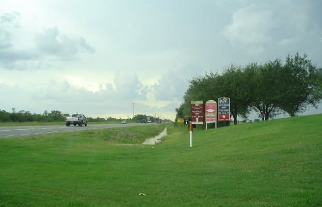
Property Detail
Fm 1093
Houston-Pasadena-The Woodlands, TX
0307 L A PATILLO, ACRES 1.5, RESTRICTED RESERVE A, BLOCK 1, WESTPARK MEADOWS SUBDIVISION PARTIAL REPLAT NO 1
0307-00-001-0082-914
FORT BEND
Commercialacreage
Texas
B and X Area of moderate flood hazard, usually the area between the limits of the 100-year and 500-year floods.
1.50 AC
2024
Katy/Grand Parkway West
2025
Houston
673112
NEARBY LISTINGS FOR SALE OR LEASE
DEMOGRAPHICS near Fm 1093
1 mile
3 mile
5 mile
2025 Total Population
15,874
109,034
269,515
2030 Population
18,094
123,387
303,537
Pop Growth 2025-2030
+ 13.99%
+ 13.16%
+ 12.62%
Average Age
35
37
36
2025 Total Households
5,044
33,941
84,092
HH Growth 2025-2030
+ 14.45%
+ 13.62%
+ 12.98%
Median Household Inc
$136,792
$138,798
$130,362
Avg Household Size
3.10
3.20
3.20
2025 Avg HH Vehicles
2.00
2.00
2.00
Median Home Value
$458,834
$450,628
$444,056
Median Year Built
2010
2010
2010
Nearby Places
Map Layers
Map Styles
 Street
 Aerial
Layers
 Traffic
 Biking
Places
Listings with unknown addresses are not visible on the map
- Restaurants
- Banks
- Shops
- Fitness
- Groceries
SALE & LEASE HISTORY
LISTING DATE
SALE/LEASE

May 25, 2018
For Sale
Nearby Properties
Address
Land Use
TOTAL SIZE
Lot Size
Zoning
Address
Land Use
TOTAL SIZE
Lot Size
Zoning
786,753 SF
116.13 AC
Address
Land Use
TOTAL SIZE
Lot Size
Zoning
57.20 AC
Address
Land Use
TOTAL SIZE
Lot Size
Zoning
610,000 SF
99.39 AC
Y
Address
Land Use
TOTAL SIZE
Lot Size
Zoning
350,883 SF
29.41 AC
Address
Land Use
TOTAL SIZE
Lot Size
Zoning
523,641 SF
17.31 AC
X
Address
Land Use
TOTAL SIZE
Lot Size
Zoning
481,055 SF
4.56 AC
Address
Land Use
TOTAL SIZE
Lot Size
Zoning
1,022 SF
21.43 AC
RAD
Address
Land Use
TOTAL SIZE
Lot Size
Zoning
13.15 AC
Address
Land Use
TOTAL SIZE
Lot Size
Zoning
15.88 AC
X
Address
Land Use
TOTAL SIZE
Lot Size
Zoning
20.70 AC
Address
Land Use
TOTAL SIZE
Lot Size
Zoning
13.36 AC
QY
Address
Land Use
TOTAL SIZE
Lot Size
Zoning
Address
Land Use
TOTAL SIZE
Lot Size
Zoning
95,597 SF
13.46 AC
Address
Land Use
TOTAL SIZE
Lot Size
Zoning
320,427 SF
15.15 AC
Address
Land Use
TOTAL SIZE
Lot Size
Zoning
240,930 SF
15 AC
Address
Land Use
TOTAL SIZE
Lot Size
Zoning
388,578 SF
16.78 AC
Address
Land Use
TOTAL SIZE
Lot Size
Zoning
105,718 SF
14.52 AC
Address
Land Use
TOTAL SIZE
Lot Size
Zoning
26,631 SF
10.61 AC
Address
Land Use
TOTAL SIZE
Lot Size
Zoning
202,589 SF
9.24 AC
J
Address
Land Use
TOTAL SIZE
Lot Size
Zoning
169,191 SF
14.42 AC
Address
Land Use
TOTAL SIZE
Lot Size
Zoning
101,783 SF
14.43 AC
Address
Land Use
TOTAL SIZE
Lot Size
Zoning
184,398 SF
28.22 AC
I
Address
Land Use
TOTAL SIZE
Lot Size
Zoning
141,552 SF
38.03 AC
TS
Address
Land Use
TOTAL SIZE
Lot Size
Zoning
101,443 SF
11.60 AC
S
Address
Land Use
TOTAL SIZE
Lot Size
Zoning
390,016 SF
14.44 AC
Address
Land Use
TOTAL SIZE
Lot Size
Zoning
285,735 SF
14.63 AC
Address
Land Use
TOTAL SIZE
Lot Size
Zoning
89,262 SF
13.22 AC
Address
Land Use
TOTAL SIZE
Lot Size
Zoning
213,260 SF
9.48 AC
Address
Land Use
TOTAL SIZE
Lot Size
Zoning
Address
Land Use
TOTAL SIZE
Lot Size
Zoning
200,793 SF
6.23 AC
The World's #1 Commercial Real Estate Marketplace
Connect with us
© 2026 CoStar Group
The information above has been obtained from sources believed reliable. While we do not doubt its accuracy we have not verified it and make no guarantee, warranty or representation about it. It is your responsibility to independently confirm its accuracy and completeness. Any projections, opinions, assumptions, or estimates used are for example only and do not represent the current or future performance of the property. The value of this transaction to you depends on tax and other factors which should be evaluated by your tax, financial, and legal advisors. You and your advisors should conduct a careful, independent investigation of the property to determine to your satisfaction the suitability of the property for your needs.