Property Record
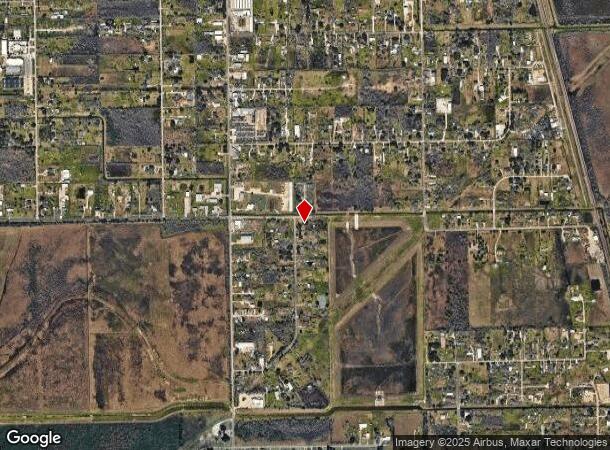
Fm 1128, Pearland, TX 77584

NEARBY LISTINGS FOR SALE OR LEASE
Property Detail
Fm 1128
Houston-The Woodlands-Sugar Land, TX
Westchester (A0242 H T & B R R)(Pearland
8215-0030-000
WESTCHESTER (A0242 H T & B R R)(PEARLAND) LOT 33, UNDIVIDED INTEREST 50.0000000000%
Vacantlandnec
Brazoria
X
Texas
48039C0040K
33
2024
0.86 AC
2025
South
660704
Houston
DEMOGRAPHICS near Fm 1128
1 Mile
3 Mile
5 Mile
2024 Total Population
8,486
61,408
149,875
2029 Population
9,386
67,548
163,323
Pop Growth 2024-2029
+ 10.61%
+ 10.00%
+ 8.97%
Average Age
35
37
36
2024 Total Households
2,968
20,463
50,764
HH Growth 2024-2029
+ 10.88%
+ 10.09%
+ 9.04%
Median Household Inc
$95,289
$104,657
$97,586
Avg Household Size
2.80
2.90
2.90
2024 Avg HH Vehicles
2.00
2.00
2.00
Median Home Value
$261,715
$281,446
$290,216
Median Year Built
2001
1998
2002
Nearby Places
Map Layers
Map Styles
 Street
 Aerial
- Restaurants
- Banks
- Shops
- Fitness
- Groceries
PUBLIC TRANSPORTATION
AIRPORT
William P Hobby
DRIVE
WALK
Distance
William P Hobby
23 min
10.5 mi
Freight Ports
Port of Houston
DRIVE
WALK
Distance
Port of Houston
34 min
18.7 mi
Nearby Properties
Address
Land Use
TOTAL SIZE
Lot Size
Zoning
Address
Land Use
TOTAL SIZE
Lot Size
Zoning
40.52 AC
0017
Address
Land Use
TOTAL SIZE
Lot Size
Zoning
83.37 AC
0004
Address
Land Use
TOTAL SIZE
Lot Size
Zoning
64.56 AC
0016
Address
Land Use
TOTAL SIZE
Lot Size
Zoning
236,642 SF
11.48 AC
Address
Land Use
TOTAL SIZE
Lot Size
Zoning
7.42 AC
Address
Land Use
TOTAL SIZE
Lot Size
Zoning
113,376 SF
9.80 AC
Address
Land Use
TOTAL SIZE
Lot Size
Zoning
67,595 SF
4.97 AC
Address
Land Use
TOTAL SIZE
Lot Size
Zoning
49.29 AC
0007
Address
Land Use
TOTAL SIZE
Lot Size
Zoning
6,948 SF
54.94 AC
2080
Address
Land Use
TOTAL SIZE
Lot Size
Zoning
19.61 AC
Address
Land Use
TOTAL SIZE
Lot Size
Zoning
95,592 SF
5.93 AC
Address
Land Use
TOTAL SIZE
Lot Size
Zoning
45,108 SF
3.74 AC
Address
Land Use
TOTAL SIZE
Lot Size
Zoning
57,558 SF
3.96 AC
0061
Address
Land Use
TOTAL SIZE
Lot Size
Zoning
77,997 SF
19 AC
0065
Address
Land Use
TOTAL SIZE
Lot Size
Zoning
67,000 SF
28.97 AC
Address
Land Use
TOTAL SIZE
Lot Size
Zoning
Address
Land Use
TOTAL SIZE
Lot Size
Zoning
67,130 SF
17.70 AC
0151
Address
Land Use
TOTAL SIZE
Lot Size
Zoning
9.72 AC
Address
Land Use
TOTAL SIZE
Lot Size
Zoning
15.30 AC
Address
Land Use
TOTAL SIZE
Lot Size
Zoning
27,648 SF
3.23 AC
0009
Address
Land Use
TOTAL SIZE
Lot Size
Zoning
26,586 SF
4.81 AC
0001
Address
Land Use
TOTAL SIZE
Lot Size
Zoning
32,130 SF
17.88 AC
0027
Address
Land Use
TOTAL SIZE
Lot Size
Zoning
1,920 SF
14.94 AC
Address
Land Use
TOTAL SIZE
Lot Size
Zoning
153,736 SF
9.25 AC
Address
Land Use
TOTAL SIZE
Lot Size
Zoning
24,000 SF
3.53 AC
0001
Address
Land Use
TOTAL SIZE
Lot Size
Zoning
39,208 SF
8.03 AC
0060
Address
Land Use
TOTAL SIZE
Lot Size
Zoning
55,152 SF
7.29 AC
0070
Address
Land Use
TOTAL SIZE
Lot Size
Zoning
32.73 AC
0019
Address
Land Use
TOTAL SIZE
Lot Size
Zoning
60,440 SF
5 AC
7010
Address
Land Use
TOTAL SIZE
Lot Size
Zoning
41.07 AC
The World's #1 Commercial Real Estate Marketplace
Connect with us
© 2025 CoStar Group
The information above has been obtained from sources believed reliable. While we do not doubt its accuracy we have not verified it and make no guarantee, warranty or representation about it. It is your responsibility to independently confirm its accuracy and completeness. Any projections, opinions, assumptions, or estimates used are for example only and do not represent the current or future performance of the property. The value of this transaction to you depends on tax and other factors which should be evaluated by your tax, financial, and legal advisors. You and your advisors should conduct a careful, independent investigation of the property to determine to your satisfaction the suitability of the property for your needs.