Property Record
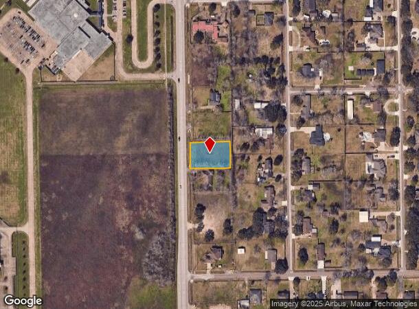
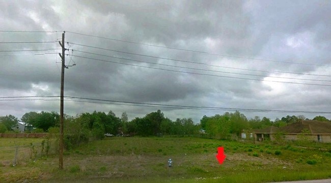
Fm 1128, Pearland, TX 77584

NEARBY LISTINGS FOR SALE OR LEASE
Property Detail
Fm 1128
Houston-The Woodlands-Sugar Land, TX
West Lea Sec 3 (A0546 H T & B)
8230-0122-940
WEST LEA SEC 3 (A0546 H T & B) BLK 12 LOT 7 COMM RES ACRES 0.59
Vacantlandnec
Brazoria
X
Texas
48039C0040K
7
2024
0.59 AC
2025
South
660704
Houston
DEMOGRAPHICS near Fm 1128
1 Mile
3 Mile
5 Mile
2024 Total Population
4,240
52,422
127,316
2029 Population
4,699
57,733
140,954
Pop Growth 2024-2029
+ 10.83%
+ 10.13%
+ 10.71%
Average Age
36
36
37
2024 Total Households
1,302
17,133
42,971
HH Growth 2024-2029
+ 10.98%
+ 10.22%
+ 10.82%
Median Household Inc
$102,123
$108,106
$105,258
Avg Household Size
3.10
3.00
2.90
2024 Avg HH Vehicles
2.00
2.00
2.00
Median Home Value
$309,495
$297,674
$309,525
Median Year Built
2003
2000
2002
Nearby Places
Map Layers
Map Styles
 Street
 Aerial
- Restaurants
- Banks
- Shops
- Fitness
- Groceries
PUBLIC TRANSPORTATION
AIRPORT
William P Hobby
DRIVE
WALK
Distance
William P Hobby
21 min
10.6 mi
Freight Ports
Port of Houston
DRIVE
WALK
Distance
Port of Houston
32 min
18.8 mi
SALE & LEASE HISTORY
LISTING DATE
SALE/LEASE

Sep 12, 2017
For Sale
Nearby Properties
Address
Land Use
TOTAL SIZE
Lot Size
Zoning
Address
Land Use
TOTAL SIZE
Lot Size
Zoning
64.56 AC
0016
Address
Land Use
TOTAL SIZE
Lot Size
Zoning
379,071 SF
20.02 AC
Address
Land Use
TOTAL SIZE
Lot Size
Zoning
321,409 SF
13.90 AC
Address
Land Use
TOTAL SIZE
Lot Size
Zoning
7.42 AC
Address
Land Use
TOTAL SIZE
Lot Size
Zoning
334,628 SF
13.87 AC
Address
Land Use
TOTAL SIZE
Lot Size
Zoning
240,616 SF
10.01 AC
Address
Land Use
TOTAL SIZE
Lot Size
Zoning
252,472 SF
13.28 AC
Address
Land Use
TOTAL SIZE
Lot Size
Zoning
79.45 AC
1000
Address
Land Use
TOTAL SIZE
Lot Size
Zoning
16,677 SF
12.38 AC
Address
Land Use
TOTAL SIZE
Lot Size
Zoning
241,488 SF
9.81 AC
Address
Land Use
TOTAL SIZE
Lot Size
Zoning
221,401 SF
11 AC
Address
Land Use
TOTAL SIZE
Lot Size
Zoning
344,782 SF
14.14 AC
Address
Land Use
TOTAL SIZE
Lot Size
Zoning
81,170 SF
50 AC
Address
Land Use
TOTAL SIZE
Lot Size
Zoning
71,700 SF
6.08 AC
Address
Land Use
TOTAL SIZE
Lot Size
Zoning
70,964 SF
6.51 AC
Address
Land Use
TOTAL SIZE
Lot Size
Zoning
106,341 SF
12.12 AC
0550
Address
Land Use
TOTAL SIZE
Lot Size
Zoning
19.61 AC
Address
Land Use
TOTAL SIZE
Lot Size
Zoning
122,473 SF
2.30 AC
Address
Land Use
TOTAL SIZE
Lot Size
Zoning
66,399 SF
6.10 AC
Address
Land Use
TOTAL SIZE
Lot Size
Zoning
64,290 SF
3.14 AC
Address
Land Use
TOTAL SIZE
Lot Size
Zoning
55,751 SF
5.04 AC
Address
Land Use
TOTAL SIZE
Lot Size
Zoning
28,143 SF
13.08 AC
Address
Land Use
TOTAL SIZE
Lot Size
Zoning
3,159 SF
64.95 AC
0227
Address
Land Use
TOTAL SIZE
Lot Size
Zoning
120,583 SF
9.07 AC
0050
Address
Land Use
TOTAL SIZE
Lot Size
Zoning
46,328 SF
2.76 AC
Address
Land Use
TOTAL SIZE
Lot Size
Zoning
67,000 SF
28.97 AC
Address
Land Use
TOTAL SIZE
Lot Size
Zoning
38,376 SF
2.55 AC
Address
Land Use
TOTAL SIZE
Lot Size
Zoning
47,820 SF
2.83 AC
Address
Land Use
TOTAL SIZE
Lot Size
Zoning
67,130 SF
17.70 AC
0151
Address
Land Use
TOTAL SIZE
Lot Size
Zoning
9.72 AC
The World's #1 Commercial Real Estate Marketplace
Connect with us
© 2025 CoStar Group
The information above has been obtained from sources believed reliable. While we do not doubt its accuracy we have not verified it and make no guarantee, warranty or representation about it. It is your responsibility to independently confirm its accuracy and completeness. Any projections, opinions, assumptions, or estimates used are for example only and do not represent the current or future performance of the property. The value of this transaction to you depends on tax and other factors which should be evaluated by your tax, financial, and legal advisors. You and your advisors should conduct a careful, independent investigation of the property to determine to your satisfaction the suitability of the property for your needs.