Property Record
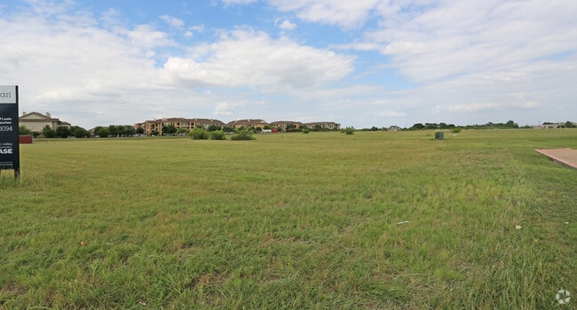
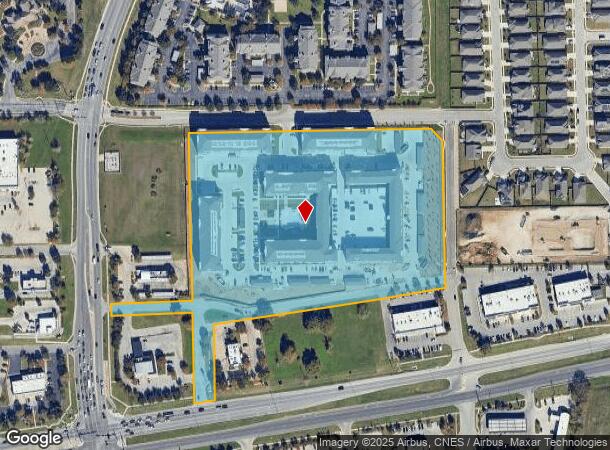
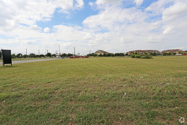
2001 E Plateau Vista Blvd E, Round Rock, TX 78665

NEARBY LISTINGS FOR SALE OR LEASE
-
-
-
-
-
-
-
-
-
-
No Photo
-
-
-
-
-
View all Round Rock listings for lease on LoopNet.com
Property Detail
2001 E Plateau Vista Blvd E
Austin
Palm Valley Market Center Sec 4 (Blk A L
Austin-Round Rock-San Marcos, TX
S12818 - PALM VALLEY MARKET CENTER SEC 4 (BLK A LTS 1-3), BLOCK A, LOT 1, ACRES 12.5184
R623395
Williamson
Multifamilydwelling
Texas
2024
1-3,1
2025
12.52 AC
021512
Round Rock
445,321 SF
DEMOGRAPHICS near 2001 E Plateau Vista Blvd E
1 Mile
3 Mile
5 Mile
2024 Total Population
15,856
103,155
243,312
2029 Population
20,127
130,204
299,365
Pop Growth 2024-2029
+ 26.94%
+ 26.22%
+ 23.04%
Average Age
36
36
36
2024 Total Households
5,979
37,656
88,761
HH Growth 2024-2029
+ 27.50%
+ 26.77%
+ 23.60%
Median Household Inc
$80,588
$83,546
$95,444
Avg Household Size
2.60
2.70
2.70
2024 Avg HH Vehicles
2.00
2.00
2.00
Median Home Value
$279,581
$302,618
$359,294
Median Year Built
1996
2000
2004
Nearby Places
Map Layers
Map Styles
 Street
 Aerial
- Restaurants
- Banks
- Shops
- Fitness
- Groceries
PUBLIC TRANSPORTATION
AIRPORT
Austin-Bergstrom International
DRIVE
WALK
Distance
Austin-Bergstrom International
44 min
33.3 mi
Freight Ports
Calhoun Port
DRIVE
WALK
Distance
Calhoun Port
204 min
176.2 mi
SALE & LEASE HISTORY
LISTING DATE
SALE/LEASE

Sep 25, 2016
For Lease
Sep 15, 2017
For Lease
Jul 13, 2017
For Sale
Nearby Properties
Address
Land Use
TOTAL SIZE
Lot Size
Zoning
Address
Land Use
TOTAL SIZE
Lot Size
Zoning
1,240,638 SF
171.60 AC
Address
Land Use
TOTAL SIZE
Lot Size
Zoning
2,089,779 SF
167.49 AC
Address
Land Use
TOTAL SIZE
Lot Size
Zoning
956,707 SF
71.90 AC
C1
Address
Land Use
TOTAL SIZE
Lot Size
Zoning
536,741 SF
80.32 AC
SF2
Address
Land Use
TOTAL SIZE
Lot Size
Zoning
422,682 SF
95.18 AC
Address
Land Use
TOTAL SIZE
Lot Size
Zoning
485,021 SF
50.17 AC
C1
Address
Land Use
TOTAL SIZE
Lot Size
Zoning
345,000 SF
48.61 AC
Address
Land Use
TOTAL SIZE
Lot Size
Zoning
533,151 SF
26.90 AC
PUD
Address
Land Use
TOTAL SIZE
Lot Size
Zoning
273,462 SF
47.12 AC
Address
Land Use
TOTAL SIZE
Lot Size
Zoning
456,943 SF
66.31 AC
SF2
Address
Land Use
TOTAL SIZE
Lot Size
Zoning
361,440 SF
19.35 AC
Address
Land Use
TOTAL SIZE
Lot Size
Zoning
362,216 SF
19.72 AC
Address
Land Use
TOTAL SIZE
Lot Size
Zoning
618,605 SF
14.11 AC
PUD
Address
Land Use
TOTAL SIZE
Lot Size
Zoning
326,015 SF
11.11 AC
Address
Land Use
TOTAL SIZE
Lot Size
Zoning
201,200 SF
9.48 AC
Address
Land Use
TOTAL SIZE
Lot Size
Zoning
411,020 SF
29.91 AC
PUD
Address
Land Use
TOTAL SIZE
Lot Size
Zoning
140,409 SF
17.15 AC
Address
Land Use
TOTAL SIZE
Lot Size
Zoning
330,541 SF
20.90 AC
PUD
Address
Land Use
TOTAL SIZE
Lot Size
Zoning
364,432 SF
20.56 AC
MF
Address
Land Use
TOTAL SIZE
Lot Size
Zoning
285,835 SF
25.69 AC
C1
Address
Land Use
TOTAL SIZE
Lot Size
Zoning
203,198 SF
14.04 AC
Address
Land Use
TOTAL SIZE
Lot Size
Zoning
344,341 SF
19.19 AC
PUD
Address
Land Use
TOTAL SIZE
Lot Size
Zoning
409,875 SF
25.28 AC
MF
Address
Land Use
TOTAL SIZE
Lot Size
Zoning
300,061 SF
19.19 AC
Address
Land Use
TOTAL SIZE
Lot Size
Zoning
330,300 SF
18.58 AC
C1
Address
Land Use
TOTAL SIZE
Lot Size
Zoning
375,523 SF
15.43 AC
PUD
Address
Land Use
TOTAL SIZE
Lot Size
Zoning
217,013 SF
20.44 AC
Address
Land Use
TOTAL SIZE
Lot Size
Zoning
326,218 SF
44.54 AC
Address
Land Use
TOTAL SIZE
Lot Size
Zoning
364,797 SF
13.50 AC
The World's #1 Commercial Real Estate Marketplace
Connect with us
© 2026 CoStar Group
The information above has been obtained from sources believed reliable. While we do not doubt its accuracy we have not verified it and make no guarantee, warranty or representation about it. It is your responsibility to independently confirm its accuracy and completeness. Any projections, opinions, assumptions, or estimates used are for example only and do not represent the current or future performance of the property. The value of this transaction to you depends on tax and other factors which should be evaluated by your tax, financial, and legal advisors. You and your advisors should conduct a careful, independent investigation of the property to determine to your satisfaction the suitability of the property for your needs.