Property Record
Fm 1518, Schertz, TX 78154
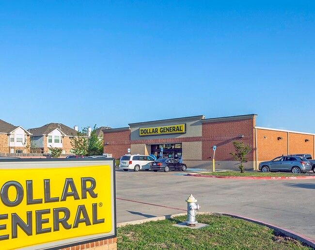

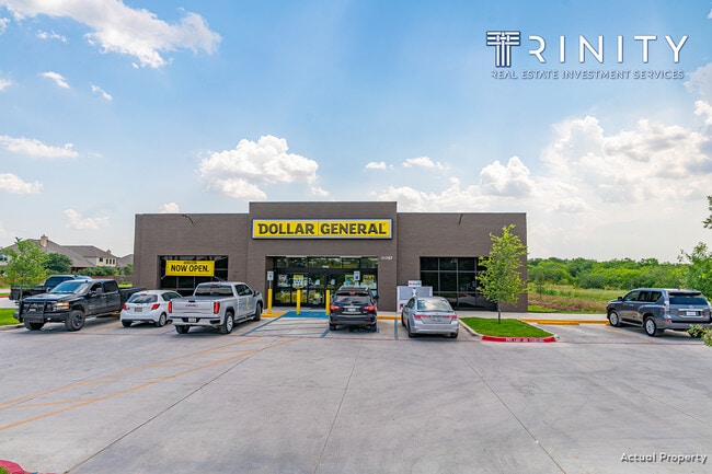
Property Detail
Fm 1518
San Antonio-New Braunfels, TX
CB 5054X (DG SCHERTZ ADD), BLOCK 1 LOT 1 2021- NEW PER PLAT 20001/1842, FILED 02-20-2020
05054-924-0010
BEXAR
Storebuilding
Texas
AE The base floodplain where base flood elevations are provided. AE Zones are now used on new format FIRMs instead of A1-A30 Zones.
1
2024
1.54 AC
2025
Northeast
210706
San Antonio
9,125 SF
NEARBY LISTINGS FOR SALE OR LEASE
DEMOGRAPHICS near Fm 1518
1 mile
3 mile
5 mile
2025 Total Population
1,863
32,467
135,461
2030 Population
1,993
35,593
147,171
Pop Growth 2025-2030
+ 6.98%
+ 9.63%
+ 8.64%
Average Age
37
39
38
2025 Total Households
615
12,021
47,815
HH Growth 2025-2030
+ 7.15%
+ 10.23%
+ 8.90%
Median Household Inc
$96,268
$84,761
$96,905
Avg Household Size
3.00
2.70
2.80
2025 Avg HH Vehicles
2.00
2.00
2.00
Median Home Value
$418,919
$286,940
$306,028
Median Year Built
2010
1995
2002
Nearby Places
Map Layers
Map Styles
 Street
 Aerial
Layers
 Traffic
 Biking
Places
Listings with unknown addresses are not visible on the map
- Restaurants
- Banks
- Shops
- Fitness
- Groceries
PUBLIC TRANSPORTATION
AIRPORT
San Antonio International
Drive
Walk
Distance
San Antonio International
26 min
16.3 mi
Freight Ports
Calhoun Port
Drive
Walk
Distance
Calhoun Port
172 min
140.3 mi
SALE & LEASE HISTORY
LISTING DATE
SALE/LEASE

Jun 02, 2021
For Sale
Jul 14, 2020
For Sale
Nearby Properties
Address
Land Use
TOTAL SIZE
Lot Size
Zoning
Address
Land Use
TOTAL SIZE
Lot Size
Zoning
116.47 AC
Address
Land Use
TOTAL SIZE
Lot Size
Zoning
412,136 SF
49 AC
Address
Land Use
TOTAL SIZE
Lot Size
Zoning
263,617 SF
8.62 AC
Address
Land Use
TOTAL SIZE
Lot Size
Zoning
147,780 SF
15 AC
Address
Land Use
TOTAL SIZE
Lot Size
Zoning
398,442 SF
14.62 AC
Address
Land Use
TOTAL SIZE
Lot Size
Zoning
113,091 SF
12.60 AC
Address
Land Use
TOTAL SIZE
Lot Size
Zoning
342,612 SF
28.49 AC
Address
Land Use
TOTAL SIZE
Lot Size
Zoning
85,117 SF
11 AC
Address
Land Use
TOTAL SIZE
Lot Size
Zoning
187,102 SF
18.40 AC
Address
Land Use
TOTAL SIZE
Lot Size
Zoning
99,263 SF
13.69 AC
Address
Land Use
TOTAL SIZE
Lot Size
Zoning
74,606 SF
8.14 AC
Address
Land Use
TOTAL SIZE
Lot Size
Zoning
33,243 SF
80.72 AC
Address
Land Use
TOTAL SIZE
Lot Size
Zoning
22,841 SF
11 AC
Address
Land Use
TOTAL SIZE
Lot Size
Zoning
113,910 SF
5.72 AC
Address
Land Use
TOTAL SIZE
Lot Size
Zoning
124,618 SF
8.59 AC
Address
Land Use
TOTAL SIZE
Lot Size
Zoning
69,638 SF
7.32 AC
Address
Land Use
TOTAL SIZE
Lot Size
Zoning
76,897 SF
15.57 AC
Address
Land Use
TOTAL SIZE
Lot Size
Zoning
35,229 SF
12.96 AC
Address
Land Use
TOTAL SIZE
Lot Size
Zoning
584 SF
52.64 AC
Address
Land Use
TOTAL SIZE
Lot Size
Zoning
160,400 SF
22.35 AC
Address
Land Use
TOTAL SIZE
Lot Size
Zoning
43,509 SF
2.36 AC
Address
Land Use
TOTAL SIZE
Lot Size
Zoning
1,332 SF
70.85 AC
Address
Land Use
TOTAL SIZE
Lot Size
Zoning
2,574 SF
127.70 AC
Address
Land Use
TOTAL SIZE
Lot Size
Zoning
24,801 SF
17.64 AC
Address
Land Use
TOTAL SIZE
Lot Size
Zoning
34,776 SF
4.06 AC
Address
Land Use
TOTAL SIZE
Lot Size
Zoning
28,251 SF
0.79 AC
Address
Land Use
TOTAL SIZE
Lot Size
Zoning
88,281 SF
5.18 AC
Address
Land Use
TOTAL SIZE
Lot Size
Zoning
10,475 SF
5.22 AC
Address
Land Use
TOTAL SIZE
Lot Size
Zoning
46,500 SF
3.01 AC
Address
Land Use
TOTAL SIZE
Lot Size
Zoning
48,440 SF
4.88 AC
The World's #1 Commercial Real Estate Marketplace
Connect with us
© 2026 CoStar Group
The information above has been obtained from sources believed reliable. While we do not doubt its accuracy we have not verified it and make no guarantee, warranty or representation about it. It is your responsibility to independently confirm its accuracy and completeness. Any projections, opinions, assumptions, or estimates used are for example only and do not represent the current or future performance of the property. The value of this transaction to you depends on tax and other factors which should be evaluated by your tax, financial, and legal advisors. You and your advisors should conduct a careful, independent investigation of the property to determine to your satisfaction the suitability of the property for your needs.