Property Record
Jo Ed Rd, La Feria, TX 78559
This Property Is For Sale
NEARBY LISTINGS FOR SALE OR LEASE
-
-
View all La Feria listings for sale on LoopNet.com
Property Detail
Jo Ed Rd
Brownsville-Harlingen, TX
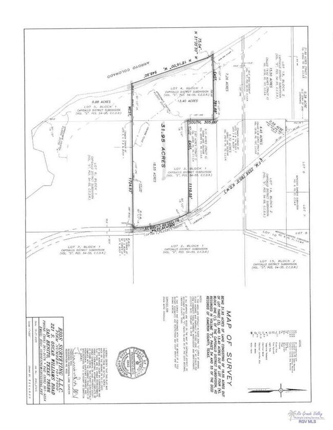
Capisallo District Subdivision
840340-0010-005000
CAPISALLO DISTRICT SUBDIVISION LOT 5 BLK 1, 6.2000 ACRES HCAD-C1400-00-001-0004-10 HB 670
Agriculturalland
Cameron
A
Texas
48061C0400F
5
2024
6.20 AC
2025
Outlying Cameron County
011905
Brownsville/Harlingen
DEMOGRAPHICS near Jo Ed Rd
1 Mile
3 Mile
5 Mile
2024 Total Population
266
9,197
33,771
2029 Population
272
9,474
35,405
Pop Growth 2024-2029
+ 2.26%
+ 3.01%
+ 4.84%
Average Age
36
36
36
2024 Total Households
87
2,808
10,592
HH Growth 2024-2029
+ 1.15%
+ 2.88%
+ 4.99%
Median Household Inc
$34,166
$38,376
$37,488
Avg Household Size
3.10
3.20
3.10
2024 Avg HH Vehicles
2.00
2.00
2.00
Median Home Value
$81,428
$102,659
$84,599
Median Year Built
1987
1989
1987
Nearby Places
Map Layers
Map Styles
 Street
 Aerial
- Restaurants
- Banks
- Shops
- Fitness
- Groceries
PUBLIC TRANSPORTATION
AIRPORT
Valley International
DRIVE
WALK
Distance
Valley International
28 min
18.1 mi
McAllen International
DRIVE
WALK
Distance
McAllen International
38 min
28.3 mi
Freight Ports
Port of Brownsville
DRIVE
WALK
Distance
Port of Brownsville
46 min
37.4 mi
Nearby Properties
Address
Land Use
TOTAL SIZE
Lot Size
Zoning
Address
Land Use
TOTAL SIZE
Lot Size
Zoning
1 SF
4.92 AC
Address
Land Use
TOTAL SIZE
Lot Size
Zoning
1 SF
20 AC
Address
Land Use
TOTAL SIZE
Lot Size
Zoning
40,170 SF
3.09 AC
Address
Land Use
TOTAL SIZE
Lot Size
Zoning
11,812 SF
8.55 AC
Address
Land Use
TOTAL SIZE
Lot Size
Zoning
38,592 SF
2.69 AC
Address
Land Use
TOTAL SIZE
Lot Size
Zoning
58,495 SF
24.73 AC
Address
Land Use
TOTAL SIZE
Lot Size
Zoning
113,125 SF
19.93 AC
Address
Land Use
TOTAL SIZE
Lot Size
Zoning
80,193 SF
6.46 AC
Address
Land Use
TOTAL SIZE
Lot Size
Zoning
725 SF
3.21 AC
Address
Land Use
TOTAL SIZE
Lot Size
Zoning
1 SF
27.82 AC
Address
Land Use
TOTAL SIZE
Lot Size
Zoning
18,516 SF
2.55 AC
Address
Land Use
TOTAL SIZE
Lot Size
Zoning
29,050 SF
14.70 AC
D
Address
Land Use
TOTAL SIZE
Lot Size
Zoning
5,401 SF
1.82 AC
Address
Land Use
TOTAL SIZE
Lot Size
Zoning
30,880 SF
3.98 AC
C
Address
Land Use
TOTAL SIZE
Lot Size
Zoning
36,985 SF
9.85 AC
C
Address
Land Use
TOTAL SIZE
Lot Size
Zoning
7,200 SF
9.53 AC
Address
Land Use
TOTAL SIZE
Lot Size
Zoning
1,040 SF
4.96 AC
C
Address
Land Use
TOTAL SIZE
Lot Size
Zoning
3,480 SF
3.04 AC
C
Address
Land Use
TOTAL SIZE
Lot Size
Zoning
20,900 SF
5.15 AC
Address
Land Use
TOTAL SIZE
Lot Size
Zoning
23,040 SF
1.60 AC
Address
Land Use
TOTAL SIZE
Lot Size
Zoning
23,040 SF
1.98 AC
Address
Land Use
TOTAL SIZE
Lot Size
Zoning
6,766 SF
2.05 AC
Address
Land Use
TOTAL SIZE
Lot Size
Zoning
27,056 SF
2.22 AC
C
Address
Land Use
TOTAL SIZE
Lot Size
Zoning
3.86 AC
C
Address
Land Use
TOTAL SIZE
Lot Size
Zoning
3.86 AC
C
Address
Land Use
TOTAL SIZE
Lot Size
Zoning
24,022 SF
3.08 AC
C
Address
Land Use
TOTAL SIZE
Lot Size
Zoning
11,781 SF
1.32 AC
C
Address
Land Use
TOTAL SIZE
Lot Size
Zoning
1.67 AC
Address
Land Use
TOTAL SIZE
Lot Size
Zoning
15,240 SF
5.55 AC
C
Address
Land Use
TOTAL SIZE
Lot Size
Zoning
12,276 SF
11.27 AC
The World's #1 Commercial Real Estate Marketplace
Connect with us
© 2025 CoStar Group
The information above has been obtained from sources believed reliable. While we do not doubt its accuracy we have not verified it and make no guarantee, warranty or representation about it. It is your responsibility to independently confirm its accuracy and completeness. Any projections, opinions, assumptions, or estimates used are for example only and do not represent the current or future performance of the property. The value of this transaction to you depends on tax and other factors which should be evaluated by your tax, financial, and legal advisors. You and your advisors should conduct a careful, independent investigation of the property to determine to your satisfaction the suitability of the property for your needs.