Property Record
Fm 521, Rosharon, TX 77583

Property Detail
Fm 521
0068-00-000-4100-907
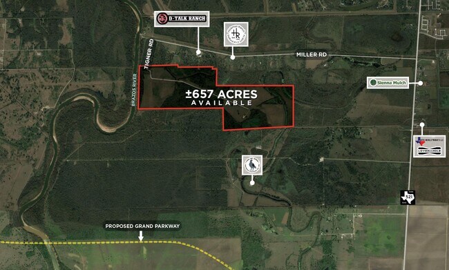
0068 WM PETTUS, TRACT 3 (PART), ACRES 284.222, PART OF A 297.11 ACRE TRACT
Ranch
FORT BEND
ZT
Texas
AE The base floodplain where base flood elevations are provided. AE Zones are now used on new format FIRMs instead of A1-A30 Zones.
284.22 AC
2024
Southwest Outlier
2025
Houston
661902
Houston-Pasadena-The Woodlands, TX
NEARBY LISTINGS FOR SALE OR LEASE
-
-
-
No Photo
-
-
-
View all Rosharon listings for sale on LoopNet.com
DEMOGRAPHICS near Fm 521
1 mile
3 mile
5 mile
2025 Total Population
356
17,081
51,418
2030 Population
439
19,998
59,444
Pop Growth 2025-2030
+ 23.31%
+ 17.08%
+ 15.61%
Average Age
39
36
36
2025 Total Households
106
4,951
15,050
HH Growth 2025-2030
+ 23.58%
+ 17.71%
+ 16.36%
Median Household Inc
$106,250
$140,939
$122,846
Avg Household Size
3.20
3.40
3.30
2025 Avg HH Vehicles
2.00
2.00
2.00
Median Home Value
$459,999
$452,777
$407,205
Median Year Built
2011
2010
2010
Nearby Places
Map Layers
Map Styles
 Street
 Aerial
Layers
 Traffic
 Biking
Places
Listings with unknown addresses are not visible on the map
- Restaurants
- Banks
- Shops
- Fitness
- Groceries
PUBLIC TRANSPORTATION
AIRPORT
William P Hobby
Drive
Walk
Distance
William P Hobby
41 min
23.3 mi
Freight Ports
Port of Houston
Drive
Walk
Distance
Port of Houston
45 min
27.9 mi
SALE & LEASE HISTORY
LISTING DATE
SALE/LEASE

Aug 30, 2018
For Sale
Nearby Properties
Address
Land Use
TOTAL SIZE
Lot Size
Zoning
Address
Land Use
TOTAL SIZE
Lot Size
Zoning
Address
Land Use
TOTAL SIZE
Lot Size
Zoning
228,566 SF
31.85 AC
Address
Land Use
TOTAL SIZE
Lot Size
Zoning
16.28 AC
Address
Land Use
TOTAL SIZE
Lot Size
Zoning
123,079 SF
14.99 AC
Address
Land Use
TOTAL SIZE
Lot Size
Zoning
Address
Land Use
TOTAL SIZE
Lot Size
Zoning
65,403 SF
14.65 AC
Address
Land Use
TOTAL SIZE
Lot Size
Zoning
537.89 AC
Address
Land Use
TOTAL SIZE
Lot Size
Zoning
127,500 SF
7.60 AC
Address
Land Use
TOTAL SIZE
Lot Size
Zoning
70,000 SF
64.91 AC
Address
Land Use
TOTAL SIZE
Lot Size
Zoning
21,410 SF
16 AC
Address
Land Use
TOTAL SIZE
Lot Size
Zoning
2,000 SF
24.85 AC
Address
Land Use
TOTAL SIZE
Lot Size
Zoning
28,633 SF
9.36 AC
Address
Land Use
TOTAL SIZE
Lot Size
Zoning
224.26 AC
Address
Land Use
TOTAL SIZE
Lot Size
Zoning
16,298 SF
2.87 AC
Address
Land Use
TOTAL SIZE
Lot Size
Zoning
672 SF
11.35 AC
Address
Land Use
TOTAL SIZE
Lot Size
Zoning
274.73 AC
Address
Land Use
TOTAL SIZE
Lot Size
Zoning
19.05 AC
Address
Land Use
TOTAL SIZE
Lot Size
Zoning
91.43 AC
SQ
Address
Land Use
TOTAL SIZE
Lot Size
Zoning
7,298 SF
7.97 AC
Address
Land Use
TOTAL SIZE
Lot Size
Zoning
Address
Land Use
TOTAL SIZE
Lot Size
Zoning
Address
Land Use
TOTAL SIZE
Lot Size
Zoning
1.86 AC
Address
Land Use
TOTAL SIZE
Lot Size
Zoning
665.06 AC
ZT
Address
Land Use
TOTAL SIZE
Lot Size
Zoning
41,540 SF
5.71 AC
Address
Land Use
TOTAL SIZE
Lot Size
Zoning
1.56 AC
Address
Land Use
TOTAL SIZE
Lot Size
Zoning
7,795 SF
4.30 AC
Address
Land Use
TOTAL SIZE
Lot Size
Zoning
11,341 SF
4.45 AC
AQS
Address
Land Use
TOTAL SIZE
Lot Size
Zoning
10,080 SF
4.06 AC
Address
Land Use
TOTAL SIZE
Lot Size
Zoning
99.03 AC
Address
Land Use
TOTAL SIZE
Lot Size
Zoning
13,075 SF
1.57 AC
The World's #1 Commercial Real Estate Marketplace
Connect with us
© 2026 CoStar Group
The information above has been obtained from sources believed reliable. While we do not doubt its accuracy we have not verified it and make no guarantee, warranty or representation about it. It is your responsibility to independently confirm its accuracy and completeness. Any projections, opinions, assumptions, or estimates used are for example only and do not represent the current or future performance of the property. The value of this transaction to you depends on tax and other factors which should be evaluated by your tax, financial, and legal advisors. You and your advisors should conduct a careful, independent investigation of the property to determine to your satisfaction the suitability of the property for your needs.