Property Record
Fm 558, Texarkana, TX 75501

Property Detail
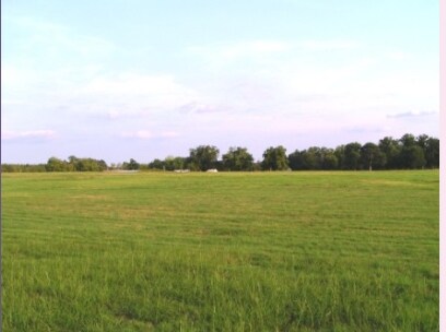
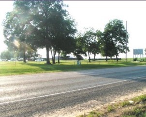
Fm 558
Texarkana, TX-AR
J E JANES A-307 6000/320 03/01/11 BLK/TRACT 2 2D 2E 2H 229.95 ACRES
11740000300
BOWIE
Vacantlandnec
Texas
AE The base floodplain where base flood elevations are provided. AE Zones are now used on new format FIRMs instead of A1-A30 Zones.
229.95 AC
2024
Texas East Area
2025
Other Market Areas
011101
NEARBY LISTINGS FOR SALE OR LEASE
-
-
View all Texarkana listings for sale on LoopNet.com
DEMOGRAPHICS near Fm 558
1 mile
3 mile
5 mile
2025 Total Population
884
12,753
53,639
2030 Population
899
12,885
53,730
Pop Growth 2025-2030
+ 1.70%
+ 1.04%
+ 0.17%
Average Age
40
39
39
2025 Total Households
367
4,608
20,804
HH Growth 2025-2030
+ 1.63%
+ 1.17%
+ 0.18%
Median Household Inc
$39,099
$36,357
$41,389
Avg Household Size
2.20
2.30
2.30
2025 Avg HH Vehicles
2.00
1.00
2.00
Median Home Value
$77,868
$81,992
$114,836
Median Year Built
1985
1977
1975
Nearby Places
Map Layers
Map Styles
 Street
 Aerial
Layers
 Traffic
 Biking
Places
Listings with unknown addresses are not visible on the map
- Restaurants
- Banks
- Shops
- Fitness
- Groceries
PUBLIC TRANSPORTATION
COMMUTER RAIL
Texarkana Amtrak Station (Texas Eagle - Amtrak)
Drive
Walk
Distance
Texarkana Amtrak Station (Texas Eagle - Amtrak)
7 min
4.0 mi
AIRPORT
Texarkana Regional-Webb Field
Drive
Walk
Distance
Texarkana Regional-Webb Field
14 min
7.8 mi
Freight Ports
Port of Shreveport
Drive
Walk
Distance
Port of Shreveport
102 min
91.2 mi
SALE & LEASE HISTORY
LISTING DATE
SALE/LEASE

Dec 13, 2016
For Sale
Nearby Properties
Address
Land Use
TOTAL SIZE
Lot Size
Zoning
Address
Land Use
TOTAL SIZE
Lot Size
Zoning
75 AC
Address
Land Use
TOTAL SIZE
Lot Size
Zoning
93.03 AC
Address
Land Use
TOTAL SIZE
Lot Size
Zoning
Address
Land Use
TOTAL SIZE
Lot Size
Zoning
19,189 SF
Address
Land Use
TOTAL SIZE
Lot Size
Zoning
Address
Land Use
TOTAL SIZE
Lot Size
Zoning
32.42 AC
Address
Land Use
TOTAL SIZE
Lot Size
Zoning
102,614 SF
0.89 AC
Address
Land Use
TOTAL SIZE
Lot Size
Zoning
74,246 SF
1.34 AC
Address
Land Use
TOTAL SIZE
Lot Size
Zoning
64,449 SF
6.23 AC
Address
Land Use
TOTAL SIZE
Lot Size
Zoning
49,910 SF
3.61 AC
Address
Land Use
TOTAL SIZE
Lot Size
Zoning
66,942 SF
5.91 AC
Address
Land Use
TOTAL SIZE
Lot Size
Zoning
36,562 SF
14.01 AC
Address
Land Use
TOTAL SIZE
Lot Size
Zoning
2,583 SF
75.09 AC
Address
Land Use
TOTAL SIZE
Lot Size
Zoning
Address
Land Use
TOTAL SIZE
Lot Size
Zoning
131,465 SF
5.50 AC
Address
Land Use
TOTAL SIZE
Lot Size
Zoning
139,000 SF
6.32 AC
Address
Land Use
TOTAL SIZE
Lot Size
Zoning
63,800 SF
8.52 AC
Address
Land Use
TOTAL SIZE
Lot Size
Zoning
149,326 SF
23.46 AC
Address
Land Use
TOTAL SIZE
Lot Size
Zoning
8,040 SF
8.76 AC
Address
Land Use
TOTAL SIZE
Lot Size
Zoning
4.55 AC
Address
Land Use
TOTAL SIZE
Lot Size
Zoning
130,022 SF
10.48 AC
Address
Land Use
TOTAL SIZE
Lot Size
Zoning
8.44 AC
Address
Land Use
TOTAL SIZE
Lot Size
Zoning
165.56 AC
Address
Land Use
TOTAL SIZE
Lot Size
Zoning
153,536 SF
10 AC
Address
Land Use
TOTAL SIZE
Lot Size
Zoning
46,743 SF
3.65 AC
Address
Land Use
TOTAL SIZE
Lot Size
Zoning
139,295 SF
12.39 AC
Address
Land Use
TOTAL SIZE
Lot Size
Zoning
18,819 SF
140.10 AC
Address
Land Use
TOTAL SIZE
Lot Size
Zoning
61,920 SF
3.46 AC
Address
Land Use
TOTAL SIZE
Lot Size
Zoning
130,288 SF
16.05 AC
Address
Land Use
TOTAL SIZE
Lot Size
Zoning
104,341 SF
11.79 AC
The World's #1 Commercial Real Estate Marketplace
Connect with us
© 2026 CoStar Group
The information above has been obtained from sources believed reliable. While we do not doubt its accuracy we have not verified it and make no guarantee, warranty or representation about it. It is your responsibility to independently confirm its accuracy and completeness. Any projections, opinions, assumptions, or estimates used are for example only and do not represent the current or future performance of the property. The value of this transaction to you depends on tax and other factors which should be evaluated by your tax, financial, and legal advisors. You and your advisors should conduct a careful, independent investigation of the property to determine to your satisfaction the suitability of the property for your needs.