Property Record
Fm 619, Taylor, TX 76574

Property Detail
Fm 619
Austin-Round Rock-San Marcos, TX
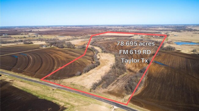
AW0061 AW0061 - BAKER, C.W. SUR., ACRES 65.227
R005912
WILLIAMSON
Agriculturalland
Texas
B and X Area of moderate flood hazard, usually the area between the limits of the 100-year and 500-year floods.
65.23 AC
2024
Georgetown
2025
Austin
021203
NEARBY LISTINGS FOR SALE OR LEASE
DEMOGRAPHICS near Fm 619
1 mile
3 mile
5 mile
2025 Total Population
97
13,493
21,577
2030 Population
110
15,394
24,677
Pop Growth 2025-2030
+ 13.40%
+ 14.09%
+ 14.37%
Average Age
43
40
40
2025 Total Households
39
5,059
8,074
HH Growth 2025-2030
+ 12.82%
+ 14.55%
+ 14.84%
Median Household Inc
$67,500
$69,246
$72,395
Avg Household Size
2.40
2.60
2.60
2025 Avg HH Vehicles
2.00
2.00
2.00
Median Home Value
$450,000
$340,831
$328,513
Median Year Built
1985
1982
1984
Nearby Places
Map Layers
Map Styles
 Street
 Aerial
Layers
 Traffic
 Biking
Places
Listings with unknown addresses are not visible on the map
- Restaurants
- Banks
- Shops
- Fitness
- Groceries
PUBLIC TRANSPORTATION
COMMUTER RAIL
Taylor Amtrak (Texas Eagle - Amtrak)
Drive
Walk
Distance
Taylor Amtrak (Texas Eagle - Amtrak)
9 min
4.0 mi
Freight Ports
Port of Houston
Drive
Walk
Distance
Port of Houston
205 min
166.4 mi
SALE & LEASE HISTORY
LISTING DATE
SALE/LEASE

Oct 27, 2022
For Sale
Oct 01, 2024
For Sale
Nearby Properties
Address
Land Use
TOTAL SIZE
Lot Size
Zoning
Address
Land Use
TOTAL SIZE
Lot Size
Zoning
1,213.97 AC
Address
Land Use
TOTAL SIZE
Lot Size
Zoning
5,060,050 SF
354.33 AC
Address
Land Use
TOTAL SIZE
Lot Size
Zoning
69,997 SF
12.30 AC
3-B1
Address
Land Use
TOTAL SIZE
Lot Size
Zoning
58.91 AC
Address
Land Use
TOTAL SIZE
Lot Size
Zoning
126,732 SF
9.52 AC
Address
Land Use
TOTAL SIZE
Lot Size
Zoning
128,023 SF
13.78 AC
2-M1
Address
Land Use
TOTAL SIZE
Lot Size
Zoning
94,210 SF
17.42 AC
3-B1
Address
Land Use
TOTAL SIZE
Lot Size
Zoning
152,302 SF
17.38 AC
3-B1
Address
Land Use
TOTAL SIZE
Lot Size
Zoning
110,004 SF
27.79 AC
2-M1
Address
Land Use
TOTAL SIZE
Lot Size
Zoning
60,000 SF
15.74 AC
Address
Land Use
TOTAL SIZE
Lot Size
Zoning
59,275 SF
3.65 AC
Address
Land Use
TOTAL SIZE
Lot Size
Zoning
72,164 SF
3.97 AC
Address
Land Use
TOTAL SIZE
Lot Size
Zoning
625 SF
51.85 AC
Address
Land Use
TOTAL SIZE
Lot Size
Zoning
Address
Land Use
TOTAL SIZE
Lot Size
Zoning
39,913 SF
1.54 AC
1-B3
Address
Land Use
TOTAL SIZE
Lot Size
Zoning
46,344 SF
4.05 AC
Address
Land Use
TOTAL SIZE
Lot Size
Zoning
8.79 AC
Address
Land Use
TOTAL SIZE
Lot Size
Zoning
Address
Land Use
TOTAL SIZE
Lot Size
Zoning
87,200 SF
8.59 AC
Address
Land Use
TOTAL SIZE
Lot Size
Zoning
80,000 SF
3.73 AC
Address
Land Use
TOTAL SIZE
Lot Size
Zoning
Address
Land Use
TOTAL SIZE
Lot Size
Zoning
76,596 SF
2.71 AC
Address
Land Use
TOTAL SIZE
Lot Size
Zoning
17,766 SF
0.77 AC
3-B1
Address
Land Use
TOTAL SIZE
Lot Size
Zoning
119,400 SF
14.03 AC
2-M1
Address
Land Use
TOTAL SIZE
Lot Size
Zoning
33,000 SF
0.38 AC
1-B3
Address
Land Use
TOTAL SIZE
Lot Size
Zoning
35.07 AC
Address
Land Use
TOTAL SIZE
Lot Size
Zoning
37,236 SF
1.20 AC
Address
Land Use
TOTAL SIZE
Lot Size
Zoning
41,000 SF
9.90 AC
Address
Land Use
TOTAL SIZE
Lot Size
Zoning
18,136 SF
3.79 AC
3-B1
Address
Land Use
TOTAL SIZE
Lot Size
Zoning
65,906 SF
7.34 AC
The World's #1 Commercial Real Estate Marketplace
Connect with us
© 2026 CoStar Group
The information above has been obtained from sources believed reliable. While we do not doubt its accuracy we have not verified it and make no guarantee, warranty or representation about it. It is your responsibility to independently confirm its accuracy and completeness. Any projections, opinions, assumptions, or estimates used are for example only and do not represent the current or future performance of the property. The value of this transaction to you depends on tax and other factors which should be evaluated by your tax, financial, and legal advisors. You and your advisors should conduct a careful, independent investigation of the property to determine to your satisfaction the suitability of the property for your needs.