No Photo
Property Record
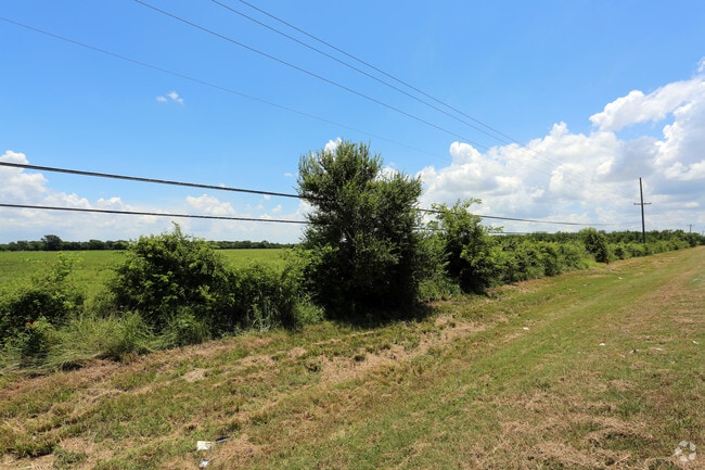
Fm 723, Rosenberg, TX 77471


This Property Is For Sale
Property Detail
Fm 723
Houston-Pasadena-The Woodlands, TX
0003 WM ANDREWS, TRACT 18, ACRES 98.504, (97% IN CITY OF ROSENBERG, SEE NOTES IN COMMENT SECTION)
0003-00-000-0180-901
FORT BEND
Ranch
Texas
Y
18
AE The base floodplain where base flood elevations are provided. AE Zones are now used on new format FIRMs instead of A1-A30 Zones.
98.50 AC
2024
Southwest Outlier
2025
Houston
675300
NEARBY LISTINGS FOR SALE OR LEASE
DEMOGRAPHICS near Fm 723
1 mile
3 mile
5 mile
2025 Total Population
2,527
41,012
89,079
2030 Population
2,922
46,580
101,714
Pop Growth 2025-2030
+ 15.63%
+ 13.58%
+ 14.18%
Average Age
35
37
38
2025 Total Households
771
13,707
30,652
HH Growth 2025-2030
+ 15.95%
+ 13.98%
+ 14.65%
Median Household Inc
$131,851
$62,825
$81,896
Avg Household Size
3.20
2.90
2.80
2025 Avg HH Vehicles
2.00
2.00
2.00
Median Home Value
$372,525
$224,481
$303,947
Median Year Built
2011
1983
2003
Nearby Places
Map Layers
Map Styles
 Street
 Aerial
Transit
 Traffic
 Biking
Places
Listings with unknown addresses are not visible on the map
- Restaurants
- Banks
- Shops
- Fitness
- Groceries
Nearby Properties
Address
Land Use
TOTAL SIZE
Lot Size
Zoning
Address
Land Use
TOTAL SIZE
Lot Size
Zoning
116.02 AC
YST
Address
Land Use
TOTAL SIZE
Lot Size
Zoning
449,167 SF
73.44 AC
IY
Address
Land Use
TOTAL SIZE
Lot Size
Zoning
672,112 SF
81.77 AC
YHN
Address
Land Use
TOTAL SIZE
Lot Size
Zoning
438,371 SF
132.75 AC
Address
Land Use
TOTAL SIZE
Lot Size
Zoning
169,798 SF
16.29 AC
Address
Land Use
TOTAL SIZE
Lot Size
Zoning
16.23 AC
Address
Land Use
TOTAL SIZE
Lot Size
Zoning
28.37 AC
Z
Address
Land Use
TOTAL SIZE
Lot Size
Zoning
54.25 AC
L
Address
Land Use
TOTAL SIZE
Lot Size
Zoning
46,959 SF
8.36 AC
S
Address
Land Use
TOTAL SIZE
Lot Size
Zoning
103,380 SF
5.44 AC
NYX
Address
Land Use
TOTAL SIZE
Lot Size
Zoning
103,204 SF
5.50 AC
YX
Address
Land Use
TOTAL SIZE
Lot Size
Zoning
250,000 SF
1.01 AC
Address
Land Use
TOTAL SIZE
Lot Size
Zoning
92,210 SF
12.09 AC
Address
Land Use
TOTAL SIZE
Lot Size
Zoning
37,951 SF
5.39 AC
L
Address
Land Use
TOTAL SIZE
Lot Size
Zoning
4,536 SF
3.74 AC
Y
Address
Land Use
TOTAL SIZE
Lot Size
Zoning
42,301 SF
5.15 AC
S
Address
Land Use
TOTAL SIZE
Lot Size
Zoning
8.01 AC
Address
Land Use
TOTAL SIZE
Lot Size
Zoning
108,706 SF
1.01 AC
Address
Land Use
TOTAL SIZE
Lot Size
Zoning
4.20 AC
YS
Address
Land Use
TOTAL SIZE
Lot Size
Zoning
105,000 SF
0.53 AC
Address
Land Use
TOTAL SIZE
Lot Size
Zoning
21,218 SF
1.86 AC
Address
Land Use
TOTAL SIZE
Lot Size
Zoning
45,695 SF
3.38 AC
XY
Address
Land Use
TOTAL SIZE
Lot Size
Zoning
115,290 SF
13.75 AC
Address
Land Use
TOTAL SIZE
Lot Size
Zoning
103,048 SF
8.60 AC
Address
Land Use
TOTAL SIZE
Lot Size
Zoning
85,803 SF
13.19 AC
Address
Land Use
TOTAL SIZE
Lot Size
Zoning
152,292 SF
12.13 AC
QSY
Address
Land Use
TOTAL SIZE
Lot Size
Zoning
134,324 SF
6 AC
LSY
Address
Land Use
TOTAL SIZE
Lot Size
Zoning
58,895 SF
4.50 AC
Address
Land Use
TOTAL SIZE
Lot Size
Zoning
82,127 SF
6.18 AC
L
Address
Land Use
TOTAL SIZE
Lot Size
Zoning
4.73 AC
The World's #1 Commercial Real Estate Marketplace
Connect with us
© 2026 CoStar Group
The information above has been obtained from sources believed reliable. While we do not doubt its accuracy we have not verified it and make no guarantee, warranty or representation about it. It is your responsibility to independently confirm its accuracy and completeness. Any projections, opinions, assumptions, or estimates used are for example only and do not represent the current or future performance of the property. The value of this transaction to you depends on tax and other factors which should be evaluated by your tax, financial, and legal advisors. You and your advisors should conduct a careful, independent investigation of the property to determine to your satisfaction the suitability of the property for your needs.