Property Record
S Us Hy 183, Austin, TX 78744

NEARBY LISTINGS FOR SALE OR LEASE
Property Detail
S Us Hy 183
Austin-Round Rock, TX
Mays G
297484
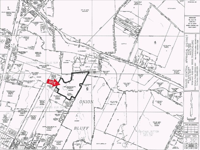
ABS 530 SUR 501 MAYS G ACR 27.79
Farms
Travis
AE
Texas
48453C0620K
27.79 AC
2024
Southeast
2025
Austin
002413
DEMOGRAPHICS near S Us Hy 183
1 Mile
3 Mile
5 Mile
2024 Total Population
517
14,461
100,237
2029 Population
558
15,832
109,436
Pop Growth 2024-2029
+ 7.93%
+ 9.48%
+ 9.18%
Average Age
36
35
34
2024 Total Households
169
4,578
32,738
HH Growth 2024-2029
+ 8.88%
+ 10.20%
+ 10.15%
Median Household Inc
$98,557
$92,587
$66,951
Avg Household Size
2.90
3.10
2.80
2024 Avg HH Vehicles
2.00
2.00
2.00
Median Home Value
$445,000
$280,952
$260,140
Median Year Built
2007
2010
2002
Nearby Places
Map Layers
Map Styles
 Street
 Aerial
- Restaurants
- Banks
- Shops
- Fitness
- Groceries
PUBLIC TRANSPORTATION
AIRPORT
Austin-Bergstrom International
DRIVE
WALK
Distance
Austin-Bergstrom International
15 min
5.8 mi
Freight Ports
Calhoun Port
DRIVE
WALK
Distance
Calhoun Port
177 min
146.7 mi
SALE & LEASE HISTORY
LISTING DATE
SALE/LEASE

Sep 24, 2016
For Sale
Nearby Properties
Address
Land Use
TOTAL SIZE
Lot Size
Zoning
Address
Land Use
TOTAL SIZE
Lot Size
Zoning
942.08 AC
Address
Land Use
TOTAL SIZE
Lot Size
Zoning
801,840 SF
63.90 AC
Address
Land Use
TOTAL SIZE
Lot Size
Zoning
290,643 SF
13.59 AC
Address
Land Use
TOTAL SIZE
Lot Size
Zoning
255,483 SF
35 AC
Address
Land Use
TOTAL SIZE
Lot Size
Zoning
335,913 SF
13.83 AC
Address
Land Use
TOTAL SIZE
Lot Size
Zoning
390,384 SF
34.08 AC
Address
Land Use
TOTAL SIZE
Lot Size
Zoning
287,925 SF
9.92 AC
Address
Land Use
TOTAL SIZE
Lot Size
Zoning
602,470 SF
67.47 AC
Address
Land Use
TOTAL SIZE
Lot Size
Zoning
288,174 SF
18.91 AC
Address
Land Use
TOTAL SIZE
Lot Size
Zoning
241,920 SF
23.37 AC
Address
Land Use
TOTAL SIZE
Lot Size
Zoning
162,000 SF
12.62 AC
Address
Land Use
TOTAL SIZE
Lot Size
Zoning
353,770 SF
23.97 AC
Address
Land Use
TOTAL SIZE
Lot Size
Zoning
326,400 SF
26.12 AC
Address
Land Use
TOTAL SIZE
Lot Size
Zoning
241,725 SF
16.76 AC
Address
Land Use
TOTAL SIZE
Lot Size
Zoning
351,255 SF
12.45 AC
Address
Land Use
TOTAL SIZE
Lot Size
Zoning
231,000 SF
13.07 AC
Address
Land Use
TOTAL SIZE
Lot Size
Zoning
257,600 SF
26.83 AC
Address
Land Use
TOTAL SIZE
Lot Size
Zoning
166,770 SF
13.51 AC
Address
Land Use
TOTAL SIZE
Lot Size
Zoning
172,800 SF
22.82 AC
Address
Land Use
TOTAL SIZE
Lot Size
Zoning
198,000 SF
11.72 AC
Address
Land Use
TOTAL SIZE
Lot Size
Zoning
264,765 SF
23.37 AC
Address
Land Use
TOTAL SIZE
Lot Size
Zoning
167,500 SF
14.03 AC
Address
Land Use
TOTAL SIZE
Lot Size
Zoning
204,741 SF
18.90 AC
Address
Land Use
TOTAL SIZE
Lot Size
Zoning
132,050 SF
11.60 AC
Address
Land Use
TOTAL SIZE
Lot Size
Zoning
139,750 SF
50.37 AC
Address
Land Use
TOTAL SIZE
Lot Size
Zoning
164,845 SF
33.90 AC
Address
Land Use
TOTAL SIZE
Lot Size
Zoning
181,115 SF
13.81 AC
Address
Land Use
TOTAL SIZE
Lot Size
Zoning
122,836 SF
10.79 AC
Address
Land Use
TOTAL SIZE
Lot Size
Zoning
150,000 SF
16.18 AC
Address
Land Use
TOTAL SIZE
Lot Size
Zoning
138,850 SF
14.09 AC
The World's #1 Commercial Real Estate Marketplace
Connect with us
© 2026 CoStar Group
The information above has been obtained from sources believed reliable. While we do not doubt its accuracy we have not verified it and make no guarantee, warranty or representation about it. It is your responsibility to independently confirm its accuracy and completeness. Any projections, opinions, assumptions, or estimates used are for example only and do not represent the current or future performance of the property. The value of this transaction to you depends on tax and other factors which should be evaluated by your tax, financial, and legal advisors. You and your advisors should conduct a careful, independent investigation of the property to determine to your satisfaction the suitability of the property for your needs.