Property Record
Fm Rr 1431, Leander, TX 78641


Property Detail
Fm Rr 1431
Austin-Round Rock-San Marcos, TX
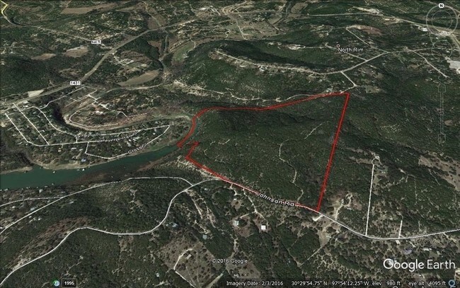
ABS 2246 SUR 53 HAYFORD S ACR 47.46
186588
TRAVIS
Farms
Texas
AE The base floodplain where base flood elevations are provided. AE Zones are now used on new format FIRMs instead of A1-A30 Zones.
47.46 AC
2023
Far Northwest
2023
Austin
020338
NEARBY LISTINGS FOR SALE OR LEASE
-
-
-
-
-
NEC W. Whitestone (F.M. 1431) @ Travisso Parkway
Leander, TX 78641
Rent Upon Request
1.79 - 18.27 AC Lot
Land
-
-
-
View all Leander listings for sale on LoopNet.com
DEMOGRAPHICS near Fm Rr 1431
1 mile
3 mile
5 mile
2025 Total Population
1,313
15,680
86,438
2030 Population
1,407
16,957
95,429
Pop Growth 2025-2030
+ 7.16%
+ 8.14%
+ 10.40%
Average Age
47
41
39
2025 Total Households
561
5,450
30,607
HH Growth 2025-2030
+ 7.66%
+ 8.73%
+ 11.06%
Median Household Inc
$110,087
$174,355
$140,469
Avg Household Size
2.30
2.90
2.80
2025 Avg HH Vehicles
2.00
2.00
2.00
Median Home Value
$755,681
$730,630
$567,969
Median Year Built
1994
2010
2004
Nearby Places
Map Layers
Map Styles
 Street
 Aerial
Transit
 Traffic
 Biking
Places
Listings with unknown addresses are not visible on the map
- Restaurants
- Banks
- Shops
- Fitness
- Groceries
PUBLIC TRANSPORTATION
AIRPORT
Austin-Bergstrom International
Drive
Walk
Distance
Austin-Bergstrom International
55 min
37.3 mi
Freight Ports
Calhoun Port
Drive
Walk
Distance
Calhoun Port
221 min
180.8 mi
SALE & LEASE HISTORY
LISTING DATE
SALE/LEASE

Sep 13, 2017
For Sale
May 02, 2017
For Sale
Nearby Properties
Address
Land Use
TOTAL SIZE
Lot Size
Zoning
Address
Land Use
TOTAL SIZE
Lot Size
Zoning
2,327 SF
810.41 AC
Address
Land Use
TOTAL SIZE
Lot Size
Zoning
673.44 AC
Address
Land Use
TOTAL SIZE
Lot Size
Zoning
670.57 AC
Address
Land Use
TOTAL SIZE
Lot Size
Zoning
158,700 SF
7.82 AC
Address
Land Use
TOTAL SIZE
Lot Size
Zoning
33,384 SF
69.27 AC
Address
Land Use
TOTAL SIZE
Lot Size
Zoning
56,448 SF
13.65 AC
Address
Land Use
TOTAL SIZE
Lot Size
Zoning
116,934 SF
15.56 AC
4-GR
Address
Land Use
TOTAL SIZE
Lot Size
Zoning
259.37 AC
Address
Land Use
TOTAL SIZE
Lot Size
Zoning
Address
Land Use
TOTAL SIZE
Lot Size
Zoning
14.78 AC
Address
Land Use
TOTAL SIZE
Lot Size
Zoning
2,366 SF
6.68 AC
Address
Land Use
TOTAL SIZE
Lot Size
Zoning
43,261 SF
31.32 AC
Address
Land Use
TOTAL SIZE
Lot Size
Zoning
Address
Land Use
TOTAL SIZE
Lot Size
Zoning
200.20 AC
Address
Land Use
TOTAL SIZE
Lot Size
Zoning
92,252 SF
10.12 AC
Address
Land Use
TOTAL SIZE
Lot Size
Zoning
2,744 SF
299.90 AC
Address
Land Use
TOTAL SIZE
Lot Size
Zoning
1,745 SF
160 AC
Address
Land Use
TOTAL SIZE
Lot Size
Zoning
160.30 AC
Address
Land Use
TOTAL SIZE
Lot Size
Zoning
160 AC
Address
Land Use
TOTAL SIZE
Lot Size
Zoning
13,714 SF
30.56 AC
Address
Land Use
TOTAL SIZE
Lot Size
Zoning
15,476 SF
7.07 AC
Address
Land Use
TOTAL SIZE
Lot Size
Zoning
29,520 SF
1.53 AC
Address
Land Use
TOTAL SIZE
Lot Size
Zoning
1,314 SF
11.41 AC
Address
Land Use
TOTAL SIZE
Lot Size
Zoning
122.80 AC
Address
Land Use
TOTAL SIZE
Lot Size
Zoning
46,955 SF
3.09 AC
Address
Land Use
TOTAL SIZE
Lot Size
Zoning
25,573 SF
3.61 AC
Address
Land Use
TOTAL SIZE
Lot Size
Zoning
42,843 SF
3.74 AC
Address
Land Use
TOTAL SIZE
Lot Size
Zoning
20,825 SF
2.57 AC
Address
Land Use
TOTAL SIZE
Lot Size
Zoning
20,672 SF
3.86 AC
Address
Land Use
TOTAL SIZE
Lot Size
Zoning
107.45 AC
The World's #1 Commercial Real Estate Marketplace
Connect with us
© 2026 CoStar Group
The information above has been obtained from sources believed reliable. While we do not doubt its accuracy we have not verified it and make no guarantee, warranty or representation about it. It is your responsibility to independently confirm its accuracy and completeness. Any projections, opinions, assumptions, or estimates used are for example only and do not represent the current or future performance of the property. The value of this transaction to you depends on tax and other factors which should be evaluated by your tax, financial, and legal advisors. You and your advisors should conduct a careful, independent investigation of the property to determine to your satisfaction the suitability of the property for your needs.