Property Record
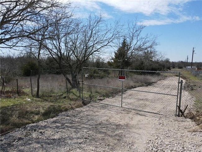
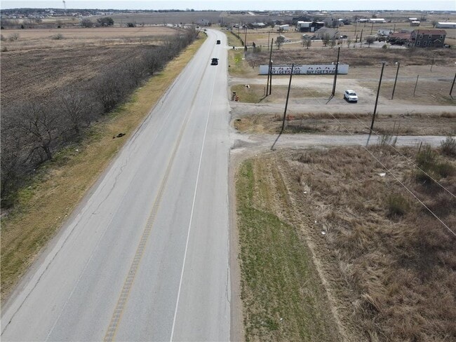
Fm Rr 812, Del Valle, TX 78617

Property Detail
Fm Rr 812
Austin-Round Rock-San Marcos, TX
ABS 2104 SUR 3 HARRISON P C ACR 17.50
856055
TRAVIS
Farms
Texas
A Areas with a 1% annual chance of flooding and a 26% chance of flooding over the life of a 30-year mortgage.
17.50 AC
2025
Southeast
2025
Austin
002453
NEARBY LISTINGS FOR SALE OR LEASE
DEMOGRAPHICS near Fm Rr 812
1 mile
3 mile
5 mile
2025 Total Population
1,138
9,933
26,807
2030 Population
1,315
11,264
29,351
Pop Growth 2025-2030
+ 15.55%
+ 13.40%
+ 9.49%
Average Age
32
33
34
2025 Total Households
285
2,564
7,172
HH Growth 2025-2030
+ 15.79%
+ 13.65%
+ 9.96%
Median Household Inc
$72,762
$81,486
$80,306
Avg Household Size
3.90
3.80
3.60
2025 Avg HH Vehicles
2.00
3.00
3.00
Median Home Value
$329,114
$304,181
$311,274
Median Year Built
2010
2008
2005
Nearby Places
Map Layers
Map Styles
 Street
 Aerial
Layers
 Traffic
 Biking
Places
Listings with unknown addresses are not visible on the map
- Restaurants
- Banks
- Shops
- Fitness
- Groceries
PUBLIC TRANSPORTATION
AIRPORT
Austin-Bergstrom International
Drive
Walk
Distance
Austin-Bergstrom International
23 min
9.4 mi
Freight Ports
Calhoun Port
Drive
Walk
Distance
Calhoun Port
181 min
147.3 mi
Nearby Properties
Address
Land Use
TOTAL SIZE
Lot Size
Zoning
Address
Land Use
TOTAL SIZE
Lot Size
Zoning
562,830 SF
213.88 AC
Address
Land Use
TOTAL SIZE
Lot Size
Zoning
Address
Land Use
TOTAL SIZE
Lot Size
Zoning
59,440 SF
17.07 AC
Address
Land Use
TOTAL SIZE
Lot Size
Zoning
22,322 SF
6 AC
Address
Land Use
TOTAL SIZE
Lot Size
Zoning
6,093 SF
10.49 AC
Address
Land Use
TOTAL SIZE
Lot Size
Zoning
1,045 SF
11.45 AC
Address
Land Use
TOTAL SIZE
Lot Size
Zoning
1,890 SF
98.40 AC
Address
Land Use
TOTAL SIZE
Lot Size
Zoning
3,752 SF
41.46 AC
Address
Land Use
TOTAL SIZE
Lot Size
Zoning
9,798 SF
5.54 AC
Address
Land Use
TOTAL SIZE
Lot Size
Zoning
9,020 SF
1.26 AC
Address
Land Use
TOTAL SIZE
Lot Size
Zoning
53.72 AC
Address
Land Use
TOTAL SIZE
Lot Size
Zoning
10,652 SF
15.99 AC
Address
Land Use
TOTAL SIZE
Lot Size
Zoning
2,400 SF
45.25 AC
Address
Land Use
TOTAL SIZE
Lot Size
Zoning
9,066 SF
12.01 AC
Address
Land Use
TOTAL SIZE
Lot Size
Zoning
43.01 AC
Address
Land Use
TOTAL SIZE
Lot Size
Zoning
115.84 AC
Address
Land Use
TOTAL SIZE
Lot Size
Zoning
1,196 SF
32.68 AC
Address
Land Use
TOTAL SIZE
Lot Size
Zoning
9,216 SF
2 AC
Address
Land Use
TOTAL SIZE
Lot Size
Zoning
11,775 SF
16.09 AC
Address
Land Use
TOTAL SIZE
Lot Size
Zoning
98.57 AC
Address
Land Use
TOTAL SIZE
Lot Size
Zoning
3,056 SF
10.05 AC
Address
Land Use
TOTAL SIZE
Lot Size
Zoning
43,916 SF
3.02 AC
Address
Land Use
TOTAL SIZE
Lot Size
Zoning
670 SF
28.16 AC
Address
Land Use
TOTAL SIZE
Lot Size
Zoning
7,520 SF
0.96 AC
Address
Land Use
TOTAL SIZE
Lot Size
Zoning
5.01 AC
Address
Land Use
TOTAL SIZE
Lot Size
Zoning
74.25 AC
Address
Land Use
TOTAL SIZE
Lot Size
Zoning
28.69 AC
Address
Land Use
TOTAL SIZE
Lot Size
Zoning
32.07 AC
The World's #1 Commercial Real Estate Marketplace
Connect with us
© 2026 CoStar Group
The information above has been obtained from sources believed reliable. While we do not doubt its accuracy we have not verified it and make no guarantee, warranty or representation about it. It is your responsibility to independently confirm its accuracy and completeness. Any projections, opinions, assumptions, or estimates used are for example only and do not represent the current or future performance of the property. The value of this transaction to you depends on tax and other factors which should be evaluated by your tax, financial, and legal advisors. You and your advisors should conduct a careful, independent investigation of the property to determine to your satisfaction the suitability of the property for your needs.