Property Record
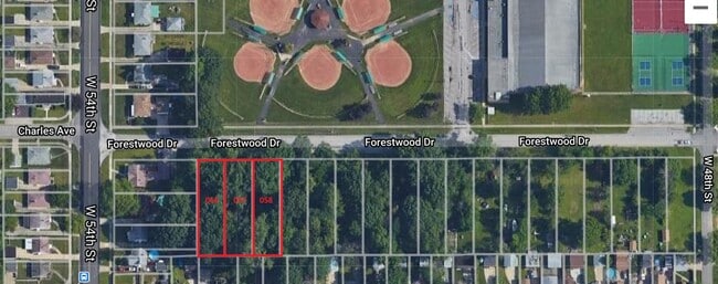
Forestwood Dr, Parma, OH 44134

NEARBY LISTINGS FOR SALE OR LEASE
Property Detail
Forestwood Dr
Cleveland-Elyria, OH
Aufait
447-04-058
11 AUFAIT 0205 ALL
Residentialacreage
Cuyahoga
X
Ohio
39035C0188E
205
2024
0.20 AC
2024
Southwest
177406
Cleveland
DEMOGRAPHICS near Forestwood Dr
1 Mile
3 Mile
5 Mile
2024 Total Population
19,246
113,713
244,891
2029 Population
18,642
109,987
236,430
Pop Growth 2024-2029
(3.14%)
(3.28%)
(3.46%)
Average Age
40
42
41
2024 Total Households
8,040
49,969
103,850
HH Growth 2024-2029
(3.35%)
(3.48%)
(3.65%)
Median Household Inc
$56,824
$57,362
$54,183
Avg Household Size
2.30
2.20
2.30
2024 Avg HH Vehicles
2.00
2.00
2.00
Median Home Value
$133,162
$142,684
$144,409
Median Year Built
1954
1955
1954
Nearby Places
Map Layers
Map Styles
 Street
 Aerial
- Restaurants
- Banks
- Shops
- Fitness
- Groceries
PUBLIC TRANSPORTATION
COMMUTER RAIL
Rockside (National Park Scenic Railway - Cuyahoga Valley Scenic Railroad)
DRIVE
WALK
Distance
Rockside (National Park Scenic Railway - Cuyahoga Valley Scenic Railroad)
12 min
5.8 mi
Canal Exploration Center (National Park Scenic Railway - Cuyahoga Valley Scenic Railroad)
DRIVE
WALK
Distance
Canal Exploration Center (National Park Scenic Railway - Cuyahoga Valley Scenic Railroad)
14 min
7.3 mi
AIRPORT
Cleveland-Hopkins International
DRIVE
WALK
Distance
Cleveland-Hopkins International
17 min
8.5 mi
Freight Ports
Port of Toledo
DRIVE
WALK
Distance
Port of Toledo
132 min
109.9 mi
SALE & LEASE HISTORY
LISTING DATE
SALE/LEASE

Oct 12, 2020
For Sale
Nearby Properties
Address
Land Use
TOTAL SIZE
Lot Size
Zoning
Address
Land Use
TOTAL SIZE
Lot Size
Zoning
477,641 SF
14.07 AC
MF-1
Address
Land Use
TOTAL SIZE
Lot Size
Zoning
245,255 SF
14 AC
Address
Land Use
TOTAL SIZE
Lot Size
Zoning
809,240 SF
36.27 AC
L-I
Address
Land Use
TOTAL SIZE
Lot Size
Zoning
379,061 SF
42.68 AC
Address
Land Use
TOTAL SIZE
Lot Size
Zoning
632,686 SF
16.44 AC
MF-3
Address
Land Use
TOTAL SIZE
Lot Size
Zoning
102,219 SF
14.01 AC
RB
Address
Land Use
TOTAL SIZE
Lot Size
Zoning
33.27 AC
IA
Address
Land Use
TOTAL SIZE
Lot Size
Zoning
355,701 SF
16.35 AC
OB
Address
Land Use
TOTAL SIZE
Lot Size
Zoning
281,600 SF
18.73 AC
SF-A
Address
Land Use
TOTAL SIZE
Lot Size
Zoning
519,592 SF
69.70 AC
L-I
Address
Land Use
TOTAL SIZE
Lot Size
Zoning
372,486 SF
3.98 AC
GR
Address
Land Use
TOTAL SIZE
Lot Size
Zoning
78,622 SF
11.78 AC
CB
Address
Land Use
TOTAL SIZE
Lot Size
Zoning
132.06 AC
IA
Address
Land Use
TOTAL SIZE
Lot Size
Zoning
440,765 SF
44.35 AC
2F
Address
Land Use
TOTAL SIZE
Lot Size
Zoning
86,081 SF
14.45 AC
B
Address
Land Use
TOTAL SIZE
Lot Size
Zoning
111,220 SF
23.65 AC
IA
Address
Land Use
TOTAL SIZE
Lot Size
Zoning
245,255 SF
13.34 AC
Address
Land Use
TOTAL SIZE
Lot Size
Zoning
19.48 AC
U5-A
Address
Land Use
TOTAL SIZE
Lot Size
Zoning
83,375 SF
9.29 AC
MF-1
Address
Land Use
TOTAL SIZE
Lot Size
Zoning
87,489 SF
8.01 AC
Address
Land Use
TOTAL SIZE
Lot Size
Zoning
74,731 SF
15.23 AC
A
Address
Land Use
TOTAL SIZE
Lot Size
Zoning
88,328 SF
35.11 AC
RM
Address
Land Use
TOTAL SIZE
Lot Size
Zoning
16,023 SF
18.41 AC
SF-DH
Address
Land Use
TOTAL SIZE
Lot Size
Zoning
239,222 SF
22.87 AC
G-B
Address
Land Use
TOTAL SIZE
Lot Size
Zoning
315,434 SF
3.48 AC
A
Address
Land Use
TOTAL SIZE
Lot Size
Zoning
208,675 SF
17.33 AC
G-B
Address
Land Use
TOTAL SIZE
Lot Size
Zoning
154,579 SF
18.46 AC
A
Address
Land Use
TOTAL SIZE
Lot Size
Zoning
107,240 SF
19.19 AC
MF-1
Address
Land Use
TOTAL SIZE
Lot Size
Zoning
17,158 SF
20.86 AC
MF-1
Address
Land Use
TOTAL SIZE
Lot Size
Zoning
166,370 SF
8.64 AC
HB
The World's #1 Commercial Real Estate Marketplace
Connect with us
© 2026 CoStar Group
The information above has been obtained from sources believed reliable. While we do not doubt its accuracy we have not verified it and make no guarantee, warranty or representation about it. It is your responsibility to independently confirm its accuracy and completeness. Any projections, opinions, assumptions, or estimates used are for example only and do not represent the current or future performance of the property. The value of this transaction to you depends on tax and other factors which should be evaluated by your tax, financial, and legal advisors. You and your advisors should conduct a careful, independent investigation of the property to determine to your satisfaction the suitability of the property for your needs.