Property Record
Forrest Ave, Dover, DE 19904
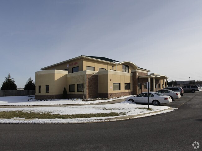
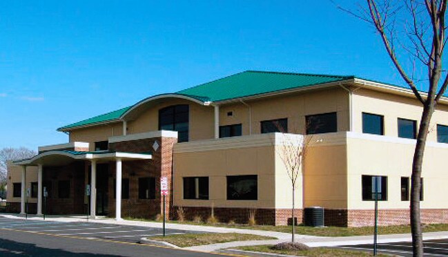

Property Detail
Forrest Ave
Dover, DE
PORTION LOTS 20&21; SOME INFO KEYED FROM LEGAL DESC, BUT COMPLETE LEGAL NOT CAPTURED
2-05-07611-02-6500-000
KENT
Residentialacreage
Delaware
CPO
19
B and X Area of moderate flood hazard, usually the area between the limits of the 100-year and 500-year floods.
1.93 AC
2025
Kent County
2025
Philadelphia
041804
NEARBY LISTINGS FOR SALE OR LEASE
DEMOGRAPHICS near Forrest Ave
1 mile
3 mile
5 mile
2025 Total Population
9,976
52,547
83,750
2030 Population
10,451
54,739
87,668
Pop Growth 2025-2030
+ 4.76%
+ 4.17%
+ 4.68%
Average Age
39
39
39
2025 Total Households
3,907
19,505
31,941
HH Growth 2025-2030
+ 4.68%
+ 4.06%
+ 5.23%
Median Household Inc
$53,190
$59,112
$67,267
Avg Household Size
2.40
2.40
2.40
2025 Avg HH Vehicles
2.00
2.00
2.00
Median Home Value
$256,228
$267,196
$300,097
Median Year Built
1987
1982
1989
Nearby Places
Map Layers
Map Styles
 Street
 Aerial
Layers
 Traffic
 Biking
Places
Listings with unknown addresses are not visible on the map
- Restaurants
- Banks
- Shops
- Fitness
- Groceries
SALE & LEASE HISTORY
LISTING DATE
SALE/LEASE

Sep 24, 2016
For Sale
Oct 28, 2019
For Sale
Feb 14, 2018
For Lease
The World's #1 Commercial Real Estate Marketplace
Connect with us
© 2026 CoStar Group
The information above has been obtained from sources believed reliable. While we do not doubt its accuracy we have not verified it and make no guarantee, warranty or representation about it. It is your responsibility to independently confirm its accuracy and completeness. Any projections, opinions, assumptions, or estimates used are for example only and do not represent the current or future performance of the property. The value of this transaction to you depends on tax and other factors which should be evaluated by your tax, financial, and legal advisors. You and your advisors should conduct a careful, independent investigation of the property to determine to your satisfaction the suitability of the property for your needs.