Property Record
Fortis Dr, Duncan, SC 29334
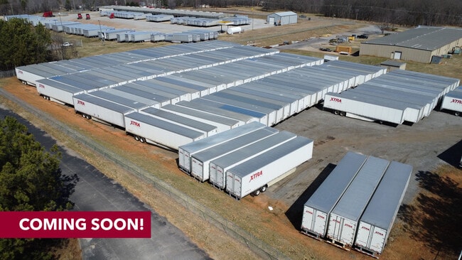

Property Detail
Fortis Dr
Spartanburg, SC
E SIDE FORTIS RD S OF BERRY SHOALS RD PB 170-485 DB 112C-927 DB 112C-929 DB 116P-784 PB 172-880
5-30-00-195.02
SPARTANBURG
Commercialacreage
South Carolina
B and X Area of moderate flood hazard, usually the area between the limits of the 100-year and 500-year floods.
4.12 AC
2024
Rt 101 Corridor
2025
Greenville/Spartanburg
023101
NEARBY LISTINGS FOR SALE OR LEASE
DEMOGRAPHICS near Fortis Dr
1 mile
3 mile
5 mile
2025 Total Population
2,627
19,600
46,150
2030 Population
2,932
22,076
51,801
Pop Growth 2025-2030
+ 11.61%
+ 12.63%
+ 12.24%
Average Age
37
38
38
2025 Total Households
902
7,113
17,175
HH Growth 2025-2030
+ 11.64%
+ 12.67%
+ 12.27%
Median Household Inc
$104,167
$91,777
$83,287
Avg Household Size
2.90
2.70
2.70
2025 Avg HH Vehicles
2.00
2.00
2.00
Median Home Value
$315,269
$305,173
$284,234
Median Year Built
2010
2007
2002
Nearby Places
Map Layers
Map Styles
 Street
 Aerial
Transit
 Traffic
 Biking
Places
Listings with unknown addresses are not visible on the map
- Restaurants
- Banks
- Shops
- Fitness
- Groceries
PUBLIC TRANSPORTATION
AIRPORT
Greenville Spartanburg International
Drive
Walk
Distance
Greenville Spartanburg International
13 min
7.2 mi
SALE & LEASE HISTORY
LISTING DATE
SALE/LEASE

Sep 30, 2024
For Sale
Sep 24, 2016
For Sale
Sep 13, 2022
For Lease
Oct 12, 2017
For Sale
Nearby Properties
Address
Land Use
TOTAL SIZE
Lot Size
Zoning
Address
Land Use
TOTAL SIZE
Lot Size
Zoning
380,932 SF
30.39 AC
Address
Land Use
TOTAL SIZE
Lot Size
Zoning
235,600 SF
14.48 AC
Address
Land Use
TOTAL SIZE
Lot Size
Zoning
873,910 SF
31.46 AC
Address
Land Use
TOTAL SIZE
Lot Size
Zoning
214,064 SF
16.18 AC
Address
Land Use
TOTAL SIZE
Lot Size
Zoning
95.88 AC
Address
Land Use
TOTAL SIZE
Lot Size
Zoning
61,536 SF
16.16 AC
Address
Land Use
TOTAL SIZE
Lot Size
Zoning
1,281 SF
41.23 AC
Address
Land Use
TOTAL SIZE
Lot Size
Zoning
2,417 SF
21.12 AC
Address
Land Use
TOTAL SIZE
Lot Size
Zoning
177,675 SF
39.88 AC
Address
Land Use
TOTAL SIZE
Lot Size
Zoning
1,218 SF
34.73 AC
Address
Land Use
TOTAL SIZE
Lot Size
Zoning
29.56 AC
Address
Land Use
TOTAL SIZE
Lot Size
Zoning
15.17 AC
Address
Land Use
TOTAL SIZE
Lot Size
Zoning
33.40 AC
Address
Land Use
TOTAL SIZE
Lot Size
Zoning
38,313 SF
15.53 AC
Address
Land Use
TOTAL SIZE
Lot Size
Zoning
215,006 SF
25.51 AC
Address
Land Use
TOTAL SIZE
Lot Size
Zoning
60,668 SF
8.02 AC
Address
Land Use
TOTAL SIZE
Lot Size
Zoning
32,310 SF
13.72 AC
Address
Land Use
TOTAL SIZE
Lot Size
Zoning
1,176 SF
20.13 AC
Address
Land Use
TOTAL SIZE
Lot Size
Zoning
107.32 AC
Address
Land Use
TOTAL SIZE
Lot Size
Zoning
851,634 SF
15.69 AC
Address
Land Use
TOTAL SIZE
Lot Size
Zoning
111,000 SF
14.36 AC
Address
Land Use
TOTAL SIZE
Lot Size
Zoning
10,756 SF
3.42 AC
Address
Land Use
TOTAL SIZE
Lot Size
Zoning
137.18 AC
Address
Land Use
TOTAL SIZE
Lot Size
Zoning
1,518 SF
78.61 AC
Address
Land Use
TOTAL SIZE
Lot Size
Zoning
72.04 AC
Address
Land Use
TOTAL SIZE
Lot Size
Zoning
139,404 SF
9.83 AC
Address
Land Use
TOTAL SIZE
Lot Size
Zoning
514,066 SF
10.44 AC
Address
Land Use
TOTAL SIZE
Lot Size
Zoning
56,769 SF
14.71 AC
Address
Land Use
TOTAL SIZE
Lot Size
Zoning
204,457 SF
47.28 AC
Address
Land Use
TOTAL SIZE
Lot Size
Zoning
223,832 SF
31.43 AC
The World's #1 Commercial Real Estate Marketplace
Connect with us
© 2026 CoStar Group
The information above has been obtained from sources believed reliable. While we do not doubt its accuracy we have not verified it and make no guarantee, warranty or representation about it. It is your responsibility to independently confirm its accuracy and completeness. Any projections, opinions, assumptions, or estimates used are for example only and do not represent the current or future performance of the property. The value of this transaction to you depends on tax and other factors which should be evaluated by your tax, financial, and legal advisors. You and your advisors should conduct a careful, independent investigation of the property to determine to your satisfaction the suitability of the property for your needs.