Property Record
Fourth St, Monroe, NJ 08831


Save to a Folder
{{folder.Name}}
{{folder.ListingIds.length}} Properties
{{folder.ListingIds.length}} Property
Create a New Folder
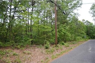
Property Detail
Fourth St
Philadelphia-Camden-Wilmington, PA-NJ-DE-MD
22,23,24
11-07601-0000-00021
GLOUCESTER
Farms
New Jersey
B and X Area of moderate flood hazard, usually the area between the limits of the 100-year and 500-year floods.
21
2025
1 AC
2026
Gloucester County
008212
Philadelphia
1,556 SF
NEARBY LISTINGS FOR SALE OR LEASE
-
-
View all Monroe listings for sale on LoopNet.com
DEMOGRAPHICS near Fourth St
1 mile
3 mile
5 mile
2025 Total Population
364
6,131
18,920
2030 Population
377
6,289
19,327
Pop Growth 2025-2030
+ 3.57%
+ 2.58%
+ 2.15%
Average Age
51
45
42
2025 Total Households
176
2,468
6,987
HH Growth 2025-2030
+ 3.41%
+ 2.51%
+ 2.12%
Median Household Inc
$55,454
$84,176
$98,683
Avg Household Size
2.00
2.40
2.70
2025 Avg HH Vehicles
2.00
2.00
2.00
Median Home Value
$122,619
$211,962
$270,555
Median Year Built
1977
1972
1975
Nearby Places
Map Layers
Map Styles
 Street
 Aerial
Layers
 Traffic
 Biking
Places
Listings with unknown addresses are not visible on the map
- Restaurants
- Banks
- Shops
- Fitness
- Groceries
PUBLIC TRANSPORTATION
COMMUTER RAIL
Hammonton (Atlantic City Line - NJ Transit Commuter Rail (NJ Transit))
Drive
Walk
Distance
Hammonton (Atlantic City Line - NJ Transit Commuter Rail (NJ Transit))
15 min
9.1 mi
AIRPORT
Atlantic City International
Drive
Walk
Distance
Atlantic City International
57 min
28.6 mi
Philadelphia International
Drive
Walk
Distance
Philadelphia International
55 min
34.9 mi
Freight Ports
Broadway Terminal - Pier 5
Drive
Walk
Distance
Broadway Terminal - Pier 5
40 min
26.4 mi
Nearby Properties
Address
Land Use
TOTAL SIZE
Lot Size
Zoning
Address
Land Use
TOTAL SIZE
Lot Size
Zoning
4,644 SF
211.55 AC
PRR
Address
Land Use
TOTAL SIZE
Lot Size
Zoning
13.48 AC
RGPR
Address
Land Use
TOTAL SIZE
Lot Size
Zoning
500 AC
PRR
Address
Land Use
TOTAL SIZE
Lot Size
Zoning
19.63 AC
RDR1
Address
Land Use
TOTAL SIZE
Lot Size
Zoning
305 AC
PAP
Address
Land Use
TOTAL SIZE
Lot Size
Zoning
1.12 AC
RGPR
Address
Land Use
TOTAL SIZE
Lot Size
Zoning
12.17 AC
PI-3
Address
Land Use
TOTAL SIZE
Lot Size
Zoning
9,718 SF
19.65 AC
RGPC
Address
Land Use
TOTAL SIZE
Lot Size
Zoning
2,504 SF
50.69 AC
Address
Land Use
TOTAL SIZE
Lot Size
Zoning
165.08 AC
PAP
Address
Land Use
TOTAL SIZE
Lot Size
Zoning
21,663 SF
3.73 AC
RG20
Address
Land Use
TOTAL SIZE
Lot Size
Zoning
472.21 AC
PRC
Address
Land Use
TOTAL SIZE
Lot Size
Zoning
19,616 SF
19.24 AC
RG20
Address
Land Use
TOTAL SIZE
Lot Size
Zoning
13,280 SF
16.83 AC
RDA
Address
Land Use
TOTAL SIZE
Lot Size
Zoning
10.18 AC
RGPR
Address
Land Use
TOTAL SIZE
Lot Size
Zoning
14,979 SF
18.83 AC
PI-3
Address
Land Use
TOTAL SIZE
Lot Size
Zoning
6,440 SF
0.43 AC
UEZC
Address
Land Use
TOTAL SIZE
Lot Size
Zoning
132.94 AC
PAP
Address
Land Use
TOTAL SIZE
Lot Size
Zoning
912 SF
5 AC
PAP
Address
Land Use
TOTAL SIZE
Lot Size
Zoning
127.24 AC
PRR
Address
Land Use
TOTAL SIZE
Lot Size
Zoning
0.92 AC
RD
Address
Land Use
TOTAL SIZE
Lot Size
Zoning
Address
Land Use
TOTAL SIZE
Lot Size
Zoning
1,344 SF
20.87 AC
RDA
Address
Land Use
TOTAL SIZE
Lot Size
Zoning
60 AC
PRR
Address
Land Use
TOTAL SIZE
Lot Size
Zoning
7.16 AC
RDA
Address
Land Use
TOTAL SIZE
Lot Size
Zoning
1.67 AC
RD
Address
Land Use
TOTAL SIZE
Lot Size
Zoning
30 AC
PAP
Address
Land Use
TOTAL SIZE
Lot Size
Zoning
0.74 AC
PVR1
Address
Land Use
TOTAL SIZE
Lot Size
Zoning
4.05 AC
RG20
Address
Land Use
TOTAL SIZE
Lot Size
Zoning
1,682 SF
3.75 AC
PVR1
The World's #1 Commercial Real Estate Marketplace
Connect with us
© 2026 CoStar Group
The information above has been obtained from sources believed reliable. While we do not doubt its accuracy we have not verified it and make no guarantee, warranty or representation about it. It is your responsibility to independently confirm its accuracy and completeness. Any projections, opinions, assumptions, or estimates used are for example only and do not represent the current or future performance of the property. The value of this transaction to you depends on tax and other factors which should be evaluated by your tax, financial, and legal advisors. You and your advisors should conduct a careful, independent investigation of the property to determine to your satisfaction the suitability of the property for your needs.