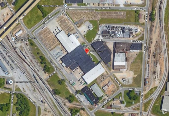
Property Record
Fowler St, Montgomery, AL 36104
Property Detail
Fowler St
Montgomery, AL
INCLUDES ONLY A PORTION OF LOT A OF THE NORTH MONTGOMERY PROJECT CORRECTED PLAT NO. 2 AS RECORDED IN PLATBOOK 16 AT PAGE 177
11-01-01-1-016-002.000
MONTGOMERY
Manufacturinglight
Alabama
M-3
1,2
C and X Area of minimal flood hazard, usually depicted on FIRMs as above the 500-year flood level.
5 AC
2025
North Montgomery
2025
Montgomery
000100
NEARBY LISTINGS FOR SALE OR LEASE
DEMOGRAPHICS near Fowler St
1 mile
3 mile
5 mile
2025 Total Population
821
40,584
90,658
2030 Population
900
41,582
91,544
Pop Growth 2025-2030
+ 9.62%
+ 2.46%
+ 0.98%
Average Age
40
38
39
2025 Total Households
364
15,847
36,304
HH Growth 2025-2030
+ 9.62%
+ 2.86%
+ 1.10%
Median Household Inc
$82,589
$39,109
$49,136
Avg Household Size
2.20
2.20
2.30
2025 Avg HH Vehicles
2.00
1.00
2.00
Median Home Value
$60,135
$87,169
$125,889
Median Year Built
1978
1958
1963
Nearby Places
Map Layers
Map Styles
 Street
 Aerial
Transit
 Traffic
 Biking
Places
Listings with unknown addresses are not visible on the map
- Restaurants
- Banks
- Shops
- Fitness
- Groceries
PUBLIC TRANSPORTATION
AIRPORT
Montgomery Regional (Dannelly Field)
Drive
Walk
Distance
Montgomery Regional (Dannelly Field)
15 min
10.6 mi
Freight Ports
Port of Mobile
Drive
Walk
Distance
Port of Mobile
186 min
169.7 mi
Nearby Properties
Address
Land Use
TOTAL SIZE
Lot Size
Zoning
Address
Land Use
TOTAL SIZE
Lot Size
Zoning
800,140 SF
2.27 AC
T5
Address
Land Use
TOTAL SIZE
Lot Size
Zoning
392,741 SF
2.98 AC
T5
Address
Land Use
TOTAL SIZE
Lot Size
Zoning
150,842 SF
5.40 AC
T5
Address
Land Use
TOTAL SIZE
Lot Size
Zoning
193,643 SF
1.61 AC
T5
Address
Land Use
TOTAL SIZE
Lot Size
Zoning
36,543 SF
0.62 AC
SD-M
Address
Land Use
TOTAL SIZE
Lot Size
Zoning
10,844 SF
1.63 AC
Address
Land Use
TOTAL SIZE
Lot Size
Zoning
285,162 SF
M-1
Address
Land Use
TOTAL SIZE
Lot Size
Zoning
107,355 SF
4.12 AC
T5
Address
Land Use
TOTAL SIZE
Lot Size
Zoning
93,981 SF
1.90 AC
T5
Address
Land Use
TOTAL SIZE
Lot Size
Zoning
13,273 SF
2.05 AC
T5
Address
Land Use
TOTAL SIZE
Lot Size
Zoning
58,930 SF
2.24 AC
T5
Address
Land Use
TOTAL SIZE
Lot Size
Zoning
122,119 SF
21 AC
R-75-S
Address
Land Use
TOTAL SIZE
Lot Size
Zoning
91,378 SF
2.46 AC
SD-M
Address
Land Use
TOTAL SIZE
Lot Size
Zoning
117,175 SF
1.49 AC
T5
Address
Land Use
TOTAL SIZE
Lot Size
Zoning
113,449 SF
0.80 AC
T5
Address
Land Use
TOTAL SIZE
Lot Size
Zoning
77,905 SF
0.83 AC
T5
Address
Land Use
TOTAL SIZE
Lot Size
Zoning
38,226 SF
5.77 AC
T5
Address
Land Use
TOTAL SIZE
Lot Size
Zoning
120,509 SF
0.29 AC
T5
Address
Land Use
TOTAL SIZE
Lot Size
Zoning
1.72 AC
T5
Address
Land Use
TOTAL SIZE
Lot Size
Zoning
22,183 SF
8.38 AC
T5
Address
Land Use
TOTAL SIZE
Lot Size
Zoning
116,707 SF
0.28 AC
T5
Address
Land Use
TOTAL SIZE
Lot Size
Zoning
96,168 SF
95.16 AC
INST
Address
Land Use
TOTAL SIZE
Lot Size
Zoning
81,736 SF
0.63 AC
T5
Address
Land Use
TOTAL SIZE
Lot Size
Zoning
3,401 SF
3.21 AC
T5
Address
Land Use
TOTAL SIZE
Lot Size
Zoning
128,328 SF
2.27 AC
T5
Address
Land Use
TOTAL SIZE
Lot Size
Zoning
144,788 SF
0.33 AC
T5
Address
Land Use
TOTAL SIZE
Lot Size
Zoning
65,060 SF
2.16 AC
T4-R
Address
Land Use
TOTAL SIZE
Lot Size
Zoning
0.90 AC
T5
Address
Land Use
TOTAL SIZE
Lot Size
Zoning
145,385 SF
3.31 AC
T4-0
Address
Land Use
TOTAL SIZE
Lot Size
Zoning
40,025 SF
2.48 AC
T5
The World's #1 Commercial Real Estate Marketplace
Connect with us
© 2026 CoStar Group
The information above has been obtained from sources believed reliable. While we do not doubt its accuracy we have not verified it and make no guarantee, warranty or representation about it. It is your responsibility to independently confirm its accuracy and completeness. Any projections, opinions, assumptions, or estimates used are for example only and do not represent the current or future performance of the property. The value of this transaction to you depends on tax and other factors which should be evaluated by your tax, financial, and legal advisors. You and your advisors should conduct a careful, independent investigation of the property to determine to your satisfaction the suitability of the property for your needs.