No Photo
Property Record
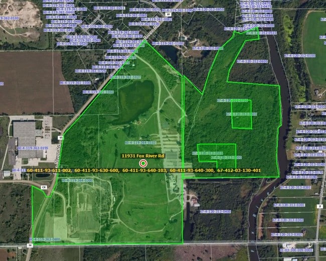
Fox River Rd, Trevor, WI 53179
Property Detail
Fox River Rd
Kenosha, WI
PT NE 1/4 & SE 1/4 SEC 36 T 1 R 19 COMM SE CORN OF SE 1/4 TH W ALG S LN TO SW CORN OF E 1/2 SD SE 1/4 TH CONT W 370.55 FT TH
70-4-120-313-0401
KENOSHA
Commercialnec
Wisconsin
AE The base floodplain where base flood elevations are provided. AE Zones are now used on new format FIRMs instead of A1-A30 Zones.
0
2025
130.89 AC
2025
Kenosha West
003002
Chicago
6,360 SF
NEARBY LISTINGS FOR SALE OR LEASE
-
-
View all Trevor listings for sale on LoopNet.com
DEMOGRAPHICS near Fox River Rd
1 mile
3 mile
5 mile
2025 Total Population
427
6,255
40,378
2030 Population
429
6,386
41,396
Pop Growth 2025-2030
+ 0.47%
+ 2.09%
+ 2.52%
Average Age
43
43
43
2025 Total Households
165
2,467
16,188
HH Growth 2025-2030
+ 0.61%
+ 2.11%
+ 2.56%
Median Household Inc
$96,710
$99,485
$94,502
Avg Household Size
2.60
2.50
2.50
2025 Avg HH Vehicles
2.00
2.00
2.00
Median Home Value
$275,833
$295,213
$304,958
Median Year Built
1975
1976
1979
Nearby Places
Map Layers
Map Styles
 Street
 Aerial
Layers
 Traffic
 Biking
Places
Listings with unknown addresses are not visible on the map
- Restaurants
- Banks
- Shops
- Fitness
- Groceries
PUBLIC TRANSPORTATION
COMMUTER RAIL
Antioch Station (North Central Service - Northeast Illinois Regional Commuter Railroad (Metra))
Drive
Walk
Distance
Antioch Station (North Central Service - Northeast Illinois Regional Commuter Railroad (Metra))
18 min
9.0 mi
Fox Lake Station (Milwaukee District North Line - Northeast Illinois Regional Commuter Railroad (Metra))
Drive
Walk
Distance
Fox Lake Station (Milwaukee District North Line - Northeast Illinois Regional Commuter Railroad (Metra))
19 min
9.2 mi
Freight Ports
Port Milwaukee
Drive
Walk
Distance
Port Milwaukee
66 min
47.8 mi
Nearby Properties
Address
Land Use
TOTAL SIZE
Lot Size
Zoning
Address
Land Use
TOTAL SIZE
Lot Size
Zoning
12,000 SF
9 AC
Address
Land Use
TOTAL SIZE
Lot Size
Zoning
142,650 SF
43 AC
Address
Land Use
TOTAL SIZE
Lot Size
Zoning
5,304 SF
49.42 AC
Address
Land Use
TOTAL SIZE
Lot Size
Zoning
2,352 SF
60.04 AC
Address
Land Use
TOTAL SIZE
Lot Size
Zoning
12,620 SF
21.59 AC
Address
Land Use
TOTAL SIZE
Lot Size
Zoning
75.11 AC
Address
Land Use
TOTAL SIZE
Lot Size
Zoning
2,708 SF
150 AC
Address
Land Use
TOTAL SIZE
Lot Size
Zoning
4,200 SF
2.48 AC
Address
Land Use
TOTAL SIZE
Lot Size
Zoning
1,380 SF
0.73 AC
Address
Land Use
TOTAL SIZE
Lot Size
Zoning
9,180 SF
286.27 AC
Address
Land Use
TOTAL SIZE
Lot Size
Zoning
3,035 SF
295.23 AC
Address
Land Use
TOTAL SIZE
Lot Size
Zoning
5,804 SF
8.54 AC
Address
Land Use
TOTAL SIZE
Lot Size
Zoning
4,910 SF
1.73 AC
Address
Land Use
TOTAL SIZE
Lot Size
Zoning
2,544 SF
6.61 AC
Address
Land Use
TOTAL SIZE
Lot Size
Zoning
33,039 SF
77 AC
Address
Land Use
TOTAL SIZE
Lot Size
Zoning
576 SF
53.07 AC
Address
Land Use
TOTAL SIZE
Lot Size
Zoning
79.48 AC
Address
Land Use
TOTAL SIZE
Lot Size
Zoning
61.50 AC
Address
Land Use
TOTAL SIZE
Lot Size
Zoning
2,713 SF
2.41 AC
Address
Land Use
TOTAL SIZE
Lot Size
Zoning
3,200 SF
130.85 AC
Address
Land Use
TOTAL SIZE
Lot Size
Zoning
3,126 SF
0.35 AC
Address
Land Use
TOTAL SIZE
Lot Size
Zoning
Address
Land Use
TOTAL SIZE
Lot Size
Zoning
6,552 SF
6.65 AC
Address
Land Use
TOTAL SIZE
Lot Size
Zoning
4,096 SF
3.99 AC
Address
Land Use
TOTAL SIZE
Lot Size
Zoning
3,876 SF
2.24 AC
Address
Land Use
TOTAL SIZE
Lot Size
Zoning
Address
Land Use
TOTAL SIZE
Lot Size
Zoning
17.07 AC
Address
Land Use
TOTAL SIZE
Lot Size
Zoning
912 SF
0.53 AC
Address
Land Use
TOTAL SIZE
Lot Size
Zoning
5,000 SF
9.87 AC
The World's #1 Commercial Real Estate Marketplace
Connect with us
© 2026 CoStar Group
The information above has been obtained from sources believed reliable. While we do not doubt its accuracy we have not verified it and make no guarantee, warranty or representation about it. It is your responsibility to independently confirm its accuracy and completeness. Any projections, opinions, assumptions, or estimates used are for example only and do not represent the current or future performance of the property. The value of this transaction to you depends on tax and other factors which should be evaluated by your tax, financial, and legal advisors. You and your advisors should conduct a careful, independent investigation of the property to determine to your satisfaction the suitability of the property for your needs.