Property Record
Frank Ward Rd, Fernandina Beach, FL 32034

NEARBY LISTINGS FOR SALE OR LEASE
Property Detail
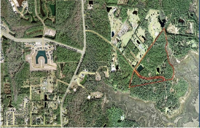
Frank Ward Rd
Jacksonville, FL
Fernandez Grant
43-2N-28-0000-0001-0030
PT D FERNANDEZ GRANT IN OR 2678/1628 (EX ESMTS IN OR 397/736 & OR 1379/514)
Miscellaneous
Nassau
AE
Florida
12031C0060J
1
2025
71.76 AC
2025
Nassau County
050203
Jacksonville (Florida)
DEMOGRAPHICS near Frank Ward Rd
1 Mile
3 Mile
5 Mile
2024 Total Population
1,084
16,596
45,119
2029 Population
1,325
20,206
54,906
Pop Growth 2024-2029
+ 22.23%
+ 21.75%
+ 21.69%
Average Age
44
45
48
2024 Total Households
451
6,710
19,266
HH Growth 2024-2029
+ 23.28%
+ 22.91%
+ 23.04%
Median Household Inc
$83,496
$92,863
$91,552
Avg Household Size
2.40
2.50
2.30
2024 Avg HH Vehicles
2.00
2.00
2.00
Median Home Value
$384,332
$363,460
$391,833
Median Year Built
2010
2008
2001
Nearby Places
Map Layers
Map Styles
 Street
 Aerial
- Restaurants
- Banks
- Shops
- Fitness
- Groceries
PUBLIC TRANSPORTATION
AIRPORT
Jacksonville International
DRIVE
WALK
Distance
Jacksonville International
39 min
21.5 mi
Freight Ports
Jacksonville Port
DRIVE
WALK
Distance
Jacksonville Port
48 min
32.9 mi
SALE & LEASE HISTORY
LISTING DATE
SALE/LEASE

Mar 15, 2018
For Sale
Nearby Properties
Address
Land Use
TOTAL SIZE
Lot Size
Zoning
Address
Land Use
TOTAL SIZE
Lot Size
Zoning
210,010 SF
19.36 AC
RG-1
Address
Land Use
TOTAL SIZE
Lot Size
Zoning
52,250 SF
38.29 AC
RSF-1
Address
Land Use
TOTAL SIZE
Lot Size
Zoning
163,686 SF
28.08 AC
CI
Address
Land Use
TOTAL SIZE
Lot Size
Zoning
105,105 SF
2.65 AC
CG
Address
Land Use
TOTAL SIZE
Lot Size
Zoning
145,581 SF
3 AC
CG
Address
Land Use
TOTAL SIZE
Lot Size
Zoning
71,090 SF
8.68 AC
CG
Address
Land Use
TOTAL SIZE
Lot Size
Zoning
35,660 SF
10.05 AC
OR
Address
Land Use
TOTAL SIZE
Lot Size
Zoning
44,734 SF
9.59 AC
OR
Address
Land Use
TOTAL SIZE
Lot Size
Zoning
32,449 SF
7.57 AC
CI
Address
Land Use
TOTAL SIZE
Lot Size
Zoning
33,818 SF
2.88 AC
CI
Address
Land Use
TOTAL SIZE
Lot Size
Zoning
18,900 SF
5.31 AC
RSF-1
Address
Land Use
TOTAL SIZE
Lot Size
Zoning
28,738 SF
3.72 AC
CG
Address
Land Use
TOTAL SIZE
Lot Size
Zoning
11.38 AC
RSF-1
Address
Land Use
TOTAL SIZE
Lot Size
Zoning
19,610 SF
5.36 AC
PUD
Address
Land Use
TOTAL SIZE
Lot Size
Zoning
28,919 SF
310 AC
I-1
Address
Land Use
TOTAL SIZE
Lot Size
Zoning
35.50 AC
OR
Address
Land Use
TOTAL SIZE
Lot Size
Zoning
28,660 SF
5.92 AC
CG
Address
Land Use
TOTAL SIZE
Lot Size
Zoning
30,374 SF
10.05 AC
OR
Address
Land Use
TOTAL SIZE
Lot Size
Zoning
19,748 SF
12.90 AC
OR
Address
Land Use
TOTAL SIZE
Lot Size
Zoning
16,214 SF
2.73 AC
PUD
Address
Land Use
TOTAL SIZE
Lot Size
Zoning
10,775 SF
7.40 AC
RSF-1
Address
Land Use
TOTAL SIZE
Lot Size
Zoning
18,100 SF
4.23 AC
CG
Address
Land Use
TOTAL SIZE
Lot Size
Zoning
1.37 AC
R-1
Address
Land Use
TOTAL SIZE
Lot Size
Zoning
884 SF
20 AC
ROS
Address
Land Use
TOTAL SIZE
Lot Size
Zoning
8,370 SF
1.35 AC
CG
Address
Land Use
TOTAL SIZE
Lot Size
Zoning
7,650 SF
4.43 AC
OR
Address
Land Use
TOTAL SIZE
Lot Size
Zoning
5,880 SF
1.68 AC
CG
Address
Land Use
TOTAL SIZE
Lot Size
Zoning
6.39 AC
PUD
Address
Land Use
TOTAL SIZE
Lot Size
Zoning
62.94 AC
PUD
The World's #1 Commercial Real Estate Marketplace
Connect with us
© 2025 CoStar Group
The information above has been obtained from sources believed reliable. While we do not doubt its accuracy we have not verified it and make no guarantee, warranty or representation about it. It is your responsibility to independently confirm its accuracy and completeness. Any projections, opinions, assumptions, or estimates used are for example only and do not represent the current or future performance of the property. The value of this transaction to you depends on tax and other factors which should be evaluated by your tax, financial, and legal advisors. You and your advisors should conduct a careful, independent investigation of the property to determine to your satisfaction the suitability of the property for your needs.