Property Record
167 S Touchmark Way, Meridian, ID 83642

Property Detail
167 S Touchmark Way
Boise City, ID
LOT 01 BLK 01 TOUCHMARK CENTER SUB #1
R8509140010
ADA
Commercialacreage
Idaho
L-O
01
B and X Area of moderate flood hazard, usually the area between the limits of the 100-year and 500-year floods.
0.64 AC
2024
Meridian
2025
Boise City/Nampa
010368
NEARBY LISTINGS FOR SALE OR LEASE
DEMOGRAPHICS near 167 S Touchmark Way
1 mile
3 mile
5 mile
2024 Total Population
4,719
101,122
254,662
2029 Population
4,968
105,776
266,638
Pop Growth 2024-2029
+ 5.28%
+ 4.60%
+ 4.70%
Average Age
44
40
40
2024 Total Households
1,918
37,853
94,155
HH Growth 2024-2029
+ 5.79%
+ 5.06%
+ 5.13%
Median Household Inc
$92,676
$93,138
$92,407
Avg Household Size
2.40
2.60
2.60
2024 Avg HH Vehicles
2.00
2.00
2.00
Median Home Value
$490,168
$487,335
$485,950
Median Year Built
2002
1999
1999
Nearby Places
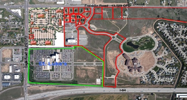
Map Layers
Map Styles
 Street
 Aerial
Transit
 Traffic
 Biking
Places
Listings with unknown addresses are not visible on the map
- Restaurants
- Banks
- Shops
- Fitness
- Groceries
PUBLIC TRANSPORTATION
AIRPORT
Boise Air Trml/Gowen Field
Drive
Walk
Distance
Boise Air Trml/Gowen Field
17 min
10.3 mi
SALE & LEASE HISTORY
LISTING DATE
SALE/LEASE

Jul 23, 2018
For Sale
Nearby Properties
Address
Land Use
TOTAL SIZE
Lot Size
Zoning
Address
Land Use
TOTAL SIZE
Lot Size
Zoning
533,727 SF
22.89 AC
C-G
Address
Land Use
TOTAL SIZE
Lot Size
Zoning
789,114 SF
11.38 AC
C-G
Address
Land Use
TOTAL SIZE
Lot Size
Zoning
505,966 SF
51.08 AC
L-O
Address
Land Use
TOTAL SIZE
Lot Size
Zoning
334,124 SF
11.21 AC
R-3D
Address
Land Use
TOTAL SIZE
Lot Size
Zoning
245,810 SF
11.19 AC
R-40
Address
Land Use
TOTAL SIZE
Lot Size
Zoning
269,509 SF
12 AC
R-40
Address
Land Use
TOTAL SIZE
Lot Size
Zoning
309,845 SF
14.53 AC
R-15
Address
Land Use
TOTAL SIZE
Lot Size
Zoning
413,805 SF
15.64 AC
C-G
Address
Land Use
TOTAL SIZE
Lot Size
Zoning
335,459 SF
11.23 AC
R-40
Address
Land Use
TOTAL SIZE
Lot Size
Zoning
243,949 SF
13.81 AC
R-40
Address
Land Use
TOTAL SIZE
Lot Size
Zoning
305,889 SF
9.91 AC
R-40
Address
Land Use
TOTAL SIZE
Lot Size
Zoning
310,580 SF
2.44 AC
C-G
Address
Land Use
TOTAL SIZE
Lot Size
Zoning
171,454 SF
10.66 AC
C-G
Address
Land Use
TOTAL SIZE
Lot Size
Zoning
203,377 SF
21.13 AC
C-G
Address
Land Use
TOTAL SIZE
Lot Size
Zoning
230,810 SF
20.09 AC
C-G
Address
Land Use
TOTAL SIZE
Lot Size
Zoning
150,000 SF
5.44 AC
C-G
Address
Land Use
TOTAL SIZE
Lot Size
Zoning
147,239 SF
7.56 AC
C-G
Address
Land Use
TOTAL SIZE
Lot Size
Zoning
238,300 SF
34.70 AC
I-L
Address
Land Use
TOTAL SIZE
Lot Size
Zoning
167,416 SF
18.57 AC
C-G
Address
Land Use
TOTAL SIZE
Lot Size
Zoning
125,362 SF
7.08 AC
C-G
Address
Land Use
TOTAL SIZE
Lot Size
Zoning
176,788 SF
16.07 AC
C-G
Address
Land Use
TOTAL SIZE
Lot Size
Zoning
211,460 SF
11.75 AC
C-G
Address
Land Use
TOTAL SIZE
Lot Size
Zoning
162,432 SF
8.31 AC
R-3D
Address
Land Use
TOTAL SIZE
Lot Size
Zoning
72,579 SF
4.48 AC
M-1D
Address
Land Use
TOTAL SIZE
Lot Size
Zoning
207,060 SF
9.88 AC
I-L
Address
Land Use
TOTAL SIZE
Lot Size
Zoning
184,577 SF
11.39 AC
C-G
Address
Land Use
TOTAL SIZE
Lot Size
Zoning
85,483 SF
2.42 AC
C-G
Address
Land Use
TOTAL SIZE
Lot Size
Zoning
118,953 SF
4.37 AC
C-G
Address
Land Use
TOTAL SIZE
Lot Size
Zoning
253,440 SF
15.19 AC
I-L
Address
Land Use
TOTAL SIZE
Lot Size
Zoning
138,828 SF
4.22 AC
C-1D
The World's #1 Commercial Real Estate Marketplace
Connect with us
© 2026 CoStar Group
The information above has been obtained from sources believed reliable. While we do not doubt its accuracy we have not verified it and make no guarantee, warranty or representation about it. It is your responsibility to independently confirm its accuracy and completeness. Any projections, opinions, assumptions, or estimates used are for example only and do not represent the current or future performance of the property. The value of this transaction to you depends on tax and other factors which should be evaluated by your tax, financial, and legal advisors. You and your advisors should conduct a careful, independent investigation of the property to determine to your satisfaction the suitability of the property for your needs.