Property Record
Friars Cove Rd, Saint Cloud, FL 34772


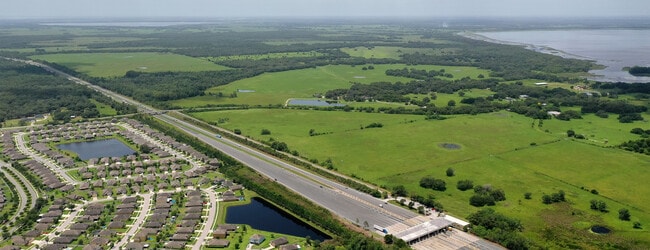
Property Detail
Friars Cove Rd
Orlando-Kissimmee-Sanford, FL
SL & IC PB B PG 36 ALL LESS SUNSHINE ST PKWY R/W
10-27-30-4950-0001-0010
OSCEOLA
Pasture
Florida
OAC
1
AE The base floodplain where base flood elevations are provided. AE Zones are now used on new format FIRMs instead of A1-A30 Zones.
570.01 AC
2024
Osceola Outlying
2025
Orlando
043304
NEARBY LISTINGS FOR SALE OR LEASE
-
-
View all Saint Cloud listings for sale on LoopNet.com
DEMOGRAPHICS near Friars Cove Rd
1 mile
3 mile
5 mile
2025 Total Population
1,181
17,168
42,950
2030 Population
1,387
19,979
50,334
Pop Growth 2025-2030
+ 17.44%
+ 16.37%
+ 17.19%
Average Age
36
37
38
2025 Total Households
344
5,277
13,931
HH Growth 2025-2030
+ 18.60%
+ 17.09%
+ 17.98%
Median Household Inc
$102,083
$95,812
$90,939
Avg Household Size
3.40
3.30
3.10
2025 Avg HH Vehicles
2.00
2.00
2.00
Median Home Value
$412,500
$416,298
$408,630
Median Year Built
2010
2009
2007
Nearby Places
Map Layers
Map Styles
 Street
 Aerial
Layers
 Traffic
 Biking
Places
Listings with unknown addresses are not visible on the map
- Restaurants
- Banks
- Shops
- Fitness
- Groceries
PUBLIC TRANSPORTATION
AIRPORT
Orlando International
Drive
Walk
Distance
Orlando International
48 min
28.2 mi
Freight Ports
Port Canaveral
Drive
Walk
Distance
Port Canaveral
94 min
69.9 mi
SALE & LEASE HISTORY
LISTING DATE
SALE/LEASE

Mar 24, 2021
For Sale
Nearby Properties
Address
Land Use
TOTAL SIZE
Lot Size
Zoning
Address
Land Use
TOTAL SIZE
Lot Size
Zoning
68,306 SF
9.59 AC
SPUD
Address
Land Use
TOTAL SIZE
Lot Size
Zoning
102,869 SF
1.71 AC
Address
Land Use
TOTAL SIZE
Lot Size
Zoning
107,129 SF
7.87 AC
SPUD
Address
Land Use
TOTAL SIZE
Lot Size
Zoning
59,852 SF
8.13 AC
SHB
Address
Land Use
TOTAL SIZE
Lot Size
Zoning
89.70 AC
OAC
Address
Land Use
TOTAL SIZE
Lot Size
Zoning
50,725 SF
29.07 AC
SR1B
Address
Land Use
TOTAL SIZE
Lot Size
Zoning
75.78 AC
Address
Land Use
TOTAL SIZE
Lot Size
Zoning
14,761 SF
1.86 AC
SHB
Address
Land Use
TOTAL SIZE
Lot Size
Zoning
1,132 SF
108.70 AC
OAC
Address
Land Use
TOTAL SIZE
Lot Size
Zoning
78.41 AC
Address
Land Use
TOTAL SIZE
Lot Size
Zoning
2,656 SF
1.52 AC
Address
Land Use
TOTAL SIZE
Lot Size
Zoning
28,712 SF
8.78 AC
OARM
Address
Land Use
TOTAL SIZE
Lot Size
Zoning
71.25 AC
Address
Land Use
TOTAL SIZE
Lot Size
Zoning
50.07 AC
Address
Land Use
TOTAL SIZE
Lot Size
Zoning
4,080 SF
1.47 AC
SHB
Address
Land Use
TOTAL SIZE
Lot Size
Zoning
8,352 SF
2.03 AC
SPUD
Address
Land Use
TOTAL SIZE
Lot Size
Zoning
6,742 SF
1.27 AC
Address
Land Use
TOTAL SIZE
Lot Size
Zoning
10,560 SF
0.89 AC
Address
Land Use
TOTAL SIZE
Lot Size
Zoning
12,618 SF
9.66 AC
OPUD
Address
Land Use
TOTAL SIZE
Lot Size
Zoning
3,894 SF
1.22 AC
SPUD
Address
Land Use
TOTAL SIZE
Lot Size
Zoning
32.28 AC
Address
Land Use
TOTAL SIZE
Lot Size
Zoning
8,835 SF
1.61 AC
OCR
Address
Land Use
TOTAL SIZE
Lot Size
Zoning
11,147 SF
1.26 AC
SHB
Address
Land Use
TOTAL SIZE
Lot Size
Zoning
37.44 AC
Address
Land Use
TOTAL SIZE
Lot Size
Zoning
8,000 SF
1.26 AC
SHB
Address
Land Use
TOTAL SIZE
Lot Size
Zoning
5,200 SF
1.38 AC
SHB
Address
Land Use
TOTAL SIZE
Lot Size
Zoning
34.73 AC
Address
Land Use
TOTAL SIZE
Lot Size
Zoning
1,961 SF
1.42 AC
OPUD
Address
Land Use
TOTAL SIZE
Lot Size
Zoning
700 SF
24.02 AC
OAC
Address
Land Use
TOTAL SIZE
Lot Size
Zoning
32.29 AC
The World's #1 Commercial Real Estate Marketplace
Connect with us
© 2026 CoStar Group
The information above has been obtained from sources believed reliable. While we do not doubt its accuracy we have not verified it and make no guarantee, warranty or representation about it. It is your responsibility to independently confirm its accuracy and completeness. Any projections, opinions, assumptions, or estimates used are for example only and do not represent the current or future performance of the property. The value of this transaction to you depends on tax and other factors which should be evaluated by your tax, financial, and legal advisors. You and your advisors should conduct a careful, independent investigation of the property to determine to your satisfaction the suitability of the property for your needs.