Property Record
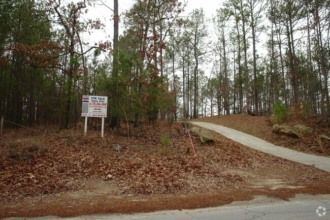
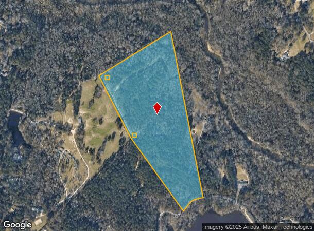
Frontier Dr Nw, Conyers, GA 30012
NEARBY LISTINGS FOR SALE OR LEASE
Property Detail
Frontier Dr Nw
Atlanta-Sandy Springs-Roswell, GA
Rural
039-0-01-0008
LL249 261 LD16 N\SIDE FRONTIER RD
Agriculturalland
Rockdale
AE
Georgia
13247C0083D
249
2024
32.96 AC
2024
I-20 East/Conyers
060101
Atlanta
DEMOGRAPHICS near Frontier Dr Nw
1 Mile
3 Mile
5 Mile
2024 Total Population
3,722
24,726
79,275
2029 Population
3,884
25,418
81,380
Pop Growth 2024-2029
+ 4.35%
+ 2.80%
+ 2.66%
Average Age
33
37
38
2024 Total Households
1,057
8,521
28,379
HH Growth 2024-2029
+ 4.35%
+ 2.83%
+ 2.52%
Median Household Inc
$51,915
$59,810
$60,974
Avg Household Size
3.30
2.80
2.70
2024 Avg HH Vehicles
2.00
2.00
2.00
Median Home Value
$75,489
$182,528
$210,499
Median Year Built
1980
1986
1992
Nearby Places
Map Layers
Map Styles
 Street
 Aerial
- Restaurants
- Banks
- Shops
- Fitness
- Groceries
PUBLIC TRANSPORTATION
AIRPORT
Hartsfield - Jackson Atlanta International
DRIVE
WALK
Distance
Hartsfield - Jackson Atlanta International
43 min
27.0 mi
Freight Ports
Georgia Ports - Savannah
DRIVE
WALK
Distance
Georgia Ports - Savannah
288 min
245.1 mi
Nearby Properties
Address
Land Use
TOTAL SIZE
Lot Size
Zoning
Address
Land Use
TOTAL SIZE
Lot Size
Zoning
2,782 SF
29.51 AC
R3/C
Address
Land Use
TOTAL SIZE
Lot Size
Zoning
290,616 SF
23.84 AC
M-1
Address
Land Use
TOTAL SIZE
Lot Size
Zoning
28,024 SF
11.24 AC
R1
Address
Land Use
TOTAL SIZE
Lot Size
Zoning
417,378 SF
31.95 AC
M1
Address
Land Use
TOTAL SIZE
Lot Size
Zoning
173,427 SF
15.18 AC
X
Address
Land Use
TOTAL SIZE
Lot Size
Zoning
273,000 SF
15.41 AC
M1
Address
Land Use
TOTAL SIZE
Lot Size
Zoning
3,888 SF
21.05 AC
RM/C
Address
Land Use
TOTAL SIZE
Lot Size
Zoning
152,302 SF
17.91 AC
X
Address
Land Use
TOTAL SIZE
Lot Size
Zoning
124,591 SF
13.89 AC
C2
Address
Land Use
TOTAL SIZE
Lot Size
Zoning
485,258 SF
23.61 AC
M
Address
Land Use
TOTAL SIZE
Lot Size
Zoning
60,470 SF
5.11 AC
C2
Address
Land Use
TOTAL SIZE
Lot Size
Zoning
196,560 SF
12.06 AC
MI
Address
Land Use
TOTAL SIZE
Lot Size
Zoning
14,575 SF
14.55 AC
OI
Address
Land Use
TOTAL SIZE
Lot Size
Zoning
1,968 SF
26.91 AC
M2
Address
Land Use
TOTAL SIZE
Lot Size
Zoning
105,600 SF
8.75 AC
M1
Address
Land Use
TOTAL SIZE
Lot Size
Zoning
713,040 SF
67.04 AC
M1
Address
Land Use
TOTAL SIZE
Lot Size
Zoning
65,460 SF
32.41 AC
M1
Address
Land Use
TOTAL SIZE
Lot Size
Zoning
36,272 SF
6.50 AC
Address
Land Use
TOTAL SIZE
Lot Size
Zoning
100,400 SF
19.73 AC
MI
Address
Land Use
TOTAL SIZE
Lot Size
Zoning
1,664 SF
6.75 AC
C2
Address
Land Use
TOTAL SIZE
Lot Size
Zoning
198,360 SF
9.02 AC
M1
Address
Land Use
TOTAL SIZE
Lot Size
Zoning
144,673 SF
17.53 AC
M1
Address
Land Use
TOTAL SIZE
Lot Size
Zoning
29.96 AC
R1
Address
Land Use
TOTAL SIZE
Lot Size
Zoning
112,000 SF
9.12 AC
M1
Address
Land Use
TOTAL SIZE
Lot Size
Zoning
20,942 SF
22.78 AC
BG
Address
Land Use
TOTAL SIZE
Lot Size
Zoning
3,060 SF
13.42 AC
M1
Address
Land Use
TOTAL SIZE
Lot Size
Zoning
117,280 SF
6.60 AC
M1
Address
Land Use
TOTAL SIZE
Lot Size
Zoning
90,000 SF
4.50 AC
M1
Address
Land Use
TOTAL SIZE
Lot Size
Zoning
16,100 SF
5.10 AC
BG
Address
Land Use
TOTAL SIZE
Lot Size
Zoning
273,459 SF
12.12 AC
M1
The World's #1 Commercial Real Estate Marketplace
Connect with us
© 2025 CoStar Group
The information above has been obtained from sources believed reliable. While we do not doubt its accuracy we have not verified it and make no guarantee, warranty or representation about it. It is your responsibility to independently confirm its accuracy and completeness. Any projections, opinions, assumptions, or estimates used are for example only and do not represent the current or future performance of the property. The value of this transaction to you depends on tax and other factors which should be evaluated by your tax, financial, and legal advisors. You and your advisors should conduct a careful, independent investigation of the property to determine to your satisfaction the suitability of the property for your needs.