Property Record
Fruitvale Rd, Valley Center, CA 92082

Save to a Folder
{{folder.Name}}
{{folder.ListingIds.length}} Properties
{{folder.ListingIds.length}} Property
Create a New Folder
Property Detail
Fruitvale Rd
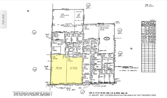
188-151-15
SEC 5-11-1W SW 1/4 OF POR
Agriculturalland
SAN DIEGO
A70
California
B and X Area of moderate flood hazard, usually the area between the limits of the 100-year and 500-year floods.
17.09 AC
2025
Outlying SD County N
2026
San Diego
019103
San Diego-Chula Vista-Carlsbad, CA
NEARBY LISTINGS FOR SALE OR LEASE
DEMOGRAPHICS near Fruitvale Rd
1 mile
3 mile
5 mile
2025 Total Population
1,091
11,367
18,607
2030 Population
1,080
11,298
18,359
Pop Growth 2025-2030
(1.01%)
(0.61%)
(1.33%)
Average Age
41
43
43
2025 Total Households
313
3,583
6,009
HH Growth 2025-2030
(1.28%)
(0.61%)
(1.45%)
Median Household Inc
$140,789
$129,094
$128,373
Avg Household Size
3.30
3.00
2.90
2025 Avg HH Vehicles
3.00
3.00
3.00
Median Home Value
$889,455
$849,870
$846,789
Median Year Built
1977
1984
1984
Nearby Places
Map Layers
Map Styles
 Street
 Aerial
Layers
 Traffic
 Biking
Places
Listings with unknown addresses are not visible on the map
- Restaurants
- Banks
- Shops
- Fitness
- Groceries
Nearby Properties
Address
Land Use
TOTAL SIZE
Lot Size
Zoning
Address
Land Use
TOTAL SIZE
Lot Size
Zoning
5,657 SF
5.74 AC
C30
Address
Land Use
TOTAL SIZE
Lot Size
Zoning
6.86 AC
A70
Address
Land Use
TOTAL SIZE
Lot Size
Zoning
1,845 SF
1.16 AC
C36
Address
Land Use
TOTAL SIZE
Lot Size
Zoning
762 SF
1.37 AC
C36
Address
Land Use
TOTAL SIZE
Lot Size
Zoning
13.32 AC
C36
Address
Land Use
TOTAL SIZE
Lot Size
Zoning
4,544 SF
C36
Address
Land Use
TOTAL SIZE
Lot Size
Zoning
7,953 SF
5.74 AC
M52
Address
Land Use
TOTAL SIZE
Lot Size
Zoning
1,372 SF
19.92 AC
RR
Address
Land Use
TOTAL SIZE
Lot Size
Zoning
8,825 SF
2.92 AC
C
Address
Land Use
TOTAL SIZE
Lot Size
Zoning
9,015 SF
11.81 AC
A70
Address
Land Use
TOTAL SIZE
Lot Size
Zoning
7,953 SF
3.96 AC
M52
Address
Land Use
TOTAL SIZE
Lot Size
Zoning
4.15 AC
C36
Address
Land Use
TOTAL SIZE
Lot Size
Zoning
7,380 SF
6.44 AC
C
Address
Land Use
TOTAL SIZE
Lot Size
Zoning
2,190 SF
21.72 AC
A70
Address
Land Use
TOTAL SIZE
Lot Size
Zoning
7,577 SF
3.07 AC
M52
Address
Land Use
TOTAL SIZE
Lot Size
Zoning
42.53 AC
R1
Address
Land Use
TOTAL SIZE
Lot Size
Zoning
2.83 AC
C36
Address
Land Use
TOTAL SIZE
Lot Size
Zoning
7,500 SF
2.47 AC
M54
Address
Land Use
TOTAL SIZE
Lot Size
Zoning
2.99 AC
A70
Address
Land Use
TOTAL SIZE
Lot Size
Zoning
34.03 AC
RS
Address
Land Use
TOTAL SIZE
Lot Size
Zoning
7,481 SF
40 AC
A70
Address
Land Use
TOTAL SIZE
Lot Size
Zoning
0.91 AC
C36
Address
Land Use
TOTAL SIZE
Lot Size
Zoning
99.39 AC
A70
Address
Land Use
TOTAL SIZE
Lot Size
Zoning
6,720 SF
0.64 AC
M54
Address
Land Use
TOTAL SIZE
Lot Size
Zoning
840 SF
1.31 AC
C36
Address
Land Use
TOTAL SIZE
Lot Size
Zoning
6.44 AC
C36
Address
Land Use
TOTAL SIZE
Lot Size
Zoning
4.43 AC
C34
Address
Land Use
TOTAL SIZE
Lot Size
Zoning
5.41 AC
M52
Address
Land Use
TOTAL SIZE
Lot Size
Zoning
23,200 SF
3.39 AC
M54
Address
Land Use
TOTAL SIZE
Lot Size
Zoning
9,304 SF
1.20 AC
C36
The World's #1 Commercial Real Estate Marketplace
Connect with us
© 2026 CoStar Group
The information above has been obtained from sources believed reliable. While we do not doubt its accuracy we have not verified it and make no guarantee, warranty or representation about it. It is your responsibility to independently confirm its accuracy and completeness. Any projections, opinions, assumptions, or estimates used are for example only and do not represent the current or future performance of the property. The value of this transaction to you depends on tax and other factors which should be evaluated by your tax, financial, and legal advisors. You and your advisors should conduct a careful, independent investigation of the property to determine to your satisfaction the suitability of the property for your needs.