Property Record
Fruitville Rd, Sarasota, FL 34240

NEARBY LISTINGS FOR SALE OR LEASE
-
-
View all Sarasota listings for sale on LoopNet.com
Property Detail
Fruitville Rd
North Port-Sarasota-Bradenton, FL
Not Part Of A Subdivision
0225-00-1000
N 1/2 OF NE 1/4 OF SEC 24-36-19 LYING N OF N R/W LINE OF FRUITVILLE RD AS DESC IN OR 2897/1119
Miscellaneous
Sarasota
X
Florida
12115C0180F
63
2024
73.04 AC
2025
Sarasota Outlying
001405
Tampa/St Petersburg
DEMOGRAPHICS near Fruitville Rd
1 Mile
3 Mile
5 Mile
2024 Total Population
83
1,394
9,408
2029 Population
92
1,566
11,021
Pop Growth 2024-2029
+ 10.84%
+ 12.34%
+ 17.14%
Average Age
46
44
46
2024 Total Households
31
490
3,496
HH Growth 2024-2029
+ 9.68%
+ 12.24%
+ 16.96%
Median Household Inc
$83,333
$97,069
$115,998
Avg Household Size
2.60
2.70
2.60
2024 Avg HH Vehicles
3.00
2.00
2.00
Median Home Value
$573,529
$514,773
$621,844
Median Year Built
1985
1987
2005
Nearby Places
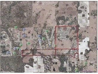
Map Layers
Map Styles
 Street
 Aerial
- Restaurants
- Banks
- Shops
- Fitness
- Groceries
PUBLIC TRANSPORTATION
AIRPORT
Sarasota/Bradenton International
DRIVE
WALK
Distance
Sarasota/Bradenton International
29 min
17.1 mi
Freight Ports
Port Manatee
DRIVE
WALK
Distance
Port Manatee
42 min
29.7 mi
Nearby Properties
Address
Land Use
TOTAL SIZE
Lot Size
Zoning
Address
Land Use
TOTAL SIZE
Lot Size
Zoning
527.19 AC
HPD
Address
Land Use
TOTAL SIZE
Lot Size
Zoning
63,371 SF
10.52 AC
PCD
Address
Land Use
TOTAL SIZE
Lot Size
Zoning
103,014 SF
200.11 AC
OUE1
Address
Land Use
TOTAL SIZE
Lot Size
Zoning
57,301 SF
10.56 AC
OUR
Address
Land Use
TOTAL SIZE
Lot Size
Zoning
80,650 SF
3.96 AC
PID
Address
Land Use
TOTAL SIZE
Lot Size
Zoning
43,374 SF
1.98 AC
PID
Address
Land Use
TOTAL SIZE
Lot Size
Zoning
28,370 SF
138.76 AC
OUE2
Address
Land Use
TOTAL SIZE
Lot Size
Zoning
148.26 AC
HPD
Address
Land Use
TOTAL SIZE
Lot Size
Zoning
16,758 SF
84.60 AC
OUE
Address
Land Use
TOTAL SIZE
Lot Size
Zoning
27,877 SF
31.73 AC
OUE
Address
Land Use
TOTAL SIZE
Lot Size
Zoning
57.60 AC
VPD
Address
Land Use
TOTAL SIZE
Lot Size
Zoning
38,340 SF
2.96 AC
PID
Address
Land Use
TOTAL SIZE
Lot Size
Zoning
10,080 SF
2.93 AC
PID
Address
Land Use
TOTAL SIZE
Lot Size
Zoning
23,272 SF
23.79 AC
OUE
Address
Land Use
TOTAL SIZE
Lot Size
Zoning
24,950 SF
2.05 AC
PID
Address
Land Use
TOTAL SIZE
Lot Size
Zoning
27,200 SF
2.18 AC
PID
Address
Land Use
TOTAL SIZE
Lot Size
Zoning
78.15 AC
VPD
Address
Land Use
TOTAL SIZE
Lot Size
Zoning
30,040 SF
3.61 AC
PID
Address
Land Use
TOTAL SIZE
Lot Size
Zoning
15,400 SF
15 AC
OUR
Address
Land Use
TOTAL SIZE
Lot Size
Zoning
19,840 SF
2.35 AC
PID
Address
Land Use
TOTAL SIZE
Lot Size
Zoning
11,664 SF
5.01 AC
GU
Address
Land Use
TOTAL SIZE
Lot Size
Zoning
34.23 AC
RSF1
Address
Land Use
TOTAL SIZE
Lot Size
Zoning
8,965 SF
57.27 AC
HPD
Address
Land Use
TOTAL SIZE
Lot Size
Zoning
24,201 SF
2.31 AC
PID
Address
Land Use
TOTAL SIZE
Lot Size
Zoning
11,360 SF
5.93 AC
PID
Address
Land Use
TOTAL SIZE
Lot Size
Zoning
20.06 AC
VPD
Address
Land Use
TOTAL SIZE
Lot Size
Zoning
74,937 SF
30 AC
PID
Address
Land Use
TOTAL SIZE
Lot Size
Zoning
12,328 SF
1.03 AC
PID
Address
Land Use
TOTAL SIZE
Lot Size
Zoning
15,000 SF
1.32 AC
PID
The World's #1 Commercial Real Estate Marketplace
Connect with us
© 2025 CoStar Group
The information above has been obtained from sources believed reliable. While we do not doubt its accuracy we have not verified it and make no guarantee, warranty or representation about it. It is your responsibility to independently confirm its accuracy and completeness. Any projections, opinions, assumptions, or estimates used are for example only and do not represent the current or future performance of the property. The value of this transaction to you depends on tax and other factors which should be evaluated by your tax, financial, and legal advisors. You and your advisors should conduct a careful, independent investigation of the property to determine to your satisfaction the suitability of the property for your needs.