Property Record
Ga Highway 100, , GA

Property Detail
Ga Highway 100
0053-0041
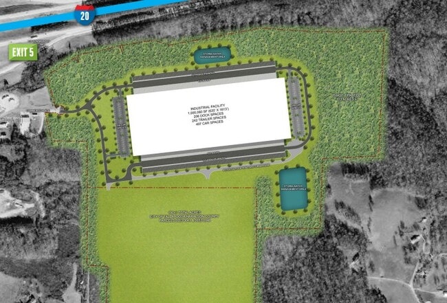
92.45 ACS
Commercialacreage
HARALSON
TAL
Georgia
B and X Area of moderate flood hazard, usually the area between the limits of the 100-year and 500-year floods.
92.45 AC
2025
Haralson County
2025
Atlanta
010401
Atlanta-Sandy Springs-Roswell, GA
NEARBY LISTINGS FOR SALE OR LEASE
DEMOGRAPHICS near Ga Highway 100
1 mile
3 mile
5 mile
2025 Total Population
296
1,980
7,468
2030 Population
321
2,141
8,049
Pop Growth 2025-2030
+ 8.45%
+ 8.13%
+ 7.78%
Average Age
40
40
40
2025 Total Households
111
731
2,813
HH Growth 2025-2030
+ 8.11%
+ 8.21%
+ 7.82%
Median Household Inc
$73,499
$69,642
$64,704
Avg Household Size
2.70
2.70
2.60
2025 Avg HH Vehicles
3.00
2.00
2.00
Median Home Value
$191,666
$220,454
$203,457
Median Year Built
1999
1993
1988
Nearby Places
Map Layers
Map Styles
 Street
 Aerial
Layers
 Traffic
 Biking
Places
Listings with unknown addresses are not visible on the map
- Restaurants
- Banks
- Shops
- Fitness
- Groceries
SALE & LEASE HISTORY
LISTING DATE
SALE/LEASE

Oct 20, 2020
For Lease
Oct 19, 2020
For Sale
Oct 19, 2020
For Sale
Nearby Properties
Address
Land Use
TOTAL SIZE
Lot Size
Zoning
Address
Land Use
TOTAL SIZE
Lot Size
Zoning
471,000 SF
447.74 AC
TAL
Address
Land Use
TOTAL SIZE
Lot Size
Zoning
659,132 SF
447.74 AC
TAL
Address
Land Use
TOTAL SIZE
Lot Size
Zoning
1,123.48 AC
A-1
Address
Land Use
TOTAL SIZE
Lot Size
Zoning
602.13 AC
M-1
Address
Land Use
TOTAL SIZE
Lot Size
Zoning
711.17 AC
A
Address
Land Use
TOTAL SIZE
Lot Size
Zoning
7,278 SF
5.19 AC
TAL
Address
Land Use
TOTAL SIZE
Lot Size
Zoning
19,512 SF
7.32 AC
TAL
Address
Land Use
TOTAL SIZE
Lot Size
Zoning
23,658 SF
1.99 AC
TAL
Address
Land Use
TOTAL SIZE
Lot Size
Zoning
53.71 AC
A-1
Address
Land Use
TOTAL SIZE
Lot Size
Zoning
181 AC
RESIDENTIA
Address
Land Use
TOTAL SIZE
Lot Size
Zoning
350.08 AC
R-1
Address
Land Use
TOTAL SIZE
Lot Size
Zoning
10,560 SF
5 AC
A-1
Address
Land Use
TOTAL SIZE
Lot Size
Zoning
9,600 SF
5 AC
A-1
Address
Land Use
TOTAL SIZE
Lot Size
Zoning
98.91 AC
TAL
Address
Land Use
TOTAL SIZE
Lot Size
Zoning
248.28 AC
I-1
Address
Land Use
TOTAL SIZE
Lot Size
Zoning
234.79 AC
A-1
Address
Land Use
TOTAL SIZE
Lot Size
Zoning
4,680 SF
3.66 AC
TAL
Address
Land Use
TOTAL SIZE
Lot Size
Zoning
45.79 AC
TAL
Address
Land Use
TOTAL SIZE
Lot Size
Zoning
133.84 AC
A-1
Address
Land Use
TOTAL SIZE
Lot Size
Zoning
404.75 AC
A-1
Address
Land Use
TOTAL SIZE
Lot Size
Zoning
72.52 AC
TAL
Address
Land Use
TOTAL SIZE
Lot Size
Zoning
75.44 AC
WAC
Address
Land Use
TOTAL SIZE
Lot Size
Zoning
7,976 SF
7.96 AC
A-1
Address
Land Use
TOTAL SIZE
Lot Size
Zoning
15,000 SF
2.13 AC
TAL
Address
Land Use
TOTAL SIZE
Lot Size
Zoning
6,150 SF
6.56 AC
C-NB
Address
Land Use
TOTAL SIZE
Lot Size
Zoning
7,612 SF
1.39 AC
TAL
Address
Land Use
TOTAL SIZE
Lot Size
Zoning
6 AC
TAL
Address
Land Use
TOTAL SIZE
Lot Size
Zoning
4,104 SF
4 AC
TAL
Address
Land Use
TOTAL SIZE
Lot Size
Zoning
53.07 AC
TAL
Address
Land Use
TOTAL SIZE
Lot Size
Zoning
113.07 AC
A-1
The World's #1 Commercial Real Estate Marketplace
Connect with us
© 2026 CoStar Group
The information above has been obtained from sources believed reliable. While we do not doubt its accuracy we have not verified it and make no guarantee, warranty or representation about it. It is your responsibility to independently confirm its accuracy and completeness. Any projections, opinions, assumptions, or estimates used are for example only and do not represent the current or future performance of the property. The value of this transaction to you depends on tax and other factors which should be evaluated by your tax, financial, and legal advisors. You and your advisors should conduct a careful, independent investigation of the property to determine to your satisfaction the suitability of the property for your needs.