Property Record
Ga Highway 365, Alto, GA 30510


NEARBY LISTINGS FOR SALE OR LEASE
-
-
View all Alto listings for sale on LoopNet.com
Property Detail
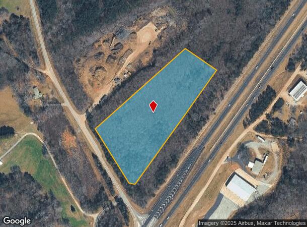
Ga Highway 365
028-087
10-192 PB 28-6 967-396
Residentialacreage
Habersham
X
Georgia
13137C0278D
7.62 AC
2025
Georgia Northeast
2025
Other Market Areas
000601
Cornelia, GA
DEMOGRAPHICS near Ga Highway 365
1 Mile
3 Mile
5 Mile
2024 Total Population
2,289
7,970
15,590
2029 Population
2,464
8,776
17,277
Pop Growth 2024-2029
+ 7.65%
+ 10.11%
+ 10.82%
Average Age
36
39
39
2024 Total Households
374
2,335
5,051
HH Growth 2024-2029
+ 9.09%
+ 10.79%
+ 11.07%
Median Household Inc
$53,174
$53,847
$52,385
Avg Household Size
2.90
2.80
2.70
2024 Avg HH Vehicles
2.00
2.00
2.00
Median Home Value
$111,628
$157,011
$166,948
Median Year Built
1996
1995
1993
Nearby Places
Map Layers
Map Styles
 Street
 Aerial
- Restaurants
- Banks
- Shops
- Fitness
- Groceries
SALE & LEASE HISTORY
LISTING DATE
SALE/LEASE

Apr 15, 2017
For Sale
Nearby Properties
Address
Land Use
TOTAL SIZE
Lot Size
Zoning
Address
Land Use
TOTAL SIZE
Lot Size
Zoning
2,176 SF
42.65 AC
M1
Address
Land Use
TOTAL SIZE
Lot Size
Zoning
451,247 SF
98.29 AC
M1
Address
Land Use
TOTAL SIZE
Lot Size
Zoning
152,186 SF
19.81 AC
HI
Address
Land Use
TOTAL SIZE
Lot Size
Zoning
74,565 SF
7.80 AC
HB
Address
Land Use
TOTAL SIZE
Lot Size
Zoning
45,064 SF
27.23 AC
HB
Address
Land Use
TOTAL SIZE
Lot Size
Zoning
82,942 SF
7.79 AC
HI
Address
Land Use
TOTAL SIZE
Lot Size
Zoning
67.20 AC
LI
Address
Land Use
TOTAL SIZE
Lot Size
Zoning
90,350 SF
19.31 AC
HB
Address
Land Use
TOTAL SIZE
Lot Size
Zoning
11,700 SF
1.55 AC
HI
Address
Land Use
TOTAL SIZE
Lot Size
Zoning
20.98 AC
LI
Address
Land Use
TOTAL SIZE
Lot Size
Zoning
84.25 AC
PID
Address
Land Use
TOTAL SIZE
Lot Size
Zoning
2,448 SF
158.96 AC
LI
Address
Land Use
TOTAL SIZE
Lot Size
Zoning
204.99 AC
ARR
Address
Land Use
TOTAL SIZE
Lot Size
Zoning
9,625 SF
20 AC
LI
Address
Land Use
TOTAL SIZE
Lot Size
Zoning
6,050 SF
1.50 AC
HI
Address
Land Use
TOTAL SIZE
Lot Size
Zoning
138.87 AC
AR-1
Address
Land Use
TOTAL SIZE
Lot Size
Zoning
4,416 SF
2.02 AC
HI
Address
Land Use
TOTAL SIZE
Lot Size
Zoning
139.56 AC
LI
Address
Land Use
TOTAL SIZE
Lot Size
Zoning
12,697 SF
2.59 AC
LI
Address
Land Use
TOTAL SIZE
Lot Size
Zoning
122.56 AC
AR-1
Address
Land Use
TOTAL SIZE
Lot Size
Zoning
122.36 AC
AR-1
Address
Land Use
TOTAL SIZE
Lot Size
Zoning
17,750 SF
2.22 AC
HI
Address
Land Use
TOTAL SIZE
Lot Size
Zoning
5,488 SF
4.70 AC
Address
Land Use
TOTAL SIZE
Lot Size
Zoning
13,000 SF
0.98 AC
MI
Address
Land Use
TOTAL SIZE
Lot Size
Zoning
106.20 AC
AGRI
Address
Land Use
TOTAL SIZE
Lot Size
Zoning
108.22 AC
LI
Address
Land Use
TOTAL SIZE
Lot Size
Zoning
7,494 SF
20.02 AC
HB
Address
Land Use
TOTAL SIZE
Lot Size
Zoning
11,920 SF
5.15 AC
HB
Address
Land Use
TOTAL SIZE
Lot Size
Zoning
6,000 SF
7.31 AC
LI
Address
Land Use
TOTAL SIZE
Lot Size
Zoning
101.20 AC
LI
The World's #1 Commercial Real Estate Marketplace
Connect with us
© 2025 CoStar Group
The information above has been obtained from sources believed reliable. While we do not doubt its accuracy we have not verified it and make no guarantee, warranty or representation about it. It is your responsibility to independently confirm its accuracy and completeness. Any projections, opinions, assumptions, or estimates used are for example only and do not represent the current or future performance of the property. The value of this transaction to you depends on tax and other factors which should be evaluated by your tax, financial, and legal advisors. You and your advisors should conduct a careful, independent investigation of the property to determine to your satisfaction the suitability of the property for your needs.