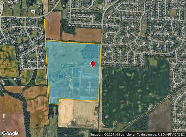
Property Record
Galloway Rd, Columbus Grove, OH 45830

NEARBY LISTINGS FOR SALE OR LEASE
Property Detail
Galloway Rd
Columbus, OH
Virginia Military Survey #13071&1473
010-258012
GALLOWAY RD ENTRY 1473 OQ 1000 108.658 ACRES
Municipalproperty
Franklin
X
Ohio
39097C0200E
108.66 AC
0
Southwest
2025
Columbus
030500
DEMOGRAPHICS near Galloway Rd
1 Mile
3 Mile
5 Mile
2024 Total Population
5,787
51,564
122,203
2029 Population
5,812
51,260
121,901
Pop Growth 2024-2029
+ 0.43%
(0.59%)
(0.25%)
Average Age
38
36
36
2024 Total Households
2,075
19,680
46,929
HH Growth 2024-2029
+ 0.39%
(0.69%)
(0.32%)
Median Household Inc
$65,964
$59,735
$64,059
Avg Household Size
2.70
2.50
2.50
2024 Avg HH Vehicles
2.00
2.00
2.00
Median Home Value
$207,401
$196,110
$195,465
Median Year Built
1990
1989
1985
Nearby Places
Map Layers
Map Styles
 Street
 Aerial
- Restaurants
- Banks
- Shops
- Fitness
- Groceries
PUBLIC TRANSPORTATION
AIRPORT
Rickenbacker International
DRIVE
WALK
Distance
Rickenbacker International
28 min
18.4 mi
John Glenn Columbus International
DRIVE
WALK
Distance
John Glenn Columbus International
31 min
19.8 mi
Freight Ports
Port of Toledo
DRIVE
WALK
Distance
Port of Toledo
192 min
140.0 mi
Nearby Properties
Address
Land Use
TOTAL SIZE
Lot Size
Zoning
Address
Land Use
TOTAL SIZE
Lot Size
Zoning
269,165 SF
7 AC
Address
Land Use
TOTAL SIZE
Lot Size
Zoning
210,724 SF
43.38 AC
Address
Land Use
TOTAL SIZE
Lot Size
Zoning
472,671 SF
70.36 AC
Address
Land Use
TOTAL SIZE
Lot Size
Zoning
1,011,597 SF
49.94 AC
Address
Land Use
TOTAL SIZE
Lot Size
Zoning
25,368 SF
27.23 AC
Address
Land Use
TOTAL SIZE
Lot Size
Zoning
247,354 SF
30.38 AC
Address
Land Use
TOTAL SIZE
Lot Size
Zoning
62,400 SF
9.02 AC
Address
Land Use
TOTAL SIZE
Lot Size
Zoning
332,176 SF
24.52 AC
Address
Land Use
TOTAL SIZE
Lot Size
Zoning
131,116 SF
15.30 AC
Address
Land Use
TOTAL SIZE
Lot Size
Zoning
117,389 SF
177.98 AC
Address
Land Use
TOTAL SIZE
Lot Size
Zoning
178,452 SF
34.84 AC
Address
Land Use
TOTAL SIZE
Lot Size
Zoning
18,823 SF
14.73 AC
Address
Land Use
TOTAL SIZE
Lot Size
Zoning
72,320 SF
2.52 AC
Address
Land Use
TOTAL SIZE
Lot Size
Zoning
52,283 SF
19.41 AC
Address
Land Use
TOTAL SIZE
Lot Size
Zoning
121,403 SF
50.93 AC
Address
Land Use
TOTAL SIZE
Lot Size
Zoning
204,787 SF
11.88 AC
Address
Land Use
TOTAL SIZE
Lot Size
Zoning
108,574 SF
17.04 AC
Address
Land Use
TOTAL SIZE
Lot Size
Zoning
35,828 SF
0.17 AC
Address
Land Use
TOTAL SIZE
Lot Size
Zoning
78,657 SF
19.41 AC
Address
Land Use
TOTAL SIZE
Lot Size
Zoning
80,520 SF
15.16 AC
Address
Land Use
TOTAL SIZE
Lot Size
Zoning
35,201 SF
281.60 AC
Address
Land Use
TOTAL SIZE
Lot Size
Zoning
55,028 SF
19.88 AC
Address
Land Use
TOTAL SIZE
Lot Size
Zoning
68,039 SF
9.08 AC
Address
Land Use
TOTAL SIZE
Lot Size
Zoning
305,458 SF
65.48 AC
Address
Land Use
TOTAL SIZE
Lot Size
Zoning
87,080 SF
6.51 AC
Address
Land Use
TOTAL SIZE
Lot Size
Zoning
70,043 SF
9.03 AC
Address
Land Use
TOTAL SIZE
Lot Size
Zoning
41,420 SF
9.20 AC
Address
Land Use
TOTAL SIZE
Lot Size
Zoning
72,595 SF
10.88 AC
Address
Land Use
TOTAL SIZE
Lot Size
Zoning
202,500 SF
12.79 AC
Address
Land Use
TOTAL SIZE
Lot Size
Zoning
56,350 SF
5.30 AC
The World's #1 Commercial Real Estate Marketplace
Connect with us
© 2026 CoStar Group
The information above has been obtained from sources believed reliable. While we do not doubt its accuracy we have not verified it and make no guarantee, warranty or representation about it. It is your responsibility to independently confirm its accuracy and completeness. Any projections, opinions, assumptions, or estimates used are for example only and do not represent the current or future performance of the property. The value of this transaction to you depends on tax and other factors which should be evaluated by your tax, financial, and legal advisors. You and your advisors should conduct a careful, independent investigation of the property to determine to your satisfaction the suitability of the property for your needs.