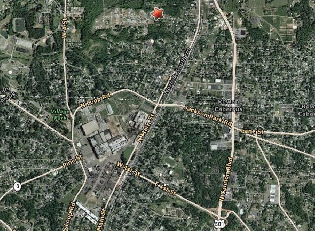
Property Record
Gary Ave, Kannapolis, NC 28081

Property Detail
Gary Ave
Charlotte-Concord-Gastonia, NC-SC
42.55AC
152-195
ROWAN
Agriculturalland
North Carolina
AE The base floodplain where base flood elevations are provided. AE Zones are now used on new format FIRMs instead of A1-A30 Zones.
42.55 AC
2025
Rowan County
2025
Charlotte
041201
NEARBY LISTINGS FOR SALE OR LEASE
DEMOGRAPHICS near Gary Ave
1 mile
3 mile
5 mile
2025 Total Population
7,329
44,412
77,786
2030 Population
7,722
47,303
82,801
Pop Growth 2025-2030
+ 5.36%
+ 6.51%
+ 6.45%
Average Age
37
39
40
2025 Total Households
2,800
17,583
30,429
HH Growth 2025-2030
+ 5.39%
+ 6.66%
+ 6.61%
Median Household Inc
$64,025
$58,114
$64,136
Avg Household Size
2.60
2.50
2.50
2025 Avg HH Vehicles
2.00
2.00
2.00
Median Home Value
$276,933
$243,947
$265,278
Median Year Built
1976
1972
1982
Nearby Places
Map Layers
Map Styles
 Street
 Aerial
Transit
 Traffic
 Biking
Places
Listings with unknown addresses are not visible on the map
- Restaurants
- Banks
- Shops
- Fitness
- Groceries
PUBLIC TRANSPORTATION
COMMUTER RAIL
Kannapolis Station (Piedmont - North Carolina by Train (NC Train))
Drive
Walk
Distance
Kannapolis Station (Piedmont - North Carolina by Train (NC Train))
6 min
2.5 mi
AIRPORT
Concord-Padgett Regional
Drive
Walk
Distance
Concord-Padgett Regional
27 min
15.5 mi
Charlotte/Douglas International
Drive
Walk
Distance
Charlotte/Douglas International
53 min
35.7 mi
Freight Ports
Port of Wilmington
Drive
Walk
Distance
Port of Wilmington
268 min
204.7 mi
SALE & LEASE HISTORY
LISTING DATE
SALE/LEASE

Oct 19, 2018
For Sale
Nearby Properties
Address
Land Use
TOTAL SIZE
Lot Size
Zoning
Address
Land Use
TOTAL SIZE
Lot Size
Zoning
276,070 SF
CC
Address
Land Use
TOTAL SIZE
Lot Size
Zoning
128,064 SF
2.68 AC
CC
Address
Land Use
TOTAL SIZE
Lot Size
Zoning
121,156 SF
3.57 AC
CC
Address
Land Use
TOTAL SIZE
Lot Size
Zoning
106,804 SF
1.81 AC
CC
Address
Land Use
TOTAL SIZE
Lot Size
Zoning
83,152 SF
7.11 AC
CC
Address
Land Use
TOTAL SIZE
Lot Size
Zoning
176,075 SF
2.35 AC
CC
Address
Land Use
TOTAL SIZE
Lot Size
Zoning
5,308 SF
15.16 AC
RC
Address
Land Use
TOTAL SIZE
Lot Size
Zoning
85,422 SF
6.30 AC
R8
Address
Land Use
TOTAL SIZE
Lot Size
Zoning
67,862 SF
1.77 AC
CC
Address
Land Use
TOTAL SIZE
Lot Size
Zoning
12,010 SF
0.40 AC
CC
Address
Land Use
TOTAL SIZE
Lot Size
Zoning
66,194 SF
2.94 AC
CC
Address
Land Use
TOTAL SIZE
Lot Size
Zoning
101,014 SF
1.84 AC
CC
Address
Land Use
TOTAL SIZE
Lot Size
Zoning
56,923 SF
2 AC
CC
Address
Land Use
TOTAL SIZE
Lot Size
Zoning
68,257 SF
8.26 AC
R8
Address
Land Use
TOTAL SIZE
Lot Size
Zoning
64,554 SF
2.67 AC
CC
Address
Land Use
TOTAL SIZE
Lot Size
Zoning
115,509 SF
4.90 AC
R8
Address
Land Use
TOTAL SIZE
Lot Size
Zoning
84,608 SF
23.75 AC
R8
Address
Land Use
TOTAL SIZE
Lot Size
Zoning
12,415 SF
25.46 AC
R8
Address
Land Use
TOTAL SIZE
Lot Size
Zoning
269,700 SF
76.24 AC
Address
Land Use
TOTAL SIZE
Lot Size
Zoning
78,771 SF
CC
Address
Land Use
TOTAL SIZE
Lot Size
Zoning
50,366 SF
1.64 AC
CC
Address
Land Use
TOTAL SIZE
Lot Size
Zoning
175,140 SF
1.12 AC
CC
Address
Land Use
TOTAL SIZE
Lot Size
Zoning
43,607 SF
14.75 AC
GC
Address
Land Use
TOTAL SIZE
Lot Size
Zoning
10,056 SF
10.11 AC
R8
Address
Land Use
TOTAL SIZE
Lot Size
Zoning
15,141 SF
22.29 AC
R4
Address
Land Use
TOTAL SIZE
Lot Size
Zoning
48,024 SF
5.26 AC
O-I
Address
Land Use
TOTAL SIZE
Lot Size
Zoning
1,545 SF
0.56 AC
CC
Address
Land Use
TOTAL SIZE
Lot Size
Zoning
83,701 SF
2.99 AC
R4
Address
Land Use
TOTAL SIZE
Lot Size
Zoning
89,623 SF
7.58 AC
CC
Address
Land Use
TOTAL SIZE
Lot Size
Zoning
2,200 SF
10.81 AC
R4
The World's #1 Commercial Real Estate Marketplace
Connect with us
© 2026 CoStar Group
The information above has been obtained from sources believed reliable. While we do not doubt its accuracy we have not verified it and make no guarantee, warranty or representation about it. It is your responsibility to independently confirm its accuracy and completeness. Any projections, opinions, assumptions, or estimates used are for example only and do not represent the current or future performance of the property. The value of this transaction to you depends on tax and other factors which should be evaluated by your tax, financial, and legal advisors. You and your advisors should conduct a careful, independent investigation of the property to determine to your satisfaction the suitability of the property for your needs.