Property Record
Gaston Day School Rd, , NC


This Property Is For Sale
Property Detail
Gaston Day School Rd
Charlotte-Concord-Gastonia, NC-SC
10 080 018 00 000
220736
GASTON
Commercialnec
North Carolina
B and X Area of moderate flood hazard, usually the area between the limits of the 100-year and 500-year floods.
1.90 AC
2025
Gaston County
2025
Charlotte
032506
NEARBY LISTINGS FOR SALE OR LEASE
DEMOGRAPHICS near Gaston Day School Rd
1 mile
3 mile
5 mile
2025 Total Population
3,448
34,593
84,662
2030 Population
3,603
36,421
88,981
Pop Growth 2025-2030
+ 4.50%
+ 5.28%
+ 5.10%
Average Age
43
41
40
2025 Total Households
1,329
13,757
33,851
HH Growth 2025-2030
+ 4.67%
+ 5.48%
+ 5.24%
Median Household Inc
$115,448
$85,957
$72,135
Avg Household Size
2.60
2.50
2.40
2025 Avg HH Vehicles
2.00
2.00
2.00
Median Home Value
$374,235
$331,071
$299,850
Median Year Built
1979
1990
1982
Nearby Places
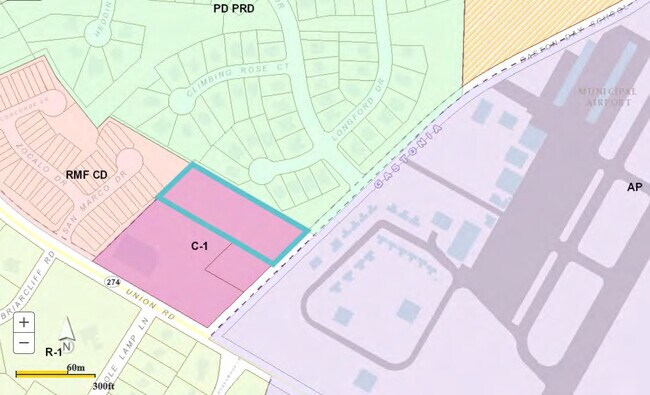
Map Layers
Map Styles
 Street
 Aerial
Layers
 Traffic
 Biking
Places
Listings with unknown addresses are not visible on the map
- Restaurants
- Banks
- Shops
- Fitness
- Groceries
PUBLIC TRANSPORTATION
COMMUTER RAIL
Drive
Walk
Distance
12 min
6.2 mi
AIRPORT
Charlotte/Douglas International
Drive
Walk
Distance
Charlotte/Douglas International
38 min
19.1 mi
Concord-Padgett Regional
Drive
Walk
Distance
Concord-Padgett Regional
51 min
35.4 mi
Nearby Properties
Address
Land Use
TOTAL SIZE
Lot Size
Zoning
Address
Land Use
TOTAL SIZE
Lot Size
Zoning
7,880 SF
18.35 AC
R1
Address
Land Use
TOTAL SIZE
Lot Size
Zoning
2,066 SF
16.10 AC
Address
Land Use
TOTAL SIZE
Lot Size
Zoning
8,040 SF
18.44 AC
APT01
Address
Land Use
TOTAL SIZE
Lot Size
Zoning
3,120 SF
15.05 AC
OFF01
Address
Land Use
TOTAL SIZE
Lot Size
Zoning
1,886 SF
13.27 AC
APT01
Address
Land Use
TOTAL SIZE
Lot Size
Zoning
1,974 SF
15.50 AC
APT01
Address
Land Use
TOTAL SIZE
Lot Size
Zoning
203,152 SF
67.60 AC
PUB01
Address
Land Use
TOTAL SIZE
Lot Size
Zoning
5,120 SF
9.42 AC
Address
Land Use
TOTAL SIZE
Lot Size
Zoning
33,258 SF
5.51 AC
Address
Land Use
TOTAL SIZE
Lot Size
Zoning
1,170 SF
320.29 AC
OFF01
Address
Land Use
TOTAL SIZE
Lot Size
Zoning
6,774 SF
13.86 AC
APT02
Address
Land Use
TOTAL SIZE
Lot Size
Zoning
1,721 SF
17.49 AC
OFF01
Address
Land Use
TOTAL SIZE
Lot Size
Zoning
14.51 AC
Address
Land Use
TOTAL SIZE
Lot Size
Zoning
1,969 SF
14.60 AC
Address
Land Use
TOTAL SIZE
Lot Size
Zoning
3.34 AC
Address
Land Use
TOTAL SIZE
Lot Size
Zoning
11,676 SF
7.31 AC
Address
Land Use
TOTAL SIZE
Lot Size
Zoning
29,958 SF
5.49 AC
R1
Address
Land Use
TOTAL SIZE
Lot Size
Zoning
1,200 SF
7.58 AC
APT02
Address
Land Use
TOTAL SIZE
Lot Size
Zoning
7,949 SF
7.95 AC
SHOP1
Address
Land Use
TOTAL SIZE
Lot Size
Zoning
5,604 SF
56.06 AC
PUB01
Address
Land Use
TOTAL SIZE
Lot Size
Zoning
64,332 SF
32.20 AC
Address
Land Use
TOTAL SIZE
Lot Size
Zoning
199,200 SF
23.83 AC
INDS1
Address
Land Use
TOTAL SIZE
Lot Size
Zoning
8,040 SF
6.26 AC
APT01
Address
Land Use
TOTAL SIZE
Lot Size
Zoning
6,608 SF
9.10 AC
Address
Land Use
TOTAL SIZE
Lot Size
Zoning
5,432 SF
7.61 AC
APT02
Address
Land Use
TOTAL SIZE
Lot Size
Zoning
98,868 SF
3.30 AC
Address
Land Use
TOTAL SIZE
Lot Size
Zoning
Address
Land Use
TOTAL SIZE
Lot Size
Zoning
39,911 SF
19.28 AC
CHUR1
Address
Land Use
TOTAL SIZE
Lot Size
Zoning
55,588 SF
5.56 AC
HCAR4
Address
Land Use
TOTAL SIZE
Lot Size
Zoning
15,000 SF
34.49 AC
PUB01
The World's #1 Commercial Real Estate Marketplace
Connect with us
© 2026 CoStar Group
The information above has been obtained from sources believed reliable. While we do not doubt its accuracy we have not verified it and make no guarantee, warranty or representation about it. It is your responsibility to independently confirm its accuracy and completeness. Any projections, opinions, assumptions, or estimates used are for example only and do not represent the current or future performance of the property. The value of this transaction to you depends on tax and other factors which should be evaluated by your tax, financial, and legal advisors. You and your advisors should conduct a careful, independent investigation of the property to determine to your satisfaction the suitability of the property for your needs.