Property Record
Gator Rock Rd, Somersworth, NH 03878

NEARBY LISTINGS FOR SALE OR LEASE
Property Detail
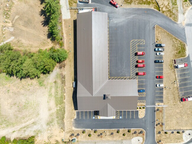
Gator Rock Rd
SMSW M:47 B:1B L:0
Strafford
Industrialacreage
New Hampshire
X
9.87 AC
23031C0519G
Strafford County
2024
Boston
2024
Boston-Cambridge-Newton, MA-NH
083001
DEMOGRAPHICS near Gator Rock Rd
1 Mile
3 Mile
5 Mile
2024 Total Population
1,592
23,569
62,119
2029 Population
1,657
24,688
65,086
Pop Growth 2024-2029
+ 4.08%
+ 4.75%
+ 4.78%
Average Age
46
41
41
2024 Total Households
734
9,666
26,368
HH Growth 2024-2029
+ 4.09%
+ 4.84%
+ 4.92%
Median Household Inc
$90,908
$90,017
$86,499
Avg Household Size
2.20
2.30
2.30
2024 Avg HH Vehicles
2.00
2.00
2.00
Median Home Value
$289,837
$280,615
$285,582
Median Year Built
1982
1976
1973
Nearby Places
Map Layers
Map Styles
 Street
 Aerial
- Restaurants
- Banks
- Shops
- Fitness
- Groceries
SALE & LEASE HISTORY
LISTING DATE
SALE/LEASE

Jun 15, 2023
For Sale
Feb 03, 2023
For Lease
Nearby Properties
Address
Land Use
TOTAL SIZE
Lot Size
Zoning
Address
Land Use
TOTAL SIZE
Lot Size
Zoning
50.50 AC
R2
Address
Land Use
TOTAL SIZE
Lot Size
Zoning
345,277 SF
49.30 AC
IND
Address
Land Use
TOTAL SIZE
Lot Size
Zoning
18.65 AC
B
Address
Land Use
TOTAL SIZE
Lot Size
Zoning
15.46 AC
C
Address
Land Use
TOTAL SIZE
Lot Size
Zoning
19.55 AC
B
Address
Land Use
TOTAL SIZE
Lot Size
Zoning
77,721 SF
22.63 AC
R1
Address
Land Use
TOTAL SIZE
Lot Size
Zoning
428,428 SF
210.42 AC
CI
Address
Land Use
TOTAL SIZE
Lot Size
Zoning
Address
Land Use
TOTAL SIZE
Lot Size
Zoning
112,173 SF
21 AC
CI
Address
Land Use
TOTAL SIZE
Lot Size
Zoning
197,921 SF
RC
Address
Land Use
TOTAL SIZE
Lot Size
Zoning
77,916 SF
6.58 AC
A
Address
Land Use
TOTAL SIZE
Lot Size
Zoning
104,186 SF
21.50 AC
CI
Address
Land Use
TOTAL SIZE
Lot Size
Zoning
5 AC
C
Address
Land Use
TOTAL SIZE
Lot Size
Zoning
2.41 AC
Address
Land Use
TOTAL SIZE
Lot Size
Zoning
5.24 AC
C
Address
Land Use
TOTAL SIZE
Lot Size
Zoning
12.74 AC
C
Address
Land Use
TOTAL SIZE
Lot Size
Zoning
8.65 AC
IT
Address
Land Use
TOTAL SIZE
Lot Size
Zoning
14.50 AC
CI
Address
Land Use
TOTAL SIZE
Lot Size
Zoning
150,000 SF
29.85 AC
IND
Address
Land Use
TOTAL SIZE
Lot Size
Zoning
26.27 AC
IT*
Address
Land Use
TOTAL SIZE
Lot Size
Zoning
46.98 AC
CI
Address
Land Use
TOTAL SIZE
Lot Size
Zoning
18.10 AC
B
Address
Land Use
TOTAL SIZE
Lot Size
Zoning
33.57 AC
CI
Address
Land Use
TOTAL SIZE
Lot Size
Zoning
2.02 AC
C
Address
Land Use
TOTAL SIZE
Lot Size
Zoning
4,916 SF
93 AC
A
Address
Land Use
TOTAL SIZE
Lot Size
Zoning
12 AC
R2
Address
Land Use
TOTAL SIZE
Lot Size
Zoning
2.04 AC
C
Address
Land Use
TOTAL SIZE
Lot Size
Zoning
34,964 SF
1.47 AC
COM-B
Address
Land Use
TOTAL SIZE
Lot Size
Zoning
44,530 SF
2.03 AC
A
Address
Land Use
TOTAL SIZE
Lot Size
Zoning
44,530 SF
5.67 AC
A
The World's #1 Commercial Real Estate Marketplace
Connect with us
© 2025 CoStar Group
The information above has been obtained from sources believed reliable. While we do not doubt its accuracy we have not verified it and make no guarantee, warranty or representation about it. It is your responsibility to independently confirm its accuracy and completeness. Any projections, opinions, assumptions, or estimates used are for example only and do not represent the current or future performance of the property. The value of this transaction to you depends on tax and other factors which should be evaluated by your tax, financial, and legal advisors. You and your advisors should conduct a careful, independent investigation of the property to determine to your satisfaction the suitability of the property for your needs.