Property Record
General Delivery, Saluda, VA 23149
Save to a Folder
{{folder.Name}}
{{folder.ListingIds.length}} Properties
{{folder.ListingIds.length}} Property
Create a New Folder
Property Detail
General Delivery
26-153A
SMITHERS CEMETARY .983 AC DB66-206 PL66-209 DB12-488 SL37-10. D12-448 SL37-10 11
Taxexempt
MIDDLESEX
VC
Virginia
B and X Area of moderate flood hazard, usually the area between the limits of the 100-year and 500-year floods.
0.98 AC
2025
Virginia Regional
2025
Other Market Areas
100101
NEARBY LISTINGS FOR SALE OR LEASE
-
-
View all Saluda listings for sale on LoopNet.com
DEMOGRAPHICS near General Delivery
1 mile
3 mile
5 mile
2025 Total Population
433
1,937
4,341
2030 Population
428
1,904
4,358
Pop Growth 2025-2030
(1.15%)
(1.70%)
+ 0.39%
Average Age
48
49
48
2025 Total Households
141
809
1,846
HH Growth 2025-2030
(2.13%)
(2.35%)
+ 0.05%
Median Household Inc
$103,472
$77,016
$83,679
Avg Household Size
2.20
2.10
2.20
2025 Avg HH Vehicles
3.00
2.00
2.00
Median Home Value
$338,095
$340,654
$308,943
Median Year Built
1958
1983
1984
Nearby Places
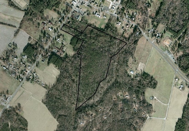
Map Layers
Map Styles
 Street
 Aerial
Layers
 Traffic
 Biking
Places
Listings with unknown addresses are not visible on the map
- Restaurants
- Banks
- Shops
- Fitness
- Groceries
SALE & LEASE HISTORY
LISTING DATE
SALE/LEASE

Sep 24, 2016
For Sale
Nearby Properties
Address
Land Use
TOTAL SIZE
Lot Size
Zoning
Address
Land Use
TOTAL SIZE
Lot Size
Zoning
56,980 SF
2.51 AC
GB
Address
Land Use
TOTAL SIZE
Lot Size
Zoning
7.05 AC
GB
Address
Land Use
TOTAL SIZE
Lot Size
Zoning
95,408 SF
17.83 AC
VC
Address
Land Use
TOTAL SIZE
Lot Size
Zoning
16,456 SF
1.43 AC
GB
Address
Land Use
TOTAL SIZE
Lot Size
Zoning
44,172 SF
5.10 AC
GB
Address
Land Use
TOTAL SIZE
Lot Size
Zoning
2,668 SF
3.36 AC
GB
Address
Land Use
TOTAL SIZE
Lot Size
Zoning
9,192 SF
8.34 AC
LDR
Address
Land Use
TOTAL SIZE
Lot Size
Zoning
34,824 SF
4.39 AC
GB
Address
Land Use
TOTAL SIZE
Lot Size
Zoning
6,713 SF
5.40 AC
B-1
Address
Land Use
TOTAL SIZE
Lot Size
Zoning
23,836 SF
7.69 AC
VC
Address
Land Use
TOTAL SIZE
Lot Size
Zoning
256.49 AC
RC-1
Address
Land Use
TOTAL SIZE
Lot Size
Zoning
11,872 SF
7.91 AC
GB
Address
Land Use
TOTAL SIZE
Lot Size
Zoning
4,017 SF
3.28 AC
VC
Address
Land Use
TOTAL SIZE
Lot Size
Zoning
16,278 SF
2 AC
GB
Address
Land Use
TOTAL SIZE
Lot Size
Zoning
446.30 AC
RC-1
Address
Land Use
TOTAL SIZE
Lot Size
Zoning
104.49 AC
VC
Address
Land Use
TOTAL SIZE
Lot Size
Zoning
9,892 SF
2.03 AC
GB
Address
Land Use
TOTAL SIZE
Lot Size
Zoning
6.67 AC
VC
Address
Land Use
TOTAL SIZE
Lot Size
Zoning
2,490 SF
0.92 AC
B-1
Address
Land Use
TOTAL SIZE
Lot Size
Zoning
12,695 SF
0.55 AC
R
Address
Land Use
TOTAL SIZE
Lot Size
Zoning
1.63 AC
WC
Address
Land Use
TOTAL SIZE
Lot Size
Zoning
7,780 SF
3.89 AC
LDR
Address
Land Use
TOTAL SIZE
Lot Size
Zoning
7,477 SF
4.41 AC
VC
Address
Land Use
TOTAL SIZE
Lot Size
Zoning
2,890 SF
2.79 AC
B-1
Address
Land Use
TOTAL SIZE
Lot Size
Zoning
10,952 SF
1.34 AC
VC
Address
Land Use
TOTAL SIZE
Lot Size
Zoning
21,865 SF
0.97 AC
H
Address
Land Use
TOTAL SIZE
Lot Size
Zoning
14,610 SF
0.39 AC
GB
Address
Land Use
TOTAL SIZE
Lot Size
Zoning
1,266 SF
32.08 AC
LI
Address
Land Use
TOTAL SIZE
Lot Size
Zoning
17,736 SF
0.93 AC
GB
Address
Land Use
TOTAL SIZE
Lot Size
Zoning
12,521 SF
2.61 AC
WC
The World's #1 Commercial Real Estate Marketplace
Connect with us
© 2026 CoStar Group
The information above has been obtained from sources believed reliable. While we do not doubt its accuracy we have not verified it and make no guarantee, warranty or representation about it. It is your responsibility to independently confirm its accuracy and completeness. Any projections, opinions, assumptions, or estimates used are for example only and do not represent the current or future performance of the property. The value of this transaction to you depends on tax and other factors which should be evaluated by your tax, financial, and legal advisors. You and your advisors should conduct a careful, independent investigation of the property to determine to your satisfaction the suitability of the property for your needs.