Property Record
Generals Hwy, Crownsville, MD 21032


NEARBY LISTINGS FOR SALE OR LEASE
-
-
View all Crownsville listings for sale on LoopNet.com
Property Detail
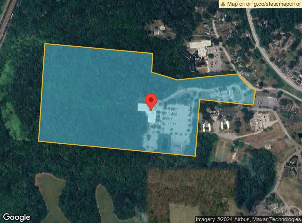
Generals Hwy
02-000-90071398
Crownsville
Officebuilding
62.34 ACRES GENERALS HWY CROWNSVILLE
X
Anne Arundel
24003C0165E
Maryland
2023
62.34 AC
2025
Annapolis
702100
Baltimore
286,262 SF
Baltimore-Columbia-Towson, MD
DEMOGRAPHICS near Generals Hwy
1 Mile
3 Mile
5 Mile
2024 Total Population
686
11,743
86,532
2029 Population
701
11,983
88,455
Pop Growth 2024-2029
+ 2.19%
+ 2.04%
+ 2.22%
Average Age
45
44
42
2024 Total Households
242
4,268
32,982
HH Growth 2024-2029
+ 2.07%
+ 2.11%
+ 2.31%
Median Household Inc
$168,750
$154,983
$135,271
Avg Household Size
2.80
2.70
2.50
2024 Avg HH Vehicles
3.00
2.00
2.00
Median Home Value
$666,044
$645,098
$576,615
Median Year Built
1987
1985
1985
Nearby Places
Map Layers
Map Styles
 Street
 Aerial
- Restaurants
- Banks
- Shops
- Fitness
- Groceries
PUBLIC TRANSPORTATION
COMMUTER RAIL
Odenton (Penn Line - Maryland Area Regional Commuter Trains (The MARC))
DRIVE
WALK
Distance
Odenton (Penn Line - Maryland Area Regional Commuter Trains (The MARC))
16 min
8.0 mi
AIRPORT
Baltimore/Washington International Thurgood Marshall
DRIVE
WALK
Distance
Baltimore/Washington International Thurgood Marshall
26 min
16.3 mi
Ronald Reagan Washington Ntl
DRIVE
WALK
Distance
Ronald Reagan Washington Ntl
54 min
37.7 mi
Freight Ports
Port of Baltimore
DRIVE
WALK
Distance
Port of Baltimore
32 min
21.6 mi
Nearby Properties
Address
Land Use
TOTAL SIZE
Lot Size
Zoning
Address
Land Use
TOTAL SIZE
Lot Size
Zoning
429.57 AC
OS
Address
Land Use
TOTAL SIZE
Lot Size
Zoning
129,728 SF
114 AC
RA
Address
Land Use
TOTAL SIZE
Lot Size
Zoning
48,036 SF
15.99 AC
RLD
Address
Land Use
TOTAL SIZE
Lot Size
Zoning
67,322 SF
13.35 AC
R1
Address
Land Use
TOTAL SIZE
Lot Size
Zoning
58,527 SF
5 AC
RA
Address
Land Use
TOTAL SIZE
Lot Size
Zoning
1,056 SF
42.88 AC
RA
Address
Land Use
TOTAL SIZE
Lot Size
Zoning
20,931 SF
2.01 AC
C2
Address
Land Use
TOTAL SIZE
Lot Size
Zoning
28,488 SF
8.37 AC
RA
Address
Land Use
TOTAL SIZE
Lot Size
Zoning
23,406 SF
14.34 AC
RA
Address
Land Use
TOTAL SIZE
Lot Size
Zoning
3,922 SF
208.70 AC
OS
Address
Land Use
TOTAL SIZE
Lot Size
Zoning
19,150 SF
2.83 AC
RA
Address
Land Use
TOTAL SIZE
Lot Size
Zoning
33,884 SF
8.89 AC
RLD
Address
Land Use
TOTAL SIZE
Lot Size
Zoning
14.49 AC
R1
Address
Land Use
TOTAL SIZE
Lot Size
Zoning
81.70 AC
RA
Address
Land Use
TOTAL SIZE
Lot Size
Zoning
7,675 SF
23.70 AC
Address
Land Use
TOTAL SIZE
Lot Size
Zoning
5 AC
RA
Address
Land Use
TOTAL SIZE
Lot Size
Zoning
44,020 SF
17.77 AC
RLD
Address
Land Use
TOTAL SIZE
Lot Size
Zoning
546.72 AC
RA
Address
Land Use
TOTAL SIZE
Lot Size
Zoning
5,941 SF
19.20 AC
RLD
Address
Land Use
TOTAL SIZE
Lot Size
Zoning
6,712 SF
8 AC
W2
Address
Land Use
TOTAL SIZE
Lot Size
Zoning
3,456 SF
2.33 AC
MA2
Address
Land Use
TOTAL SIZE
Lot Size
Zoning
13,009 SF
21.01 AC
RA
Address
Land Use
TOTAL SIZE
Lot Size
Zoning
30,226 SF
102.23 AC
RA
Address
Land Use
TOTAL SIZE
Lot Size
Zoning
11,100 SF
11.34 AC
RA
Address
Land Use
TOTAL SIZE
Lot Size
Zoning
6,366 SF
2.89 AC
C1
Address
Land Use
TOTAL SIZE
Lot Size
Zoning
11,719 SF
94.67 AC
RA
Address
Land Use
TOTAL SIZE
Lot Size
Zoning
7,483 SF
54.45 AC
RLD
Address
Land Use
TOTAL SIZE
Lot Size
Zoning
7,561 SF
6 AC
RLD
Address
Land Use
TOTAL SIZE
Lot Size
Zoning
4,580 SF
95.63 AC
R1/OS
The World's #1 Commercial Real Estate Marketplace
Connect with us
© 2026 CoStar Group
The information above has been obtained from sources believed reliable. While we do not doubt its accuracy we have not verified it and make no guarantee, warranty or representation about it. It is your responsibility to independently confirm its accuracy and completeness. Any projections, opinions, assumptions, or estimates used are for example only and do not represent the current or future performance of the property. The value of this transaction to you depends on tax and other factors which should be evaluated by your tax, financial, and legal advisors. You and your advisors should conduct a careful, independent investigation of the property to determine to your satisfaction the suitability of the property for your needs.