Property Record
Germanna Hwy, Locust Grove, VA 22508

Save to a Folder
{{folder.Name}}
{{folder.ListingIds.length}} Properties
{{folder.ListingIds.length}} Property
Create a New Folder
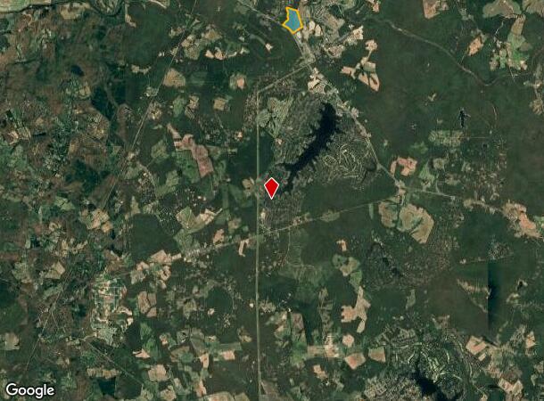
Property Detail
Germanna Hwy
Lake of the Woods, VA
4-3 GERMANNA ORD.NO. 130611-7A
146
ORANGE
Agriculturalland
Virginia
PDM MIXED
3
B and X Area of moderate flood hazard, usually the area between the limits of the 100-year and 500-year floods.
77.67 AC
2025
Virginia Regional
2025
Other Market Areas
110107
NEARBY LISTINGS FOR SALE OR LEASE
-
-
View all Locust Grove listings for lease on LoopNet.com
DEMOGRAPHICS near Germanna Hwy
1 mile
3 mile
5 mile
2025 Total Population
2,301
9,533
17,041
2030 Population
2,447
10,174
18,141
Pop Growth 2025-2030
+ 6.35%
+ 6.72%
+ 6.46%
Average Age
37
42
43
2025 Total Households
779
3,609
6,528
HH Growth 2025-2030
+ 6.42%
+ 6.84%
+ 6.56%
Median Household Inc
$130,769
$118,215
$113,033
Avg Household Size
2.90
2.60
2.60
2025 Avg HH Vehicles
3.00
2.00
2.00
Median Home Value
$344,782
$370,784
$383,358
Median Year Built
2007
2003
2001
Nearby Places
Map Layers
Map Styles
 Street
 Aerial
Layers
 Traffic
 Biking
Places
Listings with unknown addresses are not visible on the map
- Restaurants
- Banks
- Shops
- Fitness
- Groceries
SALE & LEASE HISTORY
LISTING DATE
SALE/LEASE

Sep 25, 2016
For Lease
Jun 01, 2017
For Lease
Jun 01, 2017
For Sale
Nearby Properties
Address
Land Use
TOTAL SIZE
Lot Size
Zoning
Address
Land Use
TOTAL SIZE
Lot Size
Zoning
182,737 SF
158.76 AC
A AGRICULT
Address
Land Use
TOTAL SIZE
Lot Size
Zoning
72,642 SF
9.11 AC
A AGRICULT
Address
Land Use
TOTAL SIZE
Lot Size
Zoning
37,019 SF
2.03 AC
R3 PLANNED
Address
Land Use
TOTAL SIZE
Lot Size
Zoning
62,364 SF
7.09 AC
C2 GENERAL
Address
Land Use
TOTAL SIZE
Lot Size
Zoning
60,873 SF
1.94 AC
C2 GENERAL
Address
Land Use
TOTAL SIZE
Lot Size
Zoning
3,678 SF
338 AC
A3 - AGRIC
Address
Land Use
TOTAL SIZE
Lot Size
Zoning
10,508 SF
2.19 AC
R3 PLANNED
Address
Land Use
TOTAL SIZE
Lot Size
Zoning
13,200 SF
7.16 AC
C2 GENERAL
Address
Land Use
TOTAL SIZE
Lot Size
Zoning
2,688 SF
350 AC
RU - RURAL
Address
Land Use
TOTAL SIZE
Lot Size
Zoning
4,401 SF
1.58 AC
C2 GENERAL
Address
Land Use
TOTAL SIZE
Lot Size
Zoning
9,480 SF
1.20 AC
C2 GENERAL
Address
Land Use
TOTAL SIZE
Lot Size
Zoning
630.08 AC
A AGRICULT
Address
Land Use
TOTAL SIZE
Lot Size
Zoning
13,897 SF
1.83 AC
C2 GENERAL
Address
Land Use
TOTAL SIZE
Lot Size
Zoning
251 AC
A3 - AGRIC
Address
Land Use
TOTAL SIZE
Lot Size
Zoning
22,100 SF
2.54 AC
C2 GENERAL
Address
Land Use
TOTAL SIZE
Lot Size
Zoning
22,400 SF
2.55 AC
C2 GENERAL
Address
Land Use
TOTAL SIZE
Lot Size
Zoning
39.76 AC
PDM MIXED
Address
Land Use
TOTAL SIZE
Lot Size
Zoning
48.58 AC
C2 GENERAL
Address
Land Use
TOTAL SIZE
Lot Size
Zoning
7,296 SF
3 AC
A AGRICULT
Address
Land Use
TOTAL SIZE
Lot Size
Zoning
147.32 AC
R3 PLANNED
Address
Land Use
TOTAL SIZE
Lot Size
Zoning
117.39 AC
PDM MIXED
Address
Land Use
TOTAL SIZE
Lot Size
Zoning
6,768 SF
1 AC
C2 GENERAL
Address
Land Use
TOTAL SIZE
Lot Size
Zoning
207.13 AC
A AGRICULT
Address
Land Use
TOTAL SIZE
Lot Size
Zoning
20,600 SF
2.54 AC
C2 GENERAL
Address
Land Use
TOTAL SIZE
Lot Size
Zoning
3,724 SF
1.08 AC
C2 GENERAL
Address
Land Use
TOTAL SIZE
Lot Size
Zoning
5,768 SF
1.60 AC
C2 GENERAL
Address
Land Use
TOTAL SIZE
Lot Size
Zoning
12,000 SF
3 AC
C2 GENERAL
Address
Land Use
TOTAL SIZE
Lot Size
Zoning
9,456 SF
0.88 AC
C2 GENERAL
The World's #1 Commercial Real Estate Marketplace
Connect with us
© 2026 CoStar Group
The information above has been obtained from sources believed reliable. While we do not doubt its accuracy we have not verified it and make no guarantee, warranty or representation about it. It is your responsibility to independently confirm its accuracy and completeness. Any projections, opinions, assumptions, or estimates used are for example only and do not represent the current or future performance of the property. The value of this transaction to you depends on tax and other factors which should be evaluated by your tax, financial, and legal advisors. You and your advisors should conduct a careful, independent investigation of the property to determine to your satisfaction the suitability of the property for your needs.