Property Record
Gerry Sinclairville Rd, Gerry, NY 14740

Save to a Folder
{{folder.Name}}
{{folder.ListingIds.length}} Properties
{{folder.ListingIds.length}} Property
Create a New Folder
This Property Is For Sale
Property Detail
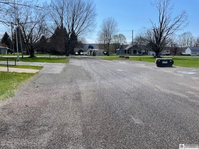
Gerry Sinclairville Rd
Jamestown-Dunkirk, NY
OLD APN: 064489 15-4-5
064489-302-018-0002-006-000
CHAUTAUQUA
Commercialnec
New York
05 - COMME
10.000
2025
0.40 AC
2025
New York West Area
036901
Other Market Areas
NEARBY LISTINGS FOR SALE OR LEASE
-
-
View all Gerry listings for sale on LoopNet.com
DEMOGRAPHICS near Gerry Sinclairville Rd
1 mile
3 mile
5 mile
2025 Total Population
512
1,508
3,842
2030 Population
499
1,465
3,745
Pop Growth 2025-2030
(2.54%)
(2.85%)
(2.52%)
Average Age
46
46
45
2025 Total Households
195
596
1,557
HH Growth 2025-2030
(2.56%)
(3.19%)
(2.83%)
Median Household Inc
$64,800
$67,846
$70,608
Avg Household Size
2.40
2.40
2.40
2025 Avg HH Vehicles
2.00
2.00
2.00
Median Home Value
$146,610
$156,451
$155,567
Median Year Built
1971
1970
1967
Nearby Places
Map Layers
Map Styles
 Street
 Aerial
Layers
 Traffic
 Biking
Places
Listings with unknown addresses are not visible on the map
- Restaurants
- Banks
- Shops
- Fitness
- Groceries
Nearby Properties
Address
Land Use
TOTAL SIZE
Lot Size
Zoning
Address
Land Use
TOTAL SIZE
Lot Size
Zoning
20,512 SF
236.10 AC
08 - GOVER
Address
Land Use
TOTAL SIZE
Lot Size
Zoning
58,716 SF
6.40 AC
04 - FARM
Address
Land Use
TOTAL SIZE
Lot Size
Zoning
33,435 SF
5.20 AC
04 - FARM
Address
Land Use
TOTAL SIZE
Lot Size
Zoning
44,243 SF
7.20 AC
04
Address
Land Use
TOTAL SIZE
Lot Size
Zoning
11,076 SF
2.10 AC
Address
Land Use
TOTAL SIZE
Lot Size
Zoning
1,912 SF
58.50 AC
04 - FARM
Address
Land Use
TOTAL SIZE
Lot Size
Zoning
1,056 SF
14.90 AC
04 - FARM
Address
Land Use
TOTAL SIZE
Lot Size
Zoning
40,800 SF
10.10 AC
06 - INDUS
Address
Land Use
TOTAL SIZE
Lot Size
Zoning
13,035 SF
6.90 AC
05 - COMME
Address
Land Use
TOTAL SIZE
Lot Size
Zoning
11,436 SF
0.49 AC
05 - COMME
Address
Land Use
TOTAL SIZE
Lot Size
Zoning
1,008 SF
34.90 AC
04 - FARM
Address
Land Use
TOTAL SIZE
Lot Size
Zoning
1,144 SF
1.60 AC
05 - COMME
Address
Land Use
TOTAL SIZE
Lot Size
Zoning
2,792 SF
1.70 AC
05 - COMME
Address
Land Use
TOTAL SIZE
Lot Size
Zoning
6,754 SF
1 AC
05 - COMME
Address
Land Use
TOTAL SIZE
Lot Size
Zoning
100 AC
04 - FARM
Address
Land Use
TOTAL SIZE
Lot Size
Zoning
9,794 SF
0.62 AC
05 - COMME
Address
Land Use
TOTAL SIZE
Lot Size
Zoning
0.14 AC
06 - INDUS
Address
Land Use
TOTAL SIZE
Lot Size
Zoning
5,530 SF
0.48 AC
04 - FARM
Address
Land Use
TOTAL SIZE
Lot Size
Zoning
4,416 SF
0.48 AC
05 - COMME
Address
Land Use
TOTAL SIZE
Lot Size
Zoning
3,184 SF
1.80 AC
03 - MULTI
Address
Land Use
TOTAL SIZE
Lot Size
Zoning
6,000 SF
3.20 AC
04 - FARM
Address
Land Use
TOTAL SIZE
Lot Size
Zoning
152.40 AC
04 - FARM
Address
Land Use
TOTAL SIZE
Lot Size
Zoning
5,856 SF
3.10 AC
05 - COMME
Address
Land Use
TOTAL SIZE
Lot Size
Zoning
12,784 SF
1.80 AC
04 - FARM
Address
Land Use
TOTAL SIZE
Lot Size
Zoning
3,576 SF
3 AC
04 - FARM
Address
Land Use
TOTAL SIZE
Lot Size
Zoning
4,086 SF
33 AC
04 - FARM
Address
Land Use
TOTAL SIZE
Lot Size
Zoning
754 SF
5.90 AC
05 - COMME
Address
Land Use
TOTAL SIZE
Lot Size
Zoning
1,820 SF
5 AC
04 - FARM
Address
Land Use
TOTAL SIZE
Lot Size
Zoning
924 SF
108 AC
04 - FARM
Address
Land Use
TOTAL SIZE
Lot Size
Zoning
101.10 AC
04 - FARM
The World's #1 Commercial Real Estate Marketplace
Connect with us
© 2026 CoStar Group
The information above has been obtained from sources believed reliable. While we do not doubt its accuracy we have not verified it and make no guarantee, warranty or representation about it. It is your responsibility to independently confirm its accuracy and completeness. Any projections, opinions, assumptions, or estimates used are for example only and do not represent the current or future performance of the property. The value of this transaction to you depends on tax and other factors which should be evaluated by your tax, financial, and legal advisors. You and your advisors should conduct a careful, independent investigation of the property to determine to your satisfaction the suitability of the property for your needs.