Property Record
Gil Harbin Ind Blvd, Valdosta, GA 31601

NEARBY LISTINGS FOR SALE OR LEASE
Property Detail
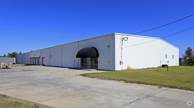
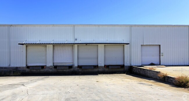
Gil Harbin Ind Blvd
0123D-013
East Industrial
Warehouse
LL 64 LD 11
X
Lowndes
13185C0220E
Georgia
2024
6.58 AC
2024
Valdosta/Lake Park
011402
Other Market Areas
36,000 SF
Valdosta, GA
DEMOGRAPHICS near Gil Harbin Ind Blvd
1 Mile
3 Mile
5 Mile
2024 Total Population
665
18,838
51,804
2029 Population
692
19,738
53,972
Pop Growth 2024-2029
+ 4.06%
+ 4.78%
+ 4.19%
Average Age
37
35
35
2024 Total Households
152
7,394
20,065
HH Growth 2024-2029
+ 5.92%
+ 5.09%
+ 4.40%
Median Household Inc
$39,642
$21,931
$29,028
Avg Household Size
2.40
2.40
2.40
2024 Avg HH Vehicles
2.00
1.00
2.00
Median Home Value
$129,545
$93,439
$134,918
Median Year Built
1980
1981
1983
Nearby Places
Map Layers
Map Styles
 Street
 Aerial
- Restaurants
- Banks
- Shops
- Fitness
- Groceries
PUBLIC TRANSPORTATION
AIRPORT
Valdosta Regional
DRIVE
WALK
Distance
Valdosta Regional
6 min
2.3 mi
SALE & LEASE HISTORY
LISTING DATE
SALE/LEASE

Sep 25, 2016
For Lease
Nearby Properties
Address
Land Use
TOTAL SIZE
Lot Size
Zoning
Address
Land Use
TOTAL SIZE
Lot Size
Zoning
1,200 SF
73.36 AC
M-2
Address
Land Use
TOTAL SIZE
Lot Size
Zoning
210,020 SF
4.22 AC
C-C
Address
Land Use
TOTAL SIZE
Lot Size
Zoning
1,686 SF
18.88 AC
R-M
Address
Land Use
TOTAL SIZE
Lot Size
Zoning
414,158 SF
40 AC
M-1
Address
Land Use
TOTAL SIZE
Lot Size
Zoning
150,802 SF
11.97 AC
M-1
Address
Land Use
TOTAL SIZE
Lot Size
Zoning
210,000 SF
81.43 AC
M-2
Address
Land Use
TOTAL SIZE
Lot Size
Zoning
203,741 SF
22.55 AC
C-H
Address
Land Use
TOTAL SIZE
Lot Size
Zoning
2,496 SF
63.73 AC
M-2
Address
Land Use
TOTAL SIZE
Lot Size
Zoning
104,544 SF
20.31 AC
R-M
Address
Land Use
TOTAL SIZE
Lot Size
Zoning
142,140 SF
24.29 AC
DR-10
Address
Land Use
TOTAL SIZE
Lot Size
Zoning
97,568 SF
3.63 AC
C-H
Address
Land Use
TOTAL SIZE
Lot Size
Zoning
101,774 SF
3.55 AC
C-H
Address
Land Use
TOTAL SIZE
Lot Size
Zoning
50,016 SF
3.79 AC
C-C
Address
Land Use
TOTAL SIZE
Lot Size
Zoning
120,400 SF
9.12 AC
M-1
Address
Land Use
TOTAL SIZE
Lot Size
Zoning
100,812 SF
6.43 AC
R-M
Address
Land Use
TOTAL SIZE
Lot Size
Zoning
76,250 SF
3.05 AC
C-H
Address
Land Use
TOTAL SIZE
Lot Size
Zoning
143,560 SF
M-1
Address
Land Use
TOTAL SIZE
Lot Size
Zoning
70,358 SF
8.41 AC
R-10
Address
Land Use
TOTAL SIZE
Lot Size
Zoning
114,460 SF
M-1
Address
Land Use
TOTAL SIZE
Lot Size
Zoning
50,340 SF
9.89 AC
C-H
Address
Land Use
TOTAL SIZE
Lot Size
Zoning
83,052 SF
6.81 AC
R-M
Address
Land Use
TOTAL SIZE
Lot Size
Zoning
140,398 SF
13.96 AC
C-H
Address
Land Use
TOTAL SIZE
Lot Size
Zoning
48,000 SF
9.06 AC
C-C
Address
Land Use
TOTAL SIZE
Lot Size
Zoning
72,832 SF
114.10 AC
M-1
Address
Land Use
TOTAL SIZE
Lot Size
Zoning
55,180 SF
2.46 AC
M-2
Address
Land Use
TOTAL SIZE
Lot Size
Zoning
3,284 SF
17.45 AC
R-M
Address
Land Use
TOTAL SIZE
Lot Size
Zoning
100,000 SF
25.27 AC
M-1
Address
Land Use
TOTAL SIZE
Lot Size
Zoning
69.02 AC
C-H
Address
Land Use
TOTAL SIZE
Lot Size
Zoning
57,408 SF
4.18 AC
C-C
The World's #1 Commercial Real Estate Marketplace
Connect with us
© 2026 CoStar Group
The information above has been obtained from sources believed reliable. While we do not doubt its accuracy we have not verified it and make no guarantee, warranty or representation about it. It is your responsibility to independently confirm its accuracy and completeness. Any projections, opinions, assumptions, or estimates used are for example only and do not represent the current or future performance of the property. The value of this transaction to you depends on tax and other factors which should be evaluated by your tax, financial, and legal advisors. You and your advisors should conduct a careful, independent investigation of the property to determine to your satisfaction the suitability of the property for your needs.