No Photo
Property Record
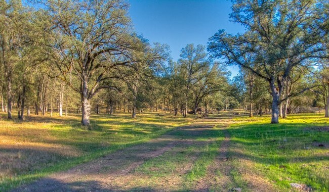
Gilbert Dr, Palo Cedro, CA 96073

NEARBY LISTINGS FOR SALE OR LEASE
-
-
View all Palo Cedro listings for sale on LoopNet.com
Property Detail
Gilbert Dr
059-060-020-000
Shasta
Agriculturalland
California
X
41.20 AC
06089C1590H
Redding/Chico
2024
Other Market Areas
2025
Redding, CA
011900
DEMOGRAPHICS near Gilbert Dr
1 Mile
3 Mile
5 Mile
2024 Total Population
1,063
5,027
25,671
2029 Population
1,029
4,844
25,371
Pop Growth 2024-2029
(3.20%)
(3.64%)
(1.17%)
Average Age
44
45
42
2024 Total Households
387
1,890
9,454
HH Growth 2024-2029
(3.10%)
(3.65%)
(1.20%)
Median Household Inc
$110,277
$93,098
$84,338
Avg Household Size
2.70
2.60
2.60
2024 Avg HH Vehicles
3.00
3.00
2.00
Median Home Value
$570,680
$490,677
$420,077
Median Year Built
1977
1980
1985
Nearby Places
Map Layers
Map Styles
 Street
 Aerial
- Restaurants
- Banks
- Shops
- Fitness
- Groceries
PUBLIC TRANSPORTATION
COMMUTER RAIL
Redding Amtrak (Coast Starlight - Amtrak)
DRIVE
WALK
Distance
Redding Amtrak (Coast Starlight - Amtrak)
14 min
9.5 mi
AIRPORT
Redding Regional
DRIVE
WALK
Distance
Redding Regional
13 min
7.8 mi
Freight Ports
Port of Richmond
DRIVE
WALK
Distance
Port of Richmond
236 min
205.8 mi
SALE & LEASE HISTORY
LISTING DATE
SALE/LEASE

Mar 29, 2017
For Sale
Nearby Properties
Address
Land Use
TOTAL SIZE
Lot Size
Zoning
Address
Land Use
TOTAL SIZE
Lot Size
Zoning
22,276 SF
5.32 AC
Address
Land Use
TOTAL SIZE
Lot Size
Zoning
89,471 SF
9.03 AC
Address
Land Use
TOTAL SIZE
Lot Size
Zoning
40.27 AC
R-R
Address
Land Use
TOTAL SIZE
Lot Size
Zoning
51,588 SF
11.86 AC
Address
Land Use
TOTAL SIZE
Lot Size
Zoning
17,214 SF
1.63 AC
Address
Land Use
TOTAL SIZE
Lot Size
Zoning
1,202 SF
1.92 AC
Address
Land Use
TOTAL SIZE
Lot Size
Zoning
3.35 AC
C-2
Address
Land Use
TOTAL SIZE
Lot Size
Zoning
39,716 SF
2.46 AC
Address
Land Use
TOTAL SIZE
Lot Size
Zoning
3,000 SF
1.25 AC
C-M
Address
Land Use
TOTAL SIZE
Lot Size
Zoning
5 AC
M-L
Address
Land Use
TOTAL SIZE
Lot Size
Zoning
12,400 SF
0.88 AC
Address
Land Use
TOTAL SIZE
Lot Size
Zoning
23,500 SF
2.39 AC
C-M
Address
Land Use
TOTAL SIZE
Lot Size
Zoning
10,600 SF
3.70 AC
Address
Land Use
TOTAL SIZE
Lot Size
Zoning
1 AC
C-2
Address
Land Use
TOTAL SIZE
Lot Size
Zoning
5.17 AC
M-L
Address
Land Use
TOTAL SIZE
Lot Size
Zoning
10.10 AC
R-R-BA-3
Address
Land Use
TOTAL SIZE
Lot Size
Zoning
11,088 SF
5 AC
M-L
Address
Land Use
TOTAL SIZE
Lot Size
Zoning
3,184 SF
1.10 AC
C-2
Address
Land Use
TOTAL SIZE
Lot Size
Zoning
12,250 SF
1.61 AC
Address
Land Use
TOTAL SIZE
Lot Size
Zoning
1.82 AC
Address
Land Use
TOTAL SIZE
Lot Size
Zoning
1.44 AC
C-M
Address
Land Use
TOTAL SIZE
Lot Size
Zoning
4,032 SF
15.16 AC
Address
Land Use
TOTAL SIZE
Lot Size
Zoning
2.02 AC
C-M
Address
Land Use
TOTAL SIZE
Lot Size
Zoning
9,800 SF
12.69 AC
M-L
Address
Land Use
TOTAL SIZE
Lot Size
Zoning
11,000 SF
0.82 AC
C-2
Address
Land Use
TOTAL SIZE
Lot Size
Zoning
5 AC
R-L
Address
Land Use
TOTAL SIZE
Lot Size
Zoning
4.05 AC
Address
Land Use
TOTAL SIZE
Lot Size
Zoning
1.96 AC
C-2
The World's #1 Commercial Real Estate Marketplace
Connect with us
© 2026 CoStar Group
The information above has been obtained from sources believed reliable. While we do not doubt its accuracy we have not verified it and make no guarantee, warranty or representation about it. It is your responsibility to independently confirm its accuracy and completeness. Any projections, opinions, assumptions, or estimates used are for example only and do not represent the current or future performance of the property. The value of this transaction to you depends on tax and other factors which should be evaluated by your tax, financial, and legal advisors. You and your advisors should conduct a careful, independent investigation of the property to determine to your satisfaction the suitability of the property for your needs.