Property Record
Gilbert St, Mansfield, MA 02048

Current Lease Availabilities
Property Detail
Gilbert St
Providence-Warwick, RI-MA
BRISTOL
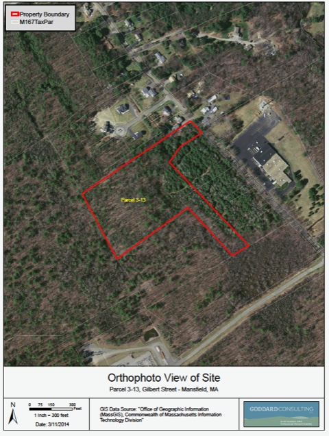
003 013
Massachusetts
Residentialacreage
13
B and X Area of moderate flood hazard, usually the area between the limits of the 100-year and 500-year floods.
10.26 AC
2025
Attleboro/New Bedford
2025
Boston
610100
NEARBY LISTINGS FOR SALE OR LEASE
DEMOGRAPHICS near Gilbert St
1 mile
3 mile
5 mile
2025 Total Population
3,745
28,852
104,022
2030 Population
3,853
29,542
106,284
Pop Growth 2025-2030
+ 2.88%
+ 2.39%
+ 2.17%
Average Age
41
42
41
2025 Total Households
1,269
10,490
40,968
HH Growth 2025-2030
+ 2.92%
+ 2.47%
+ 2.27%
Median Household Inc
$152,348
$139,593
$104,214
Avg Household Size
2.90
2.70
2.50
2025 Avg HH Vehicles
3.00
2.00
2.00
Median Home Value
$634,842
$609,862
$523,013
Median Year Built
1978
1978
1975
Nearby Places
Map Layers
Map Styles
 Street
 Aerial
Transit
 Traffic
 Biking
Places
Listings with unknown addresses are not visible on the map
- Restaurants
- Banks
- Shops
- Fitness
- Groceries
PUBLIC TRANSPORTATION
COMMUTER RAIL
Mansfield (Foxboro Line (Special Events Only) - Massachusetts Bay Transportation Authority Commuter Rail (Purple Line), Providence/Stoughton Line - Massachusetts Bay Transportation Authority Commuter Rail (Purple Line))
Drive
Walk
Distance
Mansfield (Foxboro Line (Special Events Only) - Massachusetts Bay Transportation Authority Commuter Rail (Purple Line), Providence/Stoughton Line - Massachusetts Bay Transportation Authority Commuter Rail (Purple Line))
12 min
5.1 mi
Attleboro (Foxboro Event Service - MBTA, Providence/Stoughton Line - MBTA)
Drive
Walk
Distance
Attleboro (Foxboro Event Service - MBTA, Providence/Stoughton Line - MBTA)
13 min
5.7 mi
AIRPORT
Rhode Island Tf Green International
Drive
Walk
Distance
Rhode Island Tf Green International
43 min
25.6 mi
General Edward Lawrence Logan International
Drive
Walk
Distance
General Edward Lawrence Logan International
56 min
37.9 mi
Freight Ports
Port of Davisville, RI
Drive
Walk
Distance
Port of Davisville, RI
60 min
38.0 mi
Nearby Properties
Address
Land Use
TOTAL SIZE
Lot Size
Zoning
Address
Land Use
TOTAL SIZE
Lot Size
Zoning
65.21 AC
Address
Land Use
TOTAL SIZE
Lot Size
Zoning
351,950 SF
31.45 AC
Address
Land Use
TOTAL SIZE
Lot Size
Zoning
5,022 SF
22.90 AC
RB
Address
Land Use
TOTAL SIZE
Lot Size
Zoning
25.68 AC
Address
Land Use
TOTAL SIZE
Lot Size
Zoning
Address
Land Use
TOTAL SIZE
Lot Size
Zoning
350,067 SF
20.20 AC
Address
Land Use
TOTAL SIZE
Lot Size
Zoning
442,756 SF
31.18 AC
Address
Land Use
TOTAL SIZE
Lot Size
Zoning
228,377 SF
24.19 AC
IND
Address
Land Use
TOTAL SIZE
Lot Size
Zoning
8,432 SF
46 AC
Address
Land Use
TOTAL SIZE
Lot Size
Zoning
33.31 AC
Address
Land Use
TOTAL SIZE
Lot Size
Zoning
205,400 SF
10 AC
Address
Land Use
TOTAL SIZE
Lot Size
Zoning
174,103 SF
12.40 AC
Address
Land Use
TOTAL SIZE
Lot Size
Zoning
24.50 AC
Address
Land Use
TOTAL SIZE
Lot Size
Zoning
230,394 SF
19.77 AC
Address
Land Use
TOTAL SIZE
Lot Size
Zoning
93,685 SF
8 AC
Address
Land Use
TOTAL SIZE
Lot Size
Zoning
105,166 SF
5.93 AC
Address
Land Use
TOTAL SIZE
Lot Size
Zoning
79,322 SF
12.54 AC
R15
Address
Land Use
TOTAL SIZE
Lot Size
Zoning
186,200 SF
20.27 AC
Address
Land Use
TOTAL SIZE
Lot Size
Zoning
16.82 AC
C60
Address
Land Use
TOTAL SIZE
Lot Size
Zoning
89,052 SF
17 AC
Address
Land Use
TOTAL SIZE
Lot Size
Zoning
124,840 SF
10.47 AC
Address
Land Use
TOTAL SIZE
Lot Size
Zoning
358.70 AC
Address
Land Use
TOTAL SIZE
Lot Size
Zoning
72,331 SF
22.50 AC
Address
Land Use
TOTAL SIZE
Lot Size
Zoning
164,823 SF
9.61 AC
Address
Land Use
TOTAL SIZE
Lot Size
Zoning
203,520 SF
13.50 AC
Address
Land Use
TOTAL SIZE
Lot Size
Zoning
201,232 SF
11.10 AC
Address
Land Use
TOTAL SIZE
Lot Size
Zoning
177,186 SF
20.46 AC
Address
Land Use
TOTAL SIZE
Lot Size
Zoning
6.30 AC
Address
Land Use
TOTAL SIZE
Lot Size
Zoning
80,286 SF
8.70 AC
Address
Land Use
TOTAL SIZE
Lot Size
Zoning
6.88 AC
CA
The World's #1 Commercial Real Estate Marketplace
Connect with us
© 2026 CoStar Group
The information above has been obtained from sources believed reliable. While we do not doubt its accuracy we have not verified it and make no guarantee, warranty or representation about it. It is your responsibility to independently confirm its accuracy and completeness. Any projections, opinions, assumptions, or estimates used are for example only and do not represent the current or future performance of the property. The value of this transaction to you depends on tax and other factors which should be evaluated by your tax, financial, and legal advisors. You and your advisors should conduct a careful, independent investigation of the property to determine to your satisfaction the suitability of the property for your needs.