Property Record
Glenns Bay Rd, Myrtle Beach, SC 29575

Property Detail
Glenns Bay Rd
45813030066
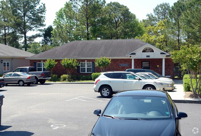
GLENNS BAY PROF PK HPR; BLDG A
Medicalbuilding
HORRY
B and X Area of moderate flood hazard, usually the area between the limits of the 100-year and 500-year floods.
South Carolina
2025
0.24 AC
2025
Outlying Horry County
051404
Myrtle Beach/Conway
1,954 SF
Myrtle Beach-Conway-North Myrtle Beach, SC
NEARBY LISTINGS FOR SALE OR LEASE
DEMOGRAPHICS near Glenns Bay Rd
1 mile
3 mile
5 mile
2025 Total Population
10,228
47,249
101,827
2030 Population
11,847
54,887
116,585
Pop Growth 2025-2030
+ 15.83%
+ 16.17%
+ 14.49%
Average Age
50
52
50
2025 Total Households
4,914
22,261
46,441
HH Growth 2025-2030
+ 15.81%
+ 16.28%
+ 14.54%
Median Household Inc
$70,690
$73,868
$73,862
Avg Household Size
2.00
2.10
2.10
2025 Avg HH Vehicles
2.00
2.00
2.00
Median Home Value
$295,042
$320,194
$327,042
Median Year Built
1992
1993
1999
Nearby Places
Map Layers
Map Styles
 Street
 Aerial
Layers
 Traffic
 Biking
Places
Listings with unknown addresses are not visible on the map
- Restaurants
- Banks
- Shops
- Fitness
- Groceries
PUBLIC TRANSPORTATION
AIRPORT
Myrtle Beach International
Drive
Walk
Distance
Myrtle Beach International
17 min
8.3 mi
Nearby Properties
Address
Land Use
TOTAL SIZE
Lot Size
Zoning
Address
Land Use
TOTAL SIZE
Lot Size
Zoning
17,640 SF
240.91 AC
Address
Land Use
TOTAL SIZE
Lot Size
Zoning
9,190 SF
85.15 AC
Address
Land Use
TOTAL SIZE
Lot Size
Zoning
9,772 SF
130.49 AC
Address
Land Use
TOTAL SIZE
Lot Size
Zoning
28,959 SF
31.56 AC
Address
Land Use
TOTAL SIZE
Lot Size
Zoning
496.81 AC
Address
Land Use
TOTAL SIZE
Lot Size
Zoning
7,144 SF
188.69 AC
Address
Land Use
TOTAL SIZE
Lot Size
Zoning
151,727 SF
20.92 AC
Address
Land Use
TOTAL SIZE
Lot Size
Zoning
8,540 SF
42.65 AC
Address
Land Use
TOTAL SIZE
Lot Size
Zoning
3,696 SF
55.20 AC
Address
Land Use
TOTAL SIZE
Lot Size
Zoning
636.81 AC
Address
Land Use
TOTAL SIZE
Lot Size
Zoning
39,275 SF
14.87 AC
Address
Land Use
TOTAL SIZE
Lot Size
Zoning
2,510 SF
43.14 AC
Address
Land Use
TOTAL SIZE
Lot Size
Zoning
194,035 SF
26.79 AC
Address
Land Use
TOTAL SIZE
Lot Size
Zoning
25,722 SF
13.73 AC
Address
Land Use
TOTAL SIZE
Lot Size
Zoning
92,277 SF
8.84 AC
Address
Land Use
TOTAL SIZE
Lot Size
Zoning
46.79 AC
Address
Land Use
TOTAL SIZE
Lot Size
Zoning
4,800 SF
75.54 AC
Address
Land Use
TOTAL SIZE
Lot Size
Zoning
57,216 SF
2.36 AC
Address
Land Use
TOTAL SIZE
Lot Size
Zoning
132,091 SF
14.03 AC
Address
Land Use
TOTAL SIZE
Lot Size
Zoning
65,578 SF
11.76 AC
Address
Land Use
TOTAL SIZE
Lot Size
Zoning
18,816 SF
10.17 AC
Address
Land Use
TOTAL SIZE
Lot Size
Zoning
25,083 SF
10.33 AC
Address
Land Use
TOTAL SIZE
Lot Size
Zoning
28,278 SF
50.53 AC
Address
Land Use
TOTAL SIZE
Lot Size
Zoning
42,768 SF
10.40 AC
Address
Land Use
TOTAL SIZE
Lot Size
Zoning
8,012 SF
7.40 AC
Address
Land Use
TOTAL SIZE
Lot Size
Zoning
74,389 SF
1.90 AC
The World's #1 Commercial Real Estate Marketplace
Connect with us
© 2026 CoStar Group
The information above has been obtained from sources believed reliable. While we do not doubt its accuracy we have not verified it and make no guarantee, warranty or representation about it. It is your responsibility to independently confirm its accuracy and completeness. Any projections, opinions, assumptions, or estimates used are for example only and do not represent the current or future performance of the property. The value of this transaction to you depends on tax and other factors which should be evaluated by your tax, financial, and legal advisors. You and your advisors should conduct a careful, independent investigation of the property to determine to your satisfaction the suitability of the property for your needs.