Property Record
Golden Ct, Hadley, MA 01035


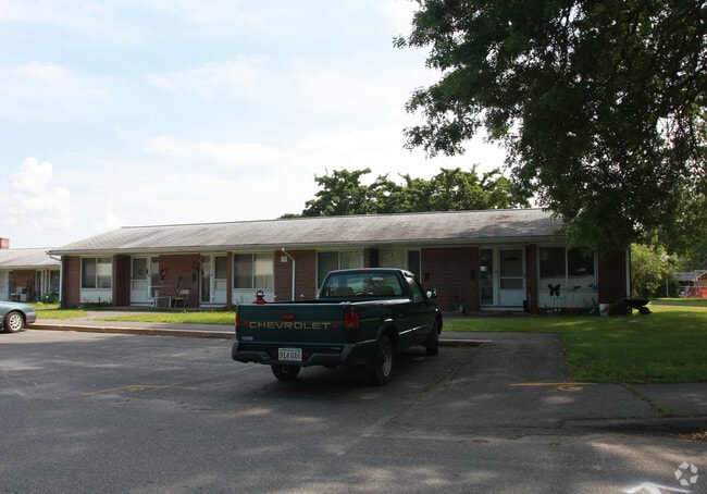
Property Detail
Golden Ct
HADL-000004I-000028
HAMPSHIRE
Governmentalpublicusegeneral
Massachusetts
B
8.70 AC
0
Amherst/East Hampshire County
2025
Hartford
821400
Amherst Town-Northampton, MA
1,680 SF
NEARBY LISTINGS FOR SALE OR LEASE
-
-
View all Hadley listings for sale on LoopNet.com
DEMOGRAPHICS near Golden Ct
1 mile
3 mile
5 mile
2025 Total Population
1,355
16,321
64,651
2030 Population
1,337
16,230
64,711
Pop Growth 2025-2030
(1.33%)
(0.56%)
+ 0.09%
Average Age
43
41
36
2025 Total Households
577
7,002
20,151
HH Growth 2025-2030
(1.39%)
(0.70%)
(0.07%)
Median Household Inc
$106,944
$85,017
$73,773
Avg Household Size
2.30
2.10
2.10
2025 Avg HH Vehicles
2.00
2.00
2.00
Median Home Value
$560,937
$457,636
$455,206
Median Year Built
1957
1958
1960
Nearby Places
Map Layers
Map Styles
 Street
 Aerial
Layers
 Traffic
 Biking
Places
Listings with unknown addresses are not visible on the map
- Restaurants
- Banks
- Shops
- Fitness
- Groceries
PUBLIC TRANSPORTATION
COMMUTER RAIL
Northampton (Valley Flyer - Amtrak, Vermonter - Amtrak)
Drive
Walk
Distance
Northampton (Valley Flyer - Amtrak, Vermonter - Amtrak)
9 min
3.4 mi
AIRPORT
Bradley International
Drive
Walk
Distance
Bradley International
58 min
32.8 mi
Freight Ports
Albany, NY Port
Drive
Walk
Distance
Albany, NY Port
118 min
94.8 mi
Nearby Properties
Address
Land Use
TOTAL SIZE
Lot Size
Zoning
Address
Land Use
TOTAL SIZE
Lot Size
Zoning
185,998 SF
32.09 AC
I
Address
Land Use
TOTAL SIZE
Lot Size
Zoning
9,424 SF
17.24 AC
AR
Address
Land Use
TOTAL SIZE
Lot Size
Zoning
18.04 AC
URB
Address
Land Use
TOTAL SIZE
Lot Size
Zoning
5.65 AC
URC
Address
Land Use
TOTAL SIZE
Lot Size
Zoning
141,603 SF
35.70 AC
B
Address
Land Use
TOTAL SIZE
Lot Size
Zoning
17.40 AC
SC
Address
Land Use
TOTAL SIZE
Lot Size
Zoning
84,480 SF
6.15 AC
I
Address
Land Use
TOTAL SIZE
Lot Size
Zoning
373,881 SF
46.52 AC
B
Address
Land Use
TOTAL SIZE
Lot Size
Zoning
61,650 SF
12.37 AC
B
Address
Land Use
TOTAL SIZE
Lot Size
Zoning
94,415 SF
3.83 AC
Address
Land Use
TOTAL SIZE
Lot Size
Zoning
12.23 AC
HB
Address
Land Use
TOTAL SIZE
Lot Size
Zoning
6,064 SF
19.39 AC
Address
Land Use
TOTAL SIZE
Lot Size
Zoning
7.58 AC
HB
Address
Land Use
TOTAL SIZE
Lot Size
Zoning
94,035 SF
4.20 AC
I
Address
Land Use
TOTAL SIZE
Lot Size
Zoning
10.37 AC
HB
Address
Land Use
TOTAL SIZE
Lot Size
Zoning
21.77 AC
GI
Address
Land Use
TOTAL SIZE
Lot Size
Zoning
127,994 SF
8.46 AC
B
Address
Land Use
TOTAL SIZE
Lot Size
Zoning
139,648 SF
13.09 AC
B
Address
Land Use
TOTAL SIZE
Lot Size
Zoning
359,938 SF
38.84 AC
I
Address
Land Use
TOTAL SIZE
Lot Size
Zoning
1.77 AC
URC
Address
Land Use
TOTAL SIZE
Lot Size
Zoning
88,144 SF
0.35 AC
CB
Address
Land Use
TOTAL SIZE
Lot Size
Zoning
115,090 SF
14.09 AC
B
Address
Land Use
TOTAL SIZE
Lot Size
Zoning
77,103 SF
11.45 AC
B
Address
Land Use
TOTAL SIZE
Lot Size
Zoning
98,482 SF
1.03 AC
CB
Address
Land Use
TOTAL SIZE
Lot Size
Zoning
59,471 SF
35 AC
LGT
Address
Land Use
TOTAL SIZE
Lot Size
Zoning
4.19 AC
HB
Address
Land Use
TOTAL SIZE
Lot Size
Zoning
80,161 SF
2.08 AC
URC
Address
Land Use
TOTAL SIZE
Lot Size
Zoning
162,055 SF
2.92 AC
CB
Address
Land Use
TOTAL SIZE
Lot Size
Zoning
15,130 SF
2.60 AC
B
Address
Land Use
TOTAL SIZE
Lot Size
Zoning
5.36 AC
HB
The World's #1 Commercial Real Estate Marketplace
Connect with us
© 2026 CoStar Group
The information above has been obtained from sources believed reliable. While we do not doubt its accuracy we have not verified it and make no guarantee, warranty or representation about it. It is your responsibility to independently confirm its accuracy and completeness. Any projections, opinions, assumptions, or estimates used are for example only and do not represent the current or future performance of the property. The value of this transaction to you depends on tax and other factors which should be evaluated by your tax, financial, and legal advisors. You and your advisors should conduct a careful, independent investigation of the property to determine to your satisfaction the suitability of the property for your needs.