Property Record
Goldston Carbonton Rd, Goldston, NC 27252


NEARBY LISTINGS FOR SALE OR LEASE
-
-
View all Goldston listings for sale on LoopNet.com
Property Detail
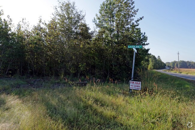
Goldston Carbonton Rd
Durham-Chapel Hill, NC
South West Gulf
9342
G10-98 AC 151.98
Vacantlandnec
Chatham
AE
North Carolina
3710960500L
151.98 AC
2025
Chatham County
2025
Raleigh/Durham
020600
DEMOGRAPHICS near Goldston Carbonton Rd
1 Mile
3 Mile
5 Mile
2024 Total Population
32
749
2,763
2029 Population
36
820
3,035
Pop Growth 2024-2029
+ 12.50%
+ 9.48%
+ 9.84%
Average Age
45
44
44
2024 Total Households
14
316
1,155
HH Growth 2024-2029
+ 7.14%
+ 9.49%
+ 9.96%
Median Household Inc
$33,749
$46,000
$52,723
Avg Household Size
2.40
2.40
2.40
2024 Avg HH Vehicles
2.00
2.00
2.00
Median Home Value
$125,000
$151,190
$151,328
Median Year Built
1967
1976
1980
Nearby Places
Map Layers
Map Styles
 Street
 Aerial
- Restaurants
- Banks
- Shops
- Fitness
- Groceries
SALE & LEASE HISTORY
LISTING DATE
SALE/LEASE

Jan 11, 2019
For Sale
Nearby Properties
Address
Land Use
TOTAL SIZE
Lot Size
Zoning
Address
Land Use
TOTAL SIZE
Lot Size
Zoning
204,932 SF
13.48 AC
IL
Address
Land Use
TOTAL SIZE
Lot Size
Zoning
305,591 SF
115.49 AC
IND-H
Address
Land Use
TOTAL SIZE
Lot Size
Zoning
220.11 AC
R-1
Address
Land Use
TOTAL SIZE
Lot Size
Zoning
450.03 AC
RESIDENTIA
Address
Land Use
TOTAL SIZE
Lot Size
Zoning
38,100 SF
25.56 AC
IL
Address
Land Use
TOTAL SIZE
Lot Size
Zoning
648.57 AC
RA
Address
Land Use
TOTAL SIZE
Lot Size
Zoning
3,095 SF
228.91 AC
RESIDENTIA
Address
Land Use
TOTAL SIZE
Lot Size
Zoning
10,060 SF
7.12 AC
R-5
Address
Land Use
TOTAL SIZE
Lot Size
Zoning
1,004 SF
205.64 AC
RESIDENTIA
Address
Land Use
TOTAL SIZE
Lot Size
Zoning
49.97 AC
RESIDENTIA
Address
Land Use
TOTAL SIZE
Lot Size
Zoning
1,660 SF
183.60 AC
RESIDENTIA
Address
Land Use
TOTAL SIZE
Lot Size
Zoning
812 SF
20.55 AC
IL
Address
Land Use
TOTAL SIZE
Lot Size
Zoning
14,400 SF
14.55 AC
IND-H
Address
Land Use
TOTAL SIZE
Lot Size
Zoning
51.97 AC
RESIDENTIA
Address
Land Use
TOTAL SIZE
Lot Size
Zoning
7,672 SF
4 AC
O&I
Address
Land Use
TOTAL SIZE
Lot Size
Zoning
7,460 SF
5.75 AC
R-1
Address
Land Use
TOTAL SIZE
Lot Size
Zoning
1,440 SF
12.86 AC
O&I
Address
Land Use
TOTAL SIZE
Lot Size
Zoning
4,630 SF
2.80 AC
R-1
Address
Land Use
TOTAL SIZE
Lot Size
Zoning
5,228 SF
1.48 AC
C-1
Address
Land Use
TOTAL SIZE
Lot Size
Zoning
3,068 SF
324 AC
R-5
Address
Land Use
TOTAL SIZE
Lot Size
Zoning
125.73 AC
RESIDENTIA
Address
Land Use
TOTAL SIZE
Lot Size
Zoning
2,925 SF
9.58 AC
RESIDENTIA
Address
Land Use
TOTAL SIZE
Lot Size
Zoning
93.27 AC
RESIDENTIA
Address
Land Use
TOTAL SIZE
Lot Size
Zoning
1,136 SF
77.18 AC
RESIDENTIA
Address
Land Use
TOTAL SIZE
Lot Size
Zoning
60.45 AC
RESIDENTIA
Address
Land Use
TOTAL SIZE
Lot Size
Zoning
64.48 AC
RESIDENTIA
Address
Land Use
TOTAL SIZE
Lot Size
Zoning
2,478 SF
51.18 AC
RESIDENTIA
Address
Land Use
TOTAL SIZE
Lot Size
Zoning
98.66 AC
IND-H
Address
Land Use
TOTAL SIZE
Lot Size
Zoning
65.37 AC
RESIDENTIA
Address
Land Use
TOTAL SIZE
Lot Size
Zoning
3,000 SF
2 AC
B-1
The World's #1 Commercial Real Estate Marketplace
Connect with us
© 2026 CoStar Group
The information above has been obtained from sources believed reliable. While we do not doubt its accuracy we have not verified it and make no guarantee, warranty or representation about it. It is your responsibility to independently confirm its accuracy and completeness. Any projections, opinions, assumptions, or estimates used are for example only and do not represent the current or future performance of the property. The value of this transaction to you depends on tax and other factors which should be evaluated by your tax, financial, and legal advisors. You and your advisors should conduct a careful, independent investigation of the property to determine to your satisfaction the suitability of the property for your needs.