Property Record
Graham Rd, Franklin, OH 45005

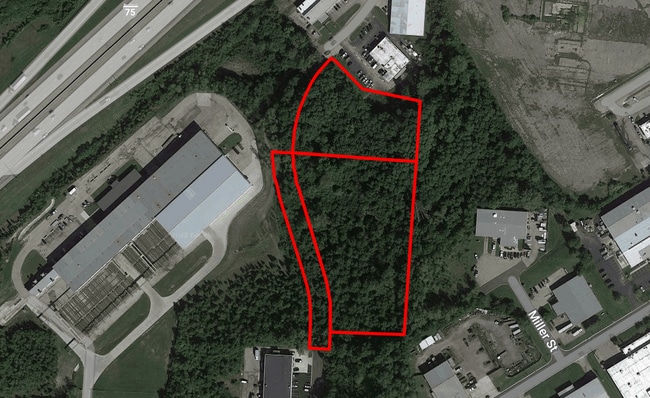
This Property Is For Sale
Property Detail
Graham Rd
Cincinnati, OH-KY-IN
GRAHAM
08-36-200-033
WARREN
Commercialacreage
Ohio
B and X Area of moderate flood hazard, usually the area between the limits of the 100-year and 500-year floods.
3.43 AC
2024
Outlying Warren County
2025
Cincinnati/Dayton
030600
NEARBY LISTINGS FOR SALE OR LEASE
DEMOGRAPHICS near Graham Rd
1 mile
3 mile
5 mile
2025 Total Population
2,052
25,646
88,080
2030 Population
2,145
26,776
91,481
Pop Growth 2025-2030
+ 4.53%
+ 4.41%
+ 3.86%
Average Age
42
42
41
2025 Total Households
796
10,435
35,373
HH Growth 2025-2030
+ 4.65%
+ 4.43%
+ 3.89%
Median Household Inc
$100,074
$71,028
$71,462
Avg Household Size
2.50
2.40
2.40
2025 Avg HH Vehicles
2.00
2.00
2.00
Median Home Value
$253,985
$228,451
$236,562
Median Year Built
1994
1973
1975
Nearby Places
Map Layers
Map Styles
 Street
 Aerial
Transit
 Traffic
 Biking
Places
Listings with unknown addresses are not visible on the map
- Restaurants
- Banks
- Shops
- Fitness
- Groceries
PUBLIC TRANSPORTATION
AIRPORT
James M Cox Dayton International
Drive
Walk
Distance
James M Cox Dayton International
41 min
30.2 mi
Freight Ports
Port of Toledo
Drive
Walk
Distance
Port of Toledo
198 min
170.4 mi
Nearby Properties
Address
Land Use
TOTAL SIZE
Lot Size
Zoning
Address
Land Use
TOTAL SIZE
Lot Size
Zoning
160,701 SF
10.83 AC
Address
Land Use
TOTAL SIZE
Lot Size
Zoning
39.51 AC
Address
Land Use
TOTAL SIZE
Lot Size
Zoning
5,000 SF
60.29 AC
Address
Land Use
TOTAL SIZE
Lot Size
Zoning
2,908 SF
16.01 AC
Address
Land Use
TOTAL SIZE
Lot Size
Zoning
33,671 SF
8.49 AC
Address
Land Use
TOTAL SIZE
Lot Size
Zoning
6,048 SF
51.16 AC
Address
Land Use
TOTAL SIZE
Lot Size
Zoning
36,570 SF
20.29 AC
Address
Land Use
TOTAL SIZE
Lot Size
Zoning
27,780 SF
61.49 AC
Address
Land Use
TOTAL SIZE
Lot Size
Zoning
15,228 SF
37.19 AC
R1
Address
Land Use
TOTAL SIZE
Lot Size
Zoning
139,382 SF
40.01 AC
Address
Land Use
TOTAL SIZE
Lot Size
Zoning
11,260 SF
6.32 AC
Address
Land Use
TOTAL SIZE
Lot Size
Zoning
17.47 AC
Address
Land Use
TOTAL SIZE
Lot Size
Zoning
48,378 SF
63.28 AC
Address
Land Use
TOTAL SIZE
Lot Size
Zoning
11,847 SF
5.96 AC
Address
Land Use
TOTAL SIZE
Lot Size
Zoning
32,550 SF
26.11 AC
Address
Land Use
TOTAL SIZE
Lot Size
Zoning
487,924 SF
22.33 AC
Address
Land Use
TOTAL SIZE
Lot Size
Zoning
217,679 SF
25.16 AC
Address
Land Use
TOTAL SIZE
Lot Size
Zoning
868 SF
36.06 AC
Address
Land Use
TOTAL SIZE
Lot Size
Zoning
13.19 AC
Address
Land Use
TOTAL SIZE
Lot Size
Zoning
12,480 SF
14.98 AC
Address
Land Use
TOTAL SIZE
Lot Size
Zoning
147,116 SF
12.07 AC
Address
Land Use
TOTAL SIZE
Lot Size
Zoning
14.36 AC
Address
Land Use
TOTAL SIZE
Lot Size
Zoning
59,038 SF
10 AC
Address
Land Use
TOTAL SIZE
Lot Size
Zoning
19,622 SF
2.94 AC
Address
Land Use
TOTAL SIZE
Lot Size
Zoning
15,530 SF
4.50 AC
Address
Land Use
TOTAL SIZE
Lot Size
Zoning
37.26 AC
Address
Land Use
TOTAL SIZE
Lot Size
Zoning
29,500 SF
10 AC
Address
Land Use
TOTAL SIZE
Lot Size
Zoning
66,339 SF
11.52 AC
Address
Land Use
TOTAL SIZE
Lot Size
Zoning
33,324 SF
9.65 AC
Address
Land Use
TOTAL SIZE
Lot Size
Zoning
102,302 SF
6.63 AC
The World's #1 Commercial Real Estate Marketplace
Connect with us
© 2026 CoStar Group
The information above has been obtained from sources believed reliable. While we do not doubt its accuracy we have not verified it and make no guarantee, warranty or representation about it. It is your responsibility to independently confirm its accuracy and completeness. Any projections, opinions, assumptions, or estimates used are for example only and do not represent the current or future performance of the property. The value of this transaction to you depends on tax and other factors which should be evaluated by your tax, financial, and legal advisors. You and your advisors should conduct a careful, independent investigation of the property to determine to your satisfaction the suitability of the property for your needs.