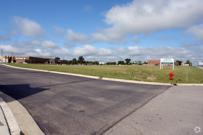
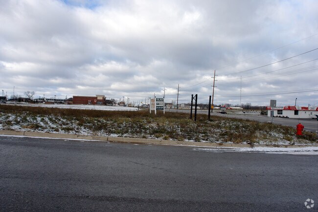
Property Record
1415 Lawson Dr, Howell, MI 48843


NEARBY LISTINGS FOR SALE OR LEASE
Property Detail
1415 Lawson Dr
11-09-200-028
SEC 9 T2N R5E COMM AT N 1/4 COR TH S01*30'57"E 921.86 FT TH S63*53'30"E 725.82 FT TH S64*41'00"E 378.41 FT TO POB TH
Commercialacreage
Livingston
X
Michigan
26093C0330D
1.54 AC
2024
Livingston County
2024
Detroit
742403
Detroit-Warren-Dearborn, MI
DEMOGRAPHICS near 1415 Lawson Dr
1 mile
3 mile
5 mile
2024 Total Population
2,950
16,598
52,423
2029 Population
3,034
17,104
53,929
Pop Growth 2024-2029
+ 2.85%
+ 3.05%
+ 2.87%
Average Age
44
43
43
2024 Total Households
1,343
6,733
21,027
HH Growth 2024-2029
+ 2.76%
+ 3.03%
+ 2.89%
Median Household Inc
$80,255
$90,634
$89,571
Avg Household Size
2.20
2.40
2.50
2024 Avg HH Vehicles
2.00
2.00
2.00
Median Home Value
$314,639
$313,559
$315,775
Median Year Built
1994
1995
1992
Nearby Places
Map Layers
Map Styles
 Street
 Aerial
Transit
 Traffic
 Biking
Places
Listings with unknown addresses are not visible on the map
- Restaurants
- Banks
- Shops
- Fitness
- Groceries
PUBLIC TRANSPORTATION
AIRPORT
Bishop International
Drive
Walk
Distance
Bishop International
54 min
41.0 mi
Freight Ports
Port of Toledo
Drive
Walk
Distance
Port of Toledo
102 min
84.2 mi
SALE & LEASE HISTORY
LISTING DATE
SALE/LEASE

Sep 24, 2016
For Sale
Nearby Properties
Address
Land Use
TOTAL SIZE
Lot Size
Zoning
Address
Land Use
TOTAL SIZE
Lot Size
Zoning
1,296 SF
19.42 AC
MUPUD
Address
Land Use
TOTAL SIZE
Lot Size
Zoning
93,620 SF
17.47 AC
MUPUD
Address
Land Use
TOTAL SIZE
Lot Size
Zoning
199,635 SF
19.85 AC
RPUD
Address
Land Use
TOTAL SIZE
Lot Size
Zoning
210,003 SF
29.17 AC
MUPUD
Address
Land Use
TOTAL SIZE
Lot Size
Zoning
161,366 SF
18.67 AC
HDR
Address
Land Use
TOTAL SIZE
Lot Size
Zoning
165,868 SF
27.80 AC
HDR
Address
Land Use
TOTAL SIZE
Lot Size
Zoning
60,900 SF
5.74 AC
NRPUD
Address
Land Use
TOTAL SIZE
Lot Size
Zoning
166,550 SF
20 AC
IND
Address
Land Use
TOTAL SIZE
Lot Size
Zoning
53,494 SF
10 AC
MUPUD
Address
Land Use
TOTAL SIZE
Lot Size
Zoning
220,091 SF
21.88 AC
NRPUD
Address
Land Use
TOTAL SIZE
Lot Size
Zoning
134,688 SF
14.97 AC
NRPUD
Address
Land Use
TOTAL SIZE
Lot Size
Zoning
5,947 SF
104.68 AC
MHP
Address
Land Use
TOTAL SIZE
Lot Size
Zoning
96,896 SF
12.11 AC
HDR
Address
Land Use
TOTAL SIZE
Lot Size
Zoning
91,380 SF
11.55 AC
HDR
Address
Land Use
TOTAL SIZE
Lot Size
Zoning
51.99 AC
MHP
Address
Land Use
TOTAL SIZE
Lot Size
Zoning
121,265 SF
15.10 AC
RCD
Address
Land Use
TOTAL SIZE
Lot Size
Zoning
65,560 SF
2.56 AC
NRPUD
Address
Land Use
TOTAL SIZE
Lot Size
Zoning
73,296 SF
7 AC
HDR
Address
Land Use
TOTAL SIZE
Lot Size
Zoning
116,885 SF
13.78 AC
RCD
Address
Land Use
TOTAL SIZE
Lot Size
Zoning
39,778 SF
10 AC
NSD
Address
Land Use
TOTAL SIZE
Lot Size
Zoning
66,582 SF
7.10 AC
PID
Address
Land Use
TOTAL SIZE
Lot Size
Zoning
88,520 SF
9.45 AC
NRPUD
Address
Land Use
TOTAL SIZE
Lot Size
Zoning
69,866 SF
9.21 AC
GCD
Address
Land Use
TOTAL SIZE
Lot Size
Zoning
56,960 SF
11.27 AC
GCD
Address
Land Use
TOTAL SIZE
Lot Size
Zoning
69,900 SF
9.50 AC
PID
Address
Land Use
TOTAL SIZE
Lot Size
Zoning
44,100 SF
5.24 AC
MUPUD
Address
Land Use
TOTAL SIZE
Lot Size
Zoning
3,685 SF
39.97 AC
SR
Address
Land Use
TOTAL SIZE
Lot Size
Zoning
58,111 SF
6.21 AC
IND
Address
Land Use
TOTAL SIZE
Lot Size
Zoning
4,032 SF
22.33 AC
PRF
Address
Land Use
TOTAL SIZE
Lot Size
Zoning
63,071 SF
10 AC
IND
The World's #1 Commercial Real Estate Marketplace
Connect with us
© 2026 CoStar Group
The information above has been obtained from sources believed reliable. While we do not doubt its accuracy we have not verified it and make no guarantee, warranty or representation about it. It is your responsibility to independently confirm its accuracy and completeness. Any projections, opinions, assumptions, or estimates used are for example only and do not represent the current or future performance of the property. The value of this transaction to you depends on tax and other factors which should be evaluated by your tax, financial, and legal advisors. You and your advisors should conduct a careful, independent investigation of the property to determine to your satisfaction the suitability of the property for your needs.