Property Record
Grange Rd, Washington, IL 61571

Property Detail
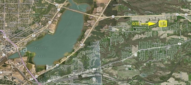
Grange Rd
Peoria, IL
SEC 18 T26N R3W E 85 ACRES OF LOT 1 (EXC TRACT A; ALSO EXC WINDSONG ESTATES) SE 1/4 39.48 AC
02-02-18-400-005
TAZEWELL
Agriculturalland
Illinois
B and X Area of moderate flood hazard, usually the area between the limits of the 100-year and 500-year floods.
1
2023
39.48 AC
2024
Outlying Tazewell County
022200
Peoria
NEARBY LISTINGS FOR SALE OR LEASE
DEMOGRAPHICS near Grange Rd
1 mile
3 mile
5 mile
2025 Total Population
2,141
20,606
55,109
2030 Population
2,172
20,567
55,049
Pop Growth 2025-2030
+ 1.45%
(0.19%)
(0.11%)
Average Age
41
41
41
2025 Total Households
842
8,344
21,983
HH Growth 2025-2030
+ 1.43%
(0.19%)
(0.15%)
Median Household Inc
$86,132
$80,477
$76,769
Avg Household Size
2.50
2.40
2.40
2025 Avg HH Vehicles
2.00
2.00
2.00
Median Home Value
$190,450
$182,836
$183,356
Median Year Built
1991
1977
1970
Nearby Places
Map Layers
Map Styles
 Street
 Aerial
Layers
 Traffic
 Biking
Places
Listings with unknown addresses are not visible on the map
- Restaurants
- Banks
- Shops
- Fitness
- Groceries
PUBLIC TRANSPORTATION
AIRPORT
General Downing - Peoria International
Drive
Walk
Distance
General Downing - Peoria International
25 min
14.1 mi
Freight Ports
Port Milwaukee
Drive
Walk
Distance
Port Milwaukee
260 min
224.2 mi
SALE & LEASE HISTORY
LISTING DATE
SALE/LEASE

Sep 24, 2016
For Sale
Nearby Properties
Address
Land Use
TOTAL SIZE
Lot Size
Zoning
Address
Land Use
TOTAL SIZE
Lot Size
Zoning
322,258 SF
1,319.75 AC
Address
Land Use
TOTAL SIZE
Lot Size
Zoning
185,656 SF
33.63 AC
Address
Land Use
TOTAL SIZE
Lot Size
Zoning
24,780 SF
1.62 AC
Address
Land Use
TOTAL SIZE
Lot Size
Zoning
80,102 SF
2 AC
Address
Land Use
TOTAL SIZE
Lot Size
Zoning
69,113 SF
9.83 AC
Address
Land Use
TOTAL SIZE
Lot Size
Zoning
283,737 SF
23.37 AC
Address
Land Use
TOTAL SIZE
Lot Size
Zoning
165,485 SF
15.75 AC
Address
Land Use
TOTAL SIZE
Lot Size
Zoning
133,070 SF
11.11 AC
Address
Land Use
TOTAL SIZE
Lot Size
Zoning
74,620 SF
6.54 AC
Address
Land Use
TOTAL SIZE
Lot Size
Zoning
35,716 SF
4 AC
Address
Land Use
TOTAL SIZE
Lot Size
Zoning
114,680 SF
7.34 AC
Address
Land Use
TOTAL SIZE
Lot Size
Zoning
66,584 SF
15.23 AC
Address
Land Use
TOTAL SIZE
Lot Size
Zoning
24,800 SF
3.20 AC
Address
Land Use
TOTAL SIZE
Lot Size
Zoning
40,040 SF
83.34 AC
Address
Land Use
TOTAL SIZE
Lot Size
Zoning
42,640 SF
4.48 AC
Address
Land Use
TOTAL SIZE
Lot Size
Zoning
81,674 SF
9.88 AC
Address
Land Use
TOTAL SIZE
Lot Size
Zoning
20,316 SF
3.52 AC
Address
Land Use
TOTAL SIZE
Lot Size
Zoning
24,800 SF
2.92 AC
Address
Land Use
TOTAL SIZE
Lot Size
Zoning
41,606 SF
6.96 AC
Address
Land Use
TOTAL SIZE
Lot Size
Zoning
101,625 SF
10.62 AC
Address
Land Use
TOTAL SIZE
Lot Size
Zoning
96,800 SF
6.64 AC
Address
Land Use
TOTAL SIZE
Lot Size
Zoning
16,371 SF
2.53 AC
Address
Land Use
TOTAL SIZE
Lot Size
Zoning
36,214 SF
3.68 AC
Address
Land Use
TOTAL SIZE
Lot Size
Zoning
28,646 SF
2.89 AC
Address
Land Use
TOTAL SIZE
Lot Size
Zoning
47,600 SF
2.32 AC
Address
Land Use
TOTAL SIZE
Lot Size
Zoning
20,000 SF
3 AC
Address
Land Use
TOTAL SIZE
Lot Size
Zoning
49,000 SF
4.12 AC
Address
Land Use
TOTAL SIZE
Lot Size
Zoning
14,000 SF
1.37 AC
Address
Land Use
TOTAL SIZE
Lot Size
Zoning
50,840 SF
9.67 AC
Address
Land Use
TOTAL SIZE
Lot Size
Zoning
107,010 SF
1.72 AC
The World's #1 Commercial Real Estate Marketplace
Connect with us
© 2026 CoStar Group
The information above has been obtained from sources believed reliable. While we do not doubt its accuracy we have not verified it and make no guarantee, warranty or representation about it. It is your responsibility to independently confirm its accuracy and completeness. Any projections, opinions, assumptions, or estimates used are for example only and do not represent the current or future performance of the property. The value of this transaction to you depends on tax and other factors which should be evaluated by your tax, financial, and legal advisors. You and your advisors should conduct a careful, independent investigation of the property to determine to your satisfaction the suitability of the property for your needs.