Property Record
Grant Line Rd, Elk Grove, CA 95624
NEARBY LISTINGS FOR SALE OR LEASE
Property Detail
Grant Line Rd
Sacramento-Roseville-Folsom, CA
Daylor
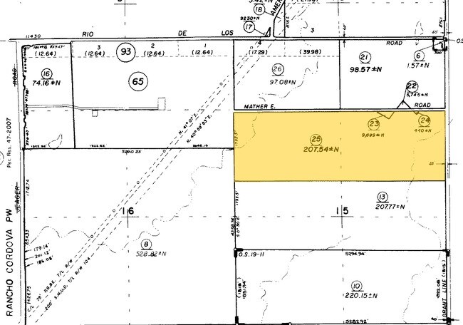
134-0120-002
36FT WESTERLY OF RESULTANT PARCEL B PER LL20040923-1502 AND AS PER PARCEL 04-23-04-A OF GD 20071228-770.
Vineyard
Sacramento
AE
California
06067C0339H
485 AC
0
Outer Sacramento County
2025
Sacramento
009307
DEMOGRAPHICS near Grant Line Rd
1 mile
3 mile
5 mile
2024 Total Population
3,244
17,158
26,503
2029 Population
3,281
17,469
26,911
Pop Growth 2024-2029
+ 1.14%
+ 1.81%
+ 1.54%
Average Age
37
36
37
2024 Total Households
1,082
5,033
8,052
HH Growth 2024-2029
+ 1.02%
+ 1.77%
+ 1.49%
Median Household Inc
$151,157
$154,392
$140,833
Avg Household Size
3.00
3.30
3.20
2024 Avg HH Vehicles
2.00
2.00
2.00
Median Home Value
$569,231
$587,701
$573,105
Median Year Built
2011
2010
2008
Nearby Places
Map Layers
Map Styles
 Street
 Aerial
Transit
 Traffic
 Biking
Places
Listings with unknown addresses are not visible on the map
- Restaurants
- Banks
- Shops
- Fitness
- Groceries
PUBLIC TRANSPORTATION
AIRPORT
Sacramento International
Drive
Walk
Distance
Sacramento International
44 min
29.9 mi
Freight Ports
Port of Stockton
Drive
Walk
Distance
Port of Stockton
51 min
38.9 mi
Nearby Properties
Address
Land Use
TOTAL SIZE
Lot Size
Zoning
Address
Land Use
TOTAL SIZE
Lot Size
Zoning
43.54 AC
LI
Address
Land Use
TOTAL SIZE
Lot Size
Zoning
221,556 SF
20.10 AC
HI
Address
Land Use
TOTAL SIZE
Lot Size
Zoning
64,579 SF
5.41 AC
LRSPA
Address
Land Use
TOTAL SIZE
Lot Size
Zoning
111,489 SF
4.96 AC
MP
Address
Land Use
TOTAL SIZE
Lot Size
Zoning
102,526 SF
4.06 AC
MP
Address
Land Use
TOTAL SIZE
Lot Size
Zoning
100 SF
50.85 AC
LRSPA
Address
Land Use
TOTAL SIZE
Lot Size
Zoning
5.38 AC
SC
Address
Land Use
TOTAL SIZE
Lot Size
Zoning
21.18 AC
HI
Address
Land Use
TOTAL SIZE
Lot Size
Zoning
1.99 AC
GC
Address
Land Use
TOTAL SIZE
Lot Size
Zoning
13.28 AC
LRSPA
Address
Land Use
TOTAL SIZE
Lot Size
Zoning
150,210 SF
6.25 AC
LI
Address
Land Use
TOTAL SIZE
Lot Size
Zoning
1,595 SF
4.01 AC
RD-25
Address
Land Use
TOTAL SIZE
Lot Size
Zoning
54,977 SF
3.94 AC
LI
Address
Land Use
TOTAL SIZE
Lot Size
Zoning
62,963 SF
4.94 AC
LC
Address
Land Use
TOTAL SIZE
Lot Size
Zoning
7,704 SF
17.01 AC
HI
Address
Land Use
TOTAL SIZE
Lot Size
Zoning
137,500 SF
7.44 AC
LI
Address
Land Use
TOTAL SIZE
Lot Size
Zoning
42,426 SF
4.20 AC
LI
Address
Land Use
TOTAL SIZE
Lot Size
Zoning
25,590 SF
2.37 AC
LC
Address
Land Use
TOTAL SIZE
Lot Size
Zoning
37,550 SF
4.38 AC
HI
Address
Land Use
TOTAL SIZE
Lot Size
Zoning
370.02 AC
AG-80
Address
Land Use
TOTAL SIZE
Lot Size
Zoning
69,000 SF
24.48 AC
HI
Address
Land Use
TOTAL SIZE
Lot Size
Zoning
3,349 SF
359.60 AC
AG-80
Address
Land Use
TOTAL SIZE
Lot Size
Zoning
18,057 SF
1.66 AC
SPA-OT
Address
Land Use
TOTAL SIZE
Lot Size
Zoning
2.03 AC
SC
Address
Land Use
TOTAL SIZE
Lot Size
Zoning
9.42 AC
SPATRI
Address
Land Use
TOTAL SIZE
Lot Size
Zoning
7.42 AC
SC
Address
Land Use
TOTAL SIZE
Lot Size
Zoning
0.88 AC
GC
Address
Land Use
TOTAL SIZE
Lot Size
Zoning
33,153 SF
7.65 AC
LI
Address
Land Use
TOTAL SIZE
Lot Size
Zoning
24.46 AC
HI
The World's #1 Commercial Real Estate Marketplace
Connect with us
© 2026 CoStar Group
The information above has been obtained from sources believed reliable. While we do not doubt its accuracy we have not verified it and make no guarantee, warranty or representation about it. It is your responsibility to independently confirm its accuracy and completeness. Any projections, opinions, assumptions, or estimates used are for example only and do not represent the current or future performance of the property. The value of this transaction to you depends on tax and other factors which should be evaluated by your tax, financial, and legal advisors. You and your advisors should conduct a careful, independent investigation of the property to determine to your satisfaction the suitability of the property for your needs.