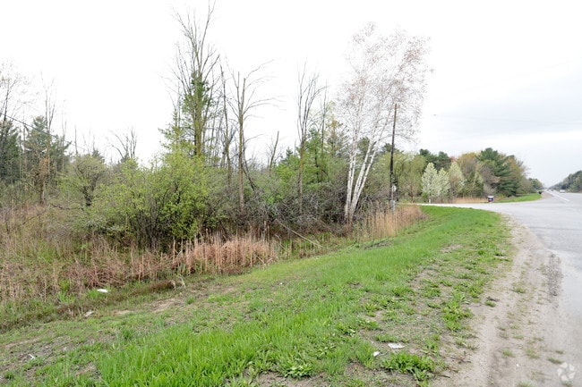
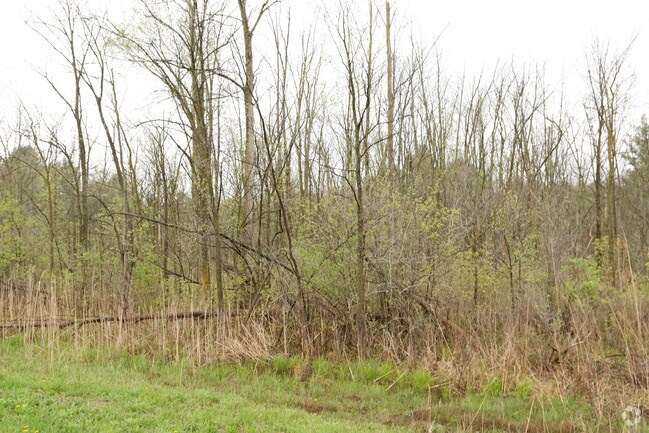
Property Record
Gratiot Rd, Saint Clair, MI 48079

Property Detail
Gratiot Rd
30-002-4009-000
BEG N 00D 00M 00S E 484' FROM THE SW SEC COR, TH N 00D 00M 00S E 550.97', TH N 61D 21M 42S E 436.50', TH S 20D 59M 02S E 812.39', TH S 89D 51M 31S W 674.02' TO BEG SECTION 2 T5N R16E 8.30A
Commercialacreage
ST. CLAIR
I-1
Michigan
B and X Area of moderate flood hazard, usually the area between the limits of the 100-year and 500-year floods.
8.31 AC
2025
St Clair & Lapeer Counties
2025
Detroit
640200
Detroit-Warren-Dearborn, MI
NEARBY LISTINGS FOR SALE OR LEASE
-
-
View all Saint Clair listings for sale on LoopNet.com
DEMOGRAPHICS near Gratiot Rd
1 mile
3 mile
5 mile
2024 Total Population
440
7,190
27,034
2029 Population
435
7,137
27,043
Pop Growth 2024-2029
(1.14%)
(0.74%)
+ 0.03%
Average Age
44
43
43
2024 Total Households
189
2,923
10,823
HH Growth 2024-2029
(1.06%)
(0.82%)
(0.05%)
Median Household Inc
$65,250
$77,608
$72,054
Avg Household Size
2.30
2.40
2.40
2024 Avg HH Vehicles
2.00
2.00
2.00
Median Home Value
$266,666
$228,472
$232,064
Median Year Built
1975
1976
1982
Nearby Places
Map Layers
Map Styles
 Street
 Aerial
Transit
 Traffic
 Biking
Places
Listings with unknown addresses are not visible on the map
- Restaurants
- Banks
- Shops
- Fitness
- Groceries
PUBLIC TRANSPORTATION
COMMUTER RAIL
Port Huron Amtrak Station (Blue Water - Amtrak)
Drive
Walk
Distance
Port Huron Amtrak Station (Blue Water - Amtrak)
14 min
7.4 mi
Freight Ports
Port of Toledo
Drive
Walk
Distance
Port of Toledo
137 min
111.9 mi
SALE & LEASE HISTORY
LISTING DATE
SALE/LEASE

May 04, 2017
For Sale
Nearby Properties
Address
Land Use
TOTAL SIZE
Lot Size
Zoning
Address
Land Use
TOTAL SIZE
Lot Size
Zoning
682,515 SF
211.45 AC
M-2
Address
Land Use
TOTAL SIZE
Lot Size
Zoning
79,276 SF
316.65 AC
M-1
Address
Land Use
TOTAL SIZE
Lot Size
Zoning
98,904 SF
29.48 AC
R1-A
Address
Land Use
TOTAL SIZE
Lot Size
Zoning
79,276 SF
311.74 AC
M-1
Address
Land Use
TOTAL SIZE
Lot Size
Zoning
204,347 SF
35.13 AC
C-2
Address
Land Use
TOTAL SIZE
Lot Size
Zoning
80,662 SF
R1-A
Address
Land Use
TOTAL SIZE
Lot Size
Zoning
138,360 SF
6.01 AC
M-1
Address
Land Use
TOTAL SIZE
Lot Size
Zoning
Address
Land Use
TOTAL SIZE
Lot Size
Zoning
108,767 SF
7.29 AC
R1-A
Address
Land Use
TOTAL SIZE
Lot Size
Zoning
83,623 SF
5.49 AC
M-1
Address
Land Use
TOTAL SIZE
Lot Size
Zoning
250,775 SF
11.29 AC
M-1
Address
Land Use
TOTAL SIZE
Lot Size
Zoning
25,111 SF
90.62 AC
B-2
Address
Land Use
TOTAL SIZE
Lot Size
Zoning
69,440 SF
12.30 AC
C-2
Address
Land Use
TOTAL SIZE
Lot Size
Zoning
100,096 SF
13.85 AC
M-2
Address
Land Use
TOTAL SIZE
Lot Size
Zoning
50,314 SF
58.60 AC
M-2
Address
Land Use
TOTAL SIZE
Lot Size
Zoning
68,348 SF
6.33 AC
M-1
Address
Land Use
TOTAL SIZE
Lot Size
Zoning
28,565 SF
R1-A
Address
Land Use
TOTAL SIZE
Lot Size
Zoning
5,213 SF
45 AC
I-2
Address
Land Use
TOTAL SIZE
Lot Size
Zoning
18,000 SF
9.62 AC
M-1
Address
Land Use
TOTAL SIZE
Lot Size
Zoning
29,312 SF
2 AC
R1-A
Address
Land Use
TOTAL SIZE
Lot Size
Zoning
10,366 SF
2.39 AC
C-3
Address
Land Use
TOTAL SIZE
Lot Size
Zoning
24,000 SF
R1-A
Address
Land Use
TOTAL SIZE
Lot Size
Zoning
13,532 SF
98.56 AC
CR
Address
Land Use
TOTAL SIZE
Lot Size
Zoning
42,222 SF
1.68 AC
M-1
Address
Land Use
TOTAL SIZE
Lot Size
Zoning
7,920 SF
5 AC
B-1
Address
Land Use
TOTAL SIZE
Lot Size
Zoning
3,933 SF
4.78 AC
C-2
Address
Land Use
TOTAL SIZE
Lot Size
Zoning
15,663 SF
5.74 AC
MIXED
Address
Land Use
TOTAL SIZE
Lot Size
Zoning
13,732 SF
1.50 AC
C-3
Address
Land Use
TOTAL SIZE
Lot Size
Zoning
16,820 SF
4.81 AC
I-1
Address
Land Use
TOTAL SIZE
Lot Size
Zoning
36,133 SF
6.53 AC
M-1
The World's #1 Commercial Real Estate Marketplace
Connect with us
© 2026 CoStar Group
The information above has been obtained from sources believed reliable. While we do not doubt its accuracy we have not verified it and make no guarantee, warranty or representation about it. It is your responsibility to independently confirm its accuracy and completeness. Any projections, opinions, assumptions, or estimates used are for example only and do not represent the current or future performance of the property. The value of this transaction to you depends on tax and other factors which should be evaluated by your tax, financial, and legal advisors. You and your advisors should conduct a careful, independent investigation of the property to determine to your satisfaction the suitability of the property for your needs.