Property Record
Graves Rd, , TN


Property Detail
Graves Rd
Chattanooga, TN-GA
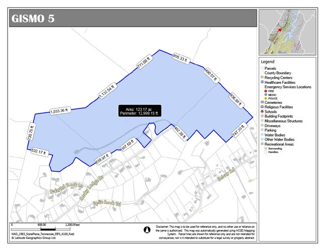
GRAVES ROAD OUT OF 65-001 FOR 2001
073-118
HAMILTON
Vacantlandnec
Tennessee
C and X Area of minimal flood hazard, usually depicted on FIRMs as above the 500-year flood level.
152.39 AC
0
Outlying Hamilton County
2025
Chattanooga
010307
NEARBY LISTINGS FOR SALE OR LEASE
DEMOGRAPHICS near Graves Rd
1 mile
3 mile
5 mile
2025 Total Population
1,059
13,644
42,251
2030 Population
1,109
14,320
44,406
Pop Growth 2025-2030
+ 4.72%
+ 4.95%
+ 5.10%
Average Age
45
43
43
2025 Total Households
416
5,415
16,751
HH Growth 2025-2030
+ 5.05%
+ 5.13%
+ 5.28%
Median Household Inc
$104,687
$87,243
$80,325
Avg Household Size
2.50
2.50
2.50
2025 Avg HH Vehicles
2.00
2.00
2.00
Median Home Value
$532,303
$319,384
$319,776
Median Year Built
1990
1985
1986
Nearby Places
Map Layers
Map Styles
 Street
 Aerial
Layers
 Traffic
 Biking
Places
Listings with unknown addresses are not visible on the map
- Restaurants
- Banks
- Shops
- Fitness
- Groceries
PUBLIC TRANSPORTATION
AIRPORT
Lovell Field
Drive
Walk
Distance
Lovell Field
28 min
17.7 mi
Freight Ports
Georgia Ports - Savannah
Drive
Walk
Distance
Georgia Ports - Savannah
423 min
375.6 mi
SALE & LEASE HISTORY
LISTING DATE
SALE/LEASE

May 03, 2023
For Sale
Feb 08, 2021
For Sale
Nearby Properties
Address
Land Use
TOTAL SIZE
Lot Size
Zoning
Address
Land Use
TOTAL SIZE
Lot Size
Zoning
286,637 SF
20.40 AC
Address
Land Use
TOTAL SIZE
Lot Size
Zoning
141,494 SF
32.80 AC
C2
Address
Land Use
TOTAL SIZE
Lot Size
Zoning
154,616 SF
15.91 AC
C2
Address
Land Use
TOTAL SIZE
Lot Size
Zoning
6,204 SF
7.70 AC
A1
Address
Land Use
TOTAL SIZE
Lot Size
Zoning
11,876 SF
2.73 AC
C2
Address
Land Use
TOTAL SIZE
Lot Size
Zoning
14,912 SF
17 AC
A
Address
Land Use
TOTAL SIZE
Lot Size
Zoning
0.05 AC
Address
Land Use
TOTAL SIZE
Lot Size
Zoning
37,866 SF
7.60 AC
UR
Address
Land Use
TOTAL SIZE
Lot Size
Zoning
11,790 SF
7.69 AC
M2
Address
Land Use
TOTAL SIZE
Lot Size
Zoning
92,135 SF
25.32 AC
A
Address
Land Use
TOTAL SIZE
Lot Size
Zoning
17,501 SF
20.08 AC
MH
Address
Land Use
TOTAL SIZE
Lot Size
Zoning
18,352 SF
5.45 AC
UR
Address
Land Use
TOTAL SIZE
Lot Size
Zoning
71,712 SF
7 AC
M2
Address
Land Use
TOTAL SIZE
Lot Size
Zoning
63,032 SF
4.05 AC
M2
Address
Land Use
TOTAL SIZE
Lot Size
Zoning
5,684 SF
8.80 AC
Address
Land Use
TOTAL SIZE
Lot Size
Zoning
14,756 SF
1.74 AC
C2
Address
Land Use
TOTAL SIZE
Lot Size
Zoning
7,500 SF
3.94 AC
M2
Address
Land Use
TOTAL SIZE
Lot Size
Zoning
97.50 AC
A
Address
Land Use
TOTAL SIZE
Lot Size
Zoning
1,200 SF
10.87 AC
Address
Land Use
TOTAL SIZE
Lot Size
Zoning
11,994 SF
2.09 AC
C2
Address
Land Use
TOTAL SIZE
Lot Size
Zoning
14,739 SF
3.90 AC
RR
Address
Land Use
TOTAL SIZE
Lot Size
Zoning
46.25 AC
A
Address
Land Use
TOTAL SIZE
Lot Size
Zoning
2,698 SF
15.75 AC
A
Address
Land Use
TOTAL SIZE
Lot Size
Zoning
64,430 SF
5.16 AC
Address
Land Use
TOTAL SIZE
Lot Size
Zoning
10,850 SF
1.37 AC
LB
Address
Land Use
TOTAL SIZE
Lot Size
Zoning
55,855 SF
6.01 AC
M2
Address
Land Use
TOTAL SIZE
Lot Size
Zoning
4,051 SF
1.36 AC
C2
Address
Land Use
TOTAL SIZE
Lot Size
Zoning
6,225 SF
3 AC
Address
Land Use
TOTAL SIZE
Lot Size
Zoning
14,400 SF
1.23 AC
The World's #1 Commercial Real Estate Marketplace
Connect with us
© 2026 CoStar Group
The information above has been obtained from sources believed reliable. While we do not doubt its accuracy we have not verified it and make no guarantee, warranty or representation about it. It is your responsibility to independently confirm its accuracy and completeness. Any projections, opinions, assumptions, or estimates used are for example only and do not represent the current or future performance of the property. The value of this transaction to you depends on tax and other factors which should be evaluated by your tax, financial, and legal advisors. You and your advisors should conduct a careful, independent investigation of the property to determine to your satisfaction the suitability of the property for your needs.