Property Record
Green Rd, Goodrich, MI 48438
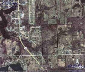

Property Detail
Green Rd
02-23-300-005
W 1/2 OF SW 1/4 EXCEPT E 330 FT OF S 660 FT SEC 23 T6N R8E 75 A (85) FR 0200019705
Agriculturalland
GENESEE
RA
Michigan
AE The base floodplain where base flood elevations are provided. AE Zones are now used on new format FIRMs instead of A1-A30 Zones.
75 AC
2024
Flint
2025
Detroit
013401
Flint, MI
NEARBY LISTINGS FOR SALE OR LEASE
-
-
View all Goodrich listings for sale on LoopNet.com
DEMOGRAPHICS near Green Rd
1 mile
3 mile
5 mile
2025 Total Population
1,602
6,168
17,977
2030 Population
1,553
6,016
17,819
Pop Growth 2025-2030
(3.06%)
(2.46%)
(0.88%)
Average Age
42
43
44
2025 Total Households
565
2,194
6,520
HH Growth 2025-2030
(3.01%)
(2.42%)
(0.81%)
Median Household Inc
$105,833
$104,294
$108,032
Avg Household Size
2.80
2.70
2.70
2025 Avg HH Vehicles
2.00
2.00
3.00
Median Home Value
$313,756
$332,913
$340,263
Median Year Built
1989
1983
1988
Nearby Places
Map Layers
Map Styles
 Street
 Aerial
Layers
 Traffic
 Biking
Places
Listings with unknown addresses are not visible on the map
- Restaurants
- Banks
- Shops
- Fitness
- Groceries
PUBLIC TRANSPORTATION
AIRPORT
Bishop International
Drive
Walk
Distance
Bishop International
41 min
24.8 mi
Freight Ports
Port of Toledo
Drive
Walk
Distance
Port of Toledo
134 min
99.7 mi
Nearby Properties
Address
Land Use
TOTAL SIZE
Lot Size
Zoning
Address
Land Use
TOTAL SIZE
Lot Size
Zoning
58,215 SF
7.99 AC
C-2
Address
Land Use
TOTAL SIZE
Lot Size
Zoning
352.82 AC
REC
Address
Land Use
TOTAL SIZE
Lot Size
Zoning
12,760 SF
16 AC
VILLAG
Address
Land Use
TOTAL SIZE
Lot Size
Zoning
27.50 AC
REC
Address
Land Use
TOTAL SIZE
Lot Size
Zoning
28,288 SF
4.98 AC
VILLAG
Address
Land Use
TOTAL SIZE
Lot Size
Zoning
74,450 SF
13.20 AC
M-1
Address
Land Use
TOTAL SIZE
Lot Size
Zoning
319.43 AC
REC
Address
Land Use
TOTAL SIZE
Lot Size
Zoning
54,720 SF
34.70 AC
VILLAG
Address
Land Use
TOTAL SIZE
Lot Size
Zoning
27,733 SF
4.56 AC
M-1
Address
Land Use
TOTAL SIZE
Lot Size
Zoning
24,311 SF
10 AC
VILLAG
Address
Land Use
TOTAL SIZE
Lot Size
Zoning
43,036 SF
24.96 AC
M-1
Address
Land Use
TOTAL SIZE
Lot Size
Zoning
12,958 SF
1.30 AC
VILLAG
Address
Land Use
TOTAL SIZE
Lot Size
Zoning
2,756 SF
140 AC
AR
Address
Land Use
TOTAL SIZE
Lot Size
Zoning
12,202 SF
0.83 AC
VILLAG
Address
Land Use
TOTAL SIZE
Lot Size
Zoning
17,363 SF
68.53 AC
FI
Address
Land Use
TOTAL SIZE
Lot Size
Zoning
12,696 SF
110.42 AC
VILLAG
Address
Land Use
TOTAL SIZE
Lot Size
Zoning
5,292 SF
0.73 AC
VILLAG
Address
Land Use
TOTAL SIZE
Lot Size
Zoning
9,840 SF
1.21 AC
VILLAG
Address
Land Use
TOTAL SIZE
Lot Size
Zoning
2,227 SF
20.44 AC
AR
Address
Land Use
TOTAL SIZE
Lot Size
Zoning
1,792 SF
153.33 AC
RA
Address
Land Use
TOTAL SIZE
Lot Size
Zoning
17,642 SF
1.67 AC
VILLAG
Address
Land Use
TOTAL SIZE
Lot Size
Zoning
12,057 SF
0.86 AC
VILLAG
Address
Land Use
TOTAL SIZE
Lot Size
Zoning
22,076 SF
5.06 AC
VILLAG
Address
Land Use
TOTAL SIZE
Lot Size
Zoning
6,000 SF
0.85 AC
VILLAG
Address
Land Use
TOTAL SIZE
Lot Size
Zoning
3,096 SF
4.68 AC
VILLAG
Address
Land Use
TOTAL SIZE
Lot Size
Zoning
4,960 SF
0.40 AC
VILLAG
Address
Land Use
TOTAL SIZE
Lot Size
Zoning
2,470 SF
113 AC
RA
Address
Land Use
TOTAL SIZE
Lot Size
Zoning
3,421 SF
2.14 AC
VILLAG
Address
Land Use
TOTAL SIZE
Lot Size
Zoning
3,682 SF
0.32 AC
VILLAG
Address
Land Use
TOTAL SIZE
Lot Size
Zoning
2,903 SF
0.99 AC
VILLAG
The World's #1 Commercial Real Estate Marketplace
Connect with us
© 2026 CoStar Group
The information above has been obtained from sources believed reliable. While we do not doubt its accuracy we have not verified it and make no guarantee, warranty or representation about it. It is your responsibility to independently confirm its accuracy and completeness. Any projections, opinions, assumptions, or estimates used are for example only and do not represent the current or future performance of the property. The value of this transaction to you depends on tax and other factors which should be evaluated by your tax, financial, and legal advisors. You and your advisors should conduct a careful, independent investigation of the property to determine to your satisfaction the suitability of the property for your needs.