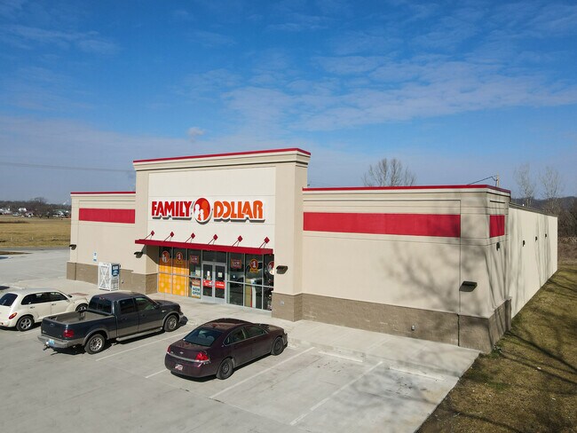
Property Record
Greenup Ave, , KY


Property Detail
Greenup Ave
175-20-04-001.00
US 23 11.355 AC M/L
Farms
GREENUP
B and X Area of moderate flood hazard, usually the area between the limits of the 100-year and 500-year floods.
Kentucky
2025
15.36 AC
2025
Greenup County
040502
Huntington/Ashland
4,940 SF
Huntington-Ashland, WV-KY-OH
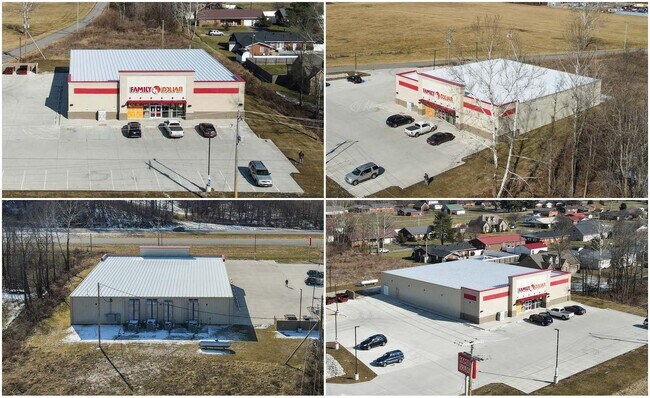
NEARBY LISTINGS FOR SALE OR LEASE
DEMOGRAPHICS near Greenup Ave
1 mile
3 mile
5 mile
2025 Total Population
2,409
16,592
32,154
2030 Population
2,365
16,329
31,478
Pop Growth 2025-2030
(1.83%)
(1.59%)
(2.10%)
Average Age
43
43
43
2025 Total Households
1,012
6,773
13,149
HH Growth 2025-2030
(1.88%)
(1.61%)
(2.14%)
Median Household Inc
$56,749
$59,768
$56,608
Avg Household Size
2.40
2.40
2.30
2025 Avg HH Vehicles
2.00
2.00
2.00
Median Home Value
$129,178
$126,943
$139,252
Median Year Built
1970
1971
1968
Nearby Places
Map Layers
Map Styles
 Street
 Aerial
Transit
 Traffic
 Biking
Places
Listings with unknown addresses are not visible on the map
- Restaurants
- Banks
- Shops
- Fitness
- Groceries
PUBLIC TRANSPORTATION
COMMUTER RAIL
Ashland Amtrak Station (Cardinal - Amtrak)
Drive
Walk
Distance
Ashland Amtrak Station (Cardinal - Amtrak)
13 min
8.6 mi
AIRPORT
Tri-State/Milton J Ferguson Field
Drive
Walk
Distance
Tri-State/Milton J Ferguson Field
33 min
20.4 mi
Freight Ports
Port of Toledo
Drive
Walk
Distance
Port of Toledo
328 min
252.1 mi
SALE & LEASE HISTORY
LISTING DATE
SALE/LEASE

Mar 30, 2022
For Sale
Nearby Properties
Address
Land Use
TOTAL SIZE
Lot Size
Zoning
Address
Land Use
TOTAL SIZE
Lot Size
Zoning
60.39 AC
Address
Land Use
TOTAL SIZE
Lot Size
Zoning
Address
Land Use
TOTAL SIZE
Lot Size
Zoning
Address
Land Use
TOTAL SIZE
Lot Size
Zoning
10,000 SF
12.85 AC
Address
Land Use
TOTAL SIZE
Lot Size
Zoning
3.86 AC
Address
Land Use
TOTAL SIZE
Lot Size
Zoning
Address
Land Use
TOTAL SIZE
Lot Size
Zoning
Address
Land Use
TOTAL SIZE
Lot Size
Zoning
1,440 SF
1.38 AC
Address
Land Use
TOTAL SIZE
Lot Size
Zoning
9.49 AC
Address
Land Use
TOTAL SIZE
Lot Size
Zoning
135,431 SF
9.19 AC
Address
Land Use
TOTAL SIZE
Lot Size
Zoning
31.10 AC
Address
Land Use
TOTAL SIZE
Lot Size
Zoning
9,300 SF
7.65 AC
Address
Land Use
TOTAL SIZE
Lot Size
Zoning
Address
Land Use
TOTAL SIZE
Lot Size
Zoning
Address
Land Use
TOTAL SIZE
Lot Size
Zoning
5.14 AC
Address
Land Use
TOTAL SIZE
Lot Size
Zoning
Address
Land Use
TOTAL SIZE
Lot Size
Zoning
10,500 SF
14.80 AC
Address
Land Use
TOTAL SIZE
Lot Size
Zoning
Address
Land Use
TOTAL SIZE
Lot Size
Zoning
5,280 SF
0.72 AC
Address
Land Use
TOTAL SIZE
Lot Size
Zoning
Address
Land Use
TOTAL SIZE
Lot Size
Zoning
31,419 SF
10.43 AC
Address
Land Use
TOTAL SIZE
Lot Size
Zoning
8.79 AC
Address
Land Use
TOTAL SIZE
Lot Size
Zoning
16.15 AC
Address
Land Use
TOTAL SIZE
Lot Size
Zoning
36,040 SF
17.19 AC
Address
Land Use
TOTAL SIZE
Lot Size
Zoning
10,000 SF
15 AC
Address
Land Use
TOTAL SIZE
Lot Size
Zoning
1,500 SF
559.08 AC
Address
Land Use
TOTAL SIZE
Lot Size
Zoning
Address
Land Use
TOTAL SIZE
Lot Size
Zoning
10.18 AC
Address
Land Use
TOTAL SIZE
Lot Size
Zoning
12,046 SF
1.12 AC
Address
Land Use
TOTAL SIZE
Lot Size
Zoning
The World's #1 Commercial Real Estate Marketplace
Connect with us
© 2026 CoStar Group
The information above has been obtained from sources believed reliable. While we do not doubt its accuracy we have not verified it and make no guarantee, warranty or representation about it. It is your responsibility to independently confirm its accuracy and completeness. Any projections, opinions, assumptions, or estimates used are for example only and do not represent the current or future performance of the property. The value of this transaction to you depends on tax and other factors which should be evaluated by your tax, financial, and legal advisors. You and your advisors should conduct a careful, independent investigation of the property to determine to your satisfaction the suitability of the property for your needs.